
The Alhucemas Islands is a group of islands and one of the Spanish plazas de soberanía just off the Moroccan coast in the Alboran Sea.

The Ceuta border fence forms part of the Morocco–Spain border at Ceuta, a city on the North African coast. Constructed by Spain, its purpose is to prevent smuggling and to stop migrants from entering Europe. Morocco objected to the construction of the barrier since it does not recognize Spanish sovereignty in Ceuta.
The Castillo de Salas was a Spanish bulk carrier that was launched in Ferrol in August, 1980. It weighed over 50,000 tons, displaced over 100,000 tons of water, measured approximately 250 metres (820 ft) in length, 40 metres (130 ft) across the beam, and 14.5 metres (48 ft) in draft. It required a crew complement of 32.
Príncipe is a working-class neighborhood in the south of the Spanish exclave city of Ceuta in northwest Africa. It has a majority Muslim population. It is linked to the centre of Ceuta by the N-352 highway, which also goes south to the border crossing with Morocco.

The Península de Almina is a peninsula making up much of the eastern part of the Spanish city of Ceuta in Africa. It is dominated by the peak of Monte Hacho. The peninsula contains Ceuta's easternmost point, Punta Almina, and is connected to the rest of Ceuta by an isthmus barely 100 metres in width.

Playa del Barranco is a beach in the municipality of Algeciras, southeastern Spain. It overlooks the Bay of Algeciras. It is approximately 500 metres in length. To the north is the Playa de El Rinconcillo.

Playa de El Chinarral is a beach in the municipality of Algeciras, southeastern Spain. It overlooks the Bay of Algeciras and the tip of the rock of Gibraltar. It is approximately 250 metres in length and 40 metres wide on average. It is located between Punta de San Garcia and El Rodeo, south of the city.

Playa de Los Ladrillos is a beach in the municipality of Algeciras, southeastern Spain. It overlooks the Bay of Algeciras, next to Playa del Barranco. It is about 200 metres in length.

Iglesia de San Francisco is a church in the Spanish city of Ceuta, bordering northern Morocco. It stands at the side of the Plaza de los Reyes, and is a distinctive Baroque twin-towered yellow building. It was built in the early eighteenth century in honour of the Holy Cross and is noted for its Baroque altarpieces and images of the Virgin and Christ.
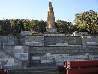
Monumento del Llano Amarillo is a monument in the Spanish territory of Ceuta, in the North of Africa, at the bottom of Mount Hacho. The fifteen metre monument was moved here from Morocco in 1962 and it is one of the few sculptures left that record Spain's period of Nationalism following the Spanish Civil War.
Playa del Chorillo is a beach of Ceuta, a Spanish city bordering northern Morocco. Like the Playa de la Ribera, it lies to the south of the isthmus. It has a length of about 1200 metres and average width of 30 metres, with black sand.

Playa de la Ribera is a beach of Ceuta, a Spanish city bordering northern Morocco. Like the Playa del Chorillo, it lies to the south of the isthmus, but on the part where it joins the mainland. It is about 405 metres long, with an average width of 40 metres. It is very busy during the summer months.
Playa Calamocarro is a beach of Ceuta, a Spanish city bordering northern Morocco. The beach is about 650 metres in length with an average width of about 15 metres. The area forms part of a protected ZEPA zone.

Playa El Desnarigado is a small beach of Ceuta, a Spanish city bordering northern Morocco. The beach is about 80 metres in length with an average width of about six metres.

Playa Benítez is a beach of Ceuta, a Spanish city bordering northern Morocco. The beach is about 900 metres (3,000 ft) in length with an average width of about 200 metres (660 ft). It forms part of the Punta Blanca. The beach is popular with sports enthusiasts.
Playar Miramar is a beach of Ceuta, a Spanish city bordering northern Morocco. The beach is about 275 metres in length with an average width of about 18 metres.

Playa del Sarchal is a beach of Ceuta, a Spanish city bordering northern Morocco. The beach has a cliff and is about 350 metres in length with an average width of about 10 metres.

Playa San Amaro is a beach of Ceuta, a Spanish city bordering northern Morocco. The sandy beach is about 280 metres in length with an average width of about 6 metres and will be well occupied in the tourist season.

The Port of Tarifa is a commercial harbor for fishing and passenger boats, located in the Andalusian town of Tarifa. It is managed by the Port Authority of Algeciras and is the closest European port to North Africa and on the main shipping route to Tangier in Morocco and Ceuta. It has a length of 25 metres, and depth of 50 metres.


