
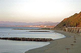
Playa Calamocarro is a beach of Ceuta, a Spanish city bordering northern Morocco. The beach is about 650 metres in length with an average width of about 15 metres. The area forms part of a protected ZEPA zone. [1]
Playa Calamocarro is a beach of Ceuta, a Spanish city bordering northern Morocco. The beach is about 650 metres in length with an average width of about 15 metres. The area forms part of a protected ZEPA zone. [1]

The Challenger Deep is the deepest-known point of the seabed of Earth, with a depth of 10,902–10,929 m (35,768–35,856 ft) by direct measurement from deep-diving submersibles, remotely operated underwater vehicles and benthic landers, and (sometimes) slightly more by sonar bathymetry.
The Mariana Trench is an oceanic trench located in the western Pacific Ocean, about 200 kilometres (124 mi) east of the Mariana Islands; it is the deepest oceanic trench on Earth. It is crescent-shaped and measures about 2,550 km (1,580 mi) in length and 69 km (43 mi) in width. The maximum known depth is 10,984 ± 25 metres at the southern end of a small slot-shaped valley in its floor known as the Challenger Deep. If Mount Everest were hypothetically placed into the trench at this point, its peak would still be underwater by more than 2 kilometres (1.2 mi).

North Redington Beach is a town in Pinellas County, Florida, United States. The population was 1,417 at the 2010 census.

Kovalam is a region in the city of Trivandrum, around 13 km southwest of the city center, whose beaches are a tourist destination.

Estero Bay is a bay located on the Pacific Coast in San Luis Obispo County, central California. It is about 15 miles (24 km) from its south end at Point Buchon/Montana de Oro State Park, to its north end at Point Estero, which is about 5 miles (8 km) northwest of Cayucos. It is indented about 5 miles (8 km) into the California coast.

Juan de Fuca Provincial Park is a provincial park located on the west coast of Vancouver Island in British Columbia, Canada. The park was established on April 4, 1996 by combining three former parks - China Beach, Loss Creek, and Botanical Beach - into one provincial park. It is the location of the majority of the Juan de Fuca Marine Trail, which is a southern compliment to the West Coast Trail within Pacific Rim National Park Reserve.

Aberavon Beach, also known as Aberavon Sands, is a three-mile (5 km) stretch of sandy beach on the north-eastern edge of Swansea Bay in Port Talbot, Wales. With its high breaker waves, it is popular with surfers. Aberavon Beach was awarded Blue Flag status in December 2007 and features in the Good Beach Guide published by the Marine Conservation Society.
SS Breda was a Dutch cargo-passenger ship sunk in Scotland during World War II.

The Copenhagen Harbour Baths are a system of recreational bathing facilities along the waterfront of Copenhagen, Denmark. There are currently four harbour baths, the first and best-known of which is located at Islands Brygge.
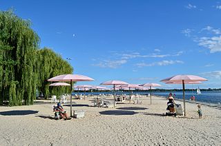
Sugar Beach is an urban beach park in Toronto, Ontario, Canada, that opened in 2010. It is located across from Redpath Sugar Refinery in Toronto's eastern East Bayfront. Like HTO Park to the west, the beach is not meant to allow wading or swimming in Lake Ontario, but rather functions as a waterfront public space for relaxation, leisure, and social activities. It cost $14 million.

The St Austell River properly known as the River Vinnick, but historically called The White River, is a 12 kilometres (7.5 mi) long river located in south Cornwall, England, United Kingdom. 50.337°N 4.793°W. The river has also been known as the "red river" due to tin streaming and mining activity upstream.

Jeanne Daprano is a retired elementary school teacher and world record setting American masters track and field athlete.
Playa del Chorrillo is a beach of Ceuta, a Spanish city bordering northern Morocco. Like the Playa de la Ribera, it lies to the south of the isthmus. It has a length of about 1200 metres and average width of 30 metres, with black sand.

Playa de la Ribera is a beach of Ceuta, a Spanish city bordering northern Morocco. Like the Playa del Chorillo, it lies to the south of the isthmus but on the part where it joins the mainland. It is about 405 metres long, with an average width of 40 metres. It is very busy during the summer months.

Playa El Desnarigado is a small beach of Ceuta, a Spanish city bordering northern Morocco. The beach is about 80 metres in length with an average width of about six metres.

Playa Benítez is a beach of Ceuta, a Spanish city bordering northern Morocco. The beach is about 900 metres (3,000 ft) in length with an average width of about 200 metres (660 ft). It forms part of the Punta Blanca. The beach is popular with sports enthusiasts.

Playa El Tarajal is a beach of Ceuta, bordering northern Morocco. The beach is about 250 metres in length with an average width of about 15 metres.
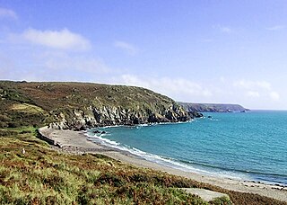
Kennack Sands is a beach and sand-dune system on the east coast of the Lizard Peninsula, Cornwall, England, UK.
SS Bardic was a Greek cargo ship that was shelled and sunk by the German battleship Scharnhorst in the Atlantic Ocean northwest of Cape Verde on 9 March 1941.
