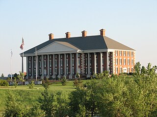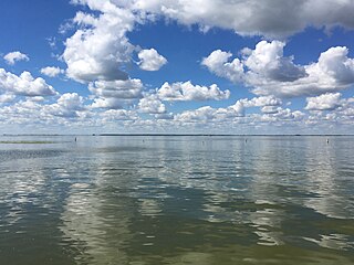
Minnehaha County is a county on the eastern border of the state of South Dakota. As of the 2020 census, the population was 197,214, making it the state's most populous county. It contains over 20% of the state's population. Its county seat is Sioux Falls, South Dakota's largest city. The county was created in 1862 and organized in 1868. Its name was derived from the Sioux word Mnihaha, meaning "rapid water," or "waterfall".

Kingsbury County is a county in the U.S. state of South Dakota. As of the 2020 census, the population was 5,187. Its county seat is De Smet. The county was created in 1873, and was organized in 1880. It was named for brothers George W. and T. A. Kingsbury, descendants of the colonial English Kingsbury family in Boston, Massachusetts. They were prominently involved in the affairs of Dakota Territory and served as elected members of several Territorial Legislatures.

Brule County is a county in the U.S. state of South Dakota. As of the 2020 census, the population was 5,247. Its county seat is Chamberlain.

Griggs County is a county in the U.S. state of North Dakota. As of the 2020 census, the population was 2,306. Its county seat is Cooperstown.

Watertown is a city in and the county seat of Codington County, South Dakota, United States. Watertown is home to the Redlin Art Center which houses many of the original art works produced by Terry Redlin, one of America's most popular wildlife artists. Watertown is located between Pelican Lake and Lake Kampeska, from which Redlin derived inspiration for his artwork.

The Cheyenne River, also written Chyone, referring to the Cheyenne people who once lived there, is a tributary of the Missouri River in the U.S. states of Wyoming and South Dakota. It is approximately 295 miles (475 km) long and drains an area of 24,240 square miles (62,800 km2). About 60% of the drainage basin is in South Dakota and almost all of the remainder is in Wyoming.

The Souris River or Mouse River is a river in central North America. Approximately 435 miles (700 km) in length, it drains about 23,600 square miles (61,100 km2) in Canada and the United States.

Plum Island is an island in Lake Michigan in the southern part of the town of Washington in Door County, off the tip of the Door Peninsula in the U.S. state of Wisconsin. The uninhabited island has a land area of 1.179 square kilometres (0.455 sq mi) or 117.87 hectares. Carp Lake is located on the northwestern side. During years when Lake Michigan's water levels are high, it is a lagoon of Lake Michigan, but it gets cut off as a separate lake during low water years.
The Drift Prairie is a geographic region of North Dakota and South Dakota.

The South Dakota Coyotes, also known as the USD Coyotes, are the athletic teams for the University of South Dakota. Their team colors are vermilion and white. They have been members of Summit League of the NCAA's Division I since the 2011–12 school year. The football team plays in Division I's Football Championship Subdivision as a member of the Missouri Valley Football Conference. The Coyotes were charter members of the Division II North Central Conference and were members until 2008 when it upgraded to Division I.

South Dakota is a state located in the north-central United States. It is usually considered to be in the Midwestern region of the country. The state can generally be divided into three geographic regions: eastern South Dakota, western South Dakota, and the Black Hills. Eastern South Dakota is lower in elevation and higher in precipitation than the western part of the state, and the Black Hills are a low, isolated mountain group in the southwestern corner of the state. Smaller sub-regions in the state include the Coteau des Prairies, Missouri Coteau, James River Valley, the Dissected Till Plains. Geologic formations in South Dakota range in age from two billion-year-old Precambrian granite in the Black Hills to glacial till deposited over the last few million years. South Dakota is the 17th-largest state in the country.
Provincial Highway 14 is a provincial highway in Manitoba. PTH 14 is a 2 lane high-speed rural highway (100 km/h) and carries relatively high traffic volumes of approximately 1800 vehicles per day. The route extends west to east from its junction with PTH 3 to its junction with PTH 75, the Lord Selkirk Highway.

Old Town in the Green Groves, by Cynthia Rylant, is a novel based on some notes left by Laura Ingalls Wilder and a general knowledge about her life and the times. This book is not officially part of the Little House series, but describes a period between the end of On the Banks Of Plum Creek and the early part of By The Shores Of Silver Lake. In the Little House books, which are not strictly autobiographical and include alterations to the actual chronology of events, this period in Wilder's life is abridged and condensed.
Kidder is a census-designated place in Marshall County, South Dakota, United States. Its population was 25 at the 2020 census.

Lake Herman State Park is a South Dakota state park in Lake County, South Dakota in the United States. The park is open for year-round recreation including camping, swimming, fishing, hiking and boating on the 1,350-acre Lake Herman. There are 72 campsites which feature electric hook-ups and 4 cabins.
Roy Lake State Park is a South Dakota state park in Marshall County, South Dakota in the United States. The park is divided in two sections on Roy Lake, and is open for year-round recreation including camping, beaches, swimming, fishing, hiking and boating. The Roy Lake Resort & Lodge is located in the park. Boat ramps are available and visitors can rent boats from the resort.
Frozen Man Creek is a stream in the U.S. state of South Dakota. It is a tributary of Plum Creek.

Oak Lake is a lake in the south-western part of the Canadian province of Manitoba in a region called Westman. Oak Lake is a kettle lake and is an aquifer supplier for numerous nearby residential areas and farms. The lake is in the RM of Sifton and sits at an elevation of 426 metres above sea level. Provincial Road 254 provides access to the lake.


