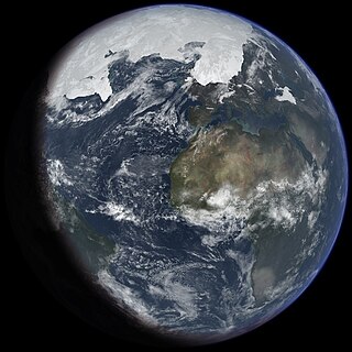
An ice age is a long period of reduction in the temperature of Earth's surface and atmosphere, resulting in the presence or expansion of continental and polar ice sheets and alpine glaciers. Earth's climate alternates between ice ages and greenhouse periods, during which there are no glaciers on the planet. Earth is in the Quaternary glaciation. Individual pulses of cold climate within an ice age are termed glacial periods, and intermittent warm periods within an ice age are called interglacials or interstadials.

The Pleistocene is the geological epoch that lasted from c. 2.58 million to 11,700 years ago, spanning the Earth's most recent period of repeated glaciations. Before a change was finally confirmed in 2009 by the International Union of Geological Sciences, the cutoff of the Pleistocene and the preceding Pliocene was regarded as being 1.806 million years Before Present (BP). Publications from earlier years may use either definition of the period. The end of the Pleistocene corresponds with the end of the last glacial period and also with the end of the Paleolithic age used in archaeology. The name is a combination of Ancient Greek πλεῖστος (pleîstos), meaning "most", and καινός, meaning "new".
The Younger Dryas, which occurred circa 12,900 to 11,700 years BP, was a return to glacial conditions which temporarily reversed the gradual climatic warming after the Last Glacial Maximum (LGM), which lasted from circa 27,000 to 20,000 years BP. The Younger Dryas was the last stage of the Pleistocene epoch that spanned from 2,580,000 to 11,700 years BP and it preceded the current, warmer Holocene epoch. The Younger Dryas was the most severe and longest lasting of several interruptions to the warming of the Earth's climate, and it was preceded by the Late Glacial Interstadial, an interval of relative warmth that lasted from 14,670 to 12,900 BP.

Lake Bonneville was the largest Late Pleistocene paleolake in the Great Basin of western North America. It was a pluvial lake that formed in response to an increase in precipitation and a decrease in evaporation as a result of cooler temperatures. The lake covered much of what is now western Utah and at its highest level extended into present-day Idaho and Nevada. Many other hydrographically closed basins in the Great Basin contained expanded lakes during the Late Pleistocene, including Lake Lahontan in northwestern Nevada.

A pluvial lake is a body of water that accumulated in a basin because of a greater moisture availability resulting from changes in temperature and/or precipitation. These intervals of greater moisture availability are not always contemporaneous with glacial periods. Pluvial lakes are typically closed lakes that occupied endorheic basins. Pluvial lakes that have since evaporated and dried out may also be referred to as paleolakes.

The Last Glacial Period (LGP), also known colloquially as the Last Ice Age or simply Ice Age, occurred from the end of the Eemian to the end of the Younger Dryas, encompassing the period c. 115,000 – c. 11,700 years ago. The LGP is part of a larger sequence of glacial and interglacial periods known as the Quaternary glaciation which started around 2,588,000 years ago and is ongoing. The definition of the Quaternary as beginning 2.58 million years ago (Mya) is based on the formation of the Arctic ice cap. The Antarctic ice sheet began to form earlier, at about 34 Mya, in the mid-Cenozoic. The term Late Cenozoic Ice Age is used to include this early phase. The previous ice age, the Saale glaciation, which ended about 128,000 years ago, was more severe than the Last Glacial Period in some areas such as Britain, but less severe in others.
Tollmann's bolide hypothesis is a hypothesis presented by Austrian palaeontologist Edith Kristan-Tollmann and geologist Alexander Tollmann in 1994. The hypothesis postulates that one or several bolides struck the Earth around 7640 ± 200 years BCE, and a much smaller one approximately 3150 ± 200 BCE. The hypothesis tries to explain early Holocene extinctions and possibly legends of the Universal Deluge.

Aeolian processes, also spelled eolian, pertain to wind activity in the study of geology and weather and specifically to the wind's ability to shape the surface of the Earth. Winds may erode, transport, and deposit materials and are effective agents in regions with sparse vegetation, a lack of soil moisture and a large supply of unconsolidated sediments. Although water is a much more powerful eroding force than wind, aeolian processes are important in arid environments such as deserts.

There have been five or six major ice ages in the history of Earth over the past 3 billion years. The Late Cenozoic Ice Age began 34 million years ago, its latest phase being the Quaternary glaciation, in progress since 2.58 million years ago.
The Late Triassic is the third and final epoch of the Triassic Period in the geologic time scale, spanning the time between 237 Ma and 201.4 Ma. It is preceded by the Middle Triassic Epoch and followed by the Early Jurassic Epoch. The corresponding series of rock beds is known as the Upper Triassic. The Late Triassic is divided into the Carnian, Norian and Rhaetian ages.
Diluvium is an archaic term applied during the 1800s to widespread surficial deposits of sediments that could not be explained by the historic action of rivers and seas. Diluvium was initially argued to have been deposited by the action of extraordinary floods of vast extent, specifically the Noachian Flood.

The Quaternary glaciation, also known as the Pleistocene glaciation, is an alternating series of glacial and interglacial periods during the Quaternary period that began 2.58 Ma and is ongoing. Although geologists describe this entire period up to the present as an "ice age", in popular culture this term usually refers to the most recent glacial period, or to the Pleistocene epoch in general. Since Earth still has polar ice sheets, geologists consider the Quaternary glaciation to be ongoing, though currently in an interglacial period.
The river regime generally describes the character of the typical fluctuations of flow of a river, but can also refer to the mathematical relationship between the river discharge and its width, depth and slope. Thus, "river regime" can describe one of two characteristics of a reach of an alluvial river:
The Sangamonian Stage is the term used in North America to designate the last interglacial period. In its most common usage, it is used for the period of time between 75,000 and 125,000 BP. This period of time is equivalent to all of Marine Isotope Stage 5 and the combined Eemian period and early part of the Weichselian glaciation in Europe. Less commonly, the Sangamonian Stage is restricted to the period between 122,000 and 132,000 BP, which is equivalent to Marine Oxygen Isotope Substage 5e and the Eemian period of Europe. It preceded the Wisconsinan (Wisconsin) Stage and followed the Illinoian Stage in North America.
North African climate cycles have a unique history that can be traced back millions of years. The cyclic climate pattern of the Sahara is characterized by significant shifts in the strength of the North African Monsoon. When the North African Monsoon is at its strongest, annual precipitation and consequently vegetation in the Sahara region increase, resulting in conditions commonly referred to as the "green Sahara". For a relatively weak North African Monsoon, the opposite is true, with decreased annual precipitation and less vegetation resulting in a phase of the Sahara climate cycle known as the "desert Sahara".
The Carnian pluvial episode (CPE), often called the Carnian pluvial event, was an interval of major change in global climate that was synchronous with significant changes in Earth's biota both in the sea and on land. It occurred during the latter part of the Carnian Stage, a subdivision of the late Triassic period, and lasted for perhaps 1-2 million years. The CPE represents a significant episode in the evolution and diversification of many taxa that are important today, among them some of the earliest dinosaurs, lepidosaurs, pterosaurs and true mammals. In the marine realm it saw the first appearance among the microplankton of coccoliths and dinoflagellates, with the latter linked to the rapid diversification of scleractinian corals through the establishment of symbiotic zooxanthellae within them. The CPE also saw the extinction of many aquatic invertebrate species, especially among the ammonoids, bryozoa, and crinoids.

Lake Manly was a pluvial lake in Death Valley, California, covering much of Death Valley with a surface area of 1,600 square kilometres (620 sq mi) during the so-called "Blackwelder stand". Water levels varied through its history, and the chronology is further complicated by active tectonic processes that have modified the elevations of the various shorelines of Lake Manly; during the Blackwelder stage they reached 47–90 metres (154–295 ft) above sea level. The lake received water mainly from the Amargosa River and at various points from the Mojave River and Owens River. The lake and its substantial catchment favoured the spread of a number of aquatic species, including some lizards, pupfish and springsnails. The lake probably supported a substantial ecosystem, and a number of diatoms developed there.
Lake Palomas is a former lake in New Mexico, United States, and Chihuahua, Mexico. This lake was relatively large and reached a size of about 9,100 square kilometres (3,500 sq mi) during its highstands. Preceded by Lake Cabeza de Vaca, it formed during the Pleistocene and continued into the Holocene, when several different lake phases occurred. Presently its basin is a major source of airborne dust in the region.

Lake Panamint is a former lake that occupied Panamint Valley in California during the Pleistocene. It was formed mainly by water overflowing through the Owens River and which passed through Lake Searles into the Panamint Valley. At times, Lake Panamint itself overflowed into Death Valley and Lake Manly.

Lake Estancia was a lake formed in the Estancia Valley, central New Mexico, which left various coastal landforms in the valley. The lake was mostly fed by creek and groundwater from the Manzano Mountains, and fluctuated between freshwater stages and saltier stages. The lake had a diverse fauna, including cutthroat trout; they may have reached it during a possible past stage where it was overflowing.