King Phalo Airport is an airport serving East London, a city in the Eastern Cape province on the southeast coast of South Africa.

Chief Dawid Stuurman International Airport is an airport serving Port Elizabeth (Gqeberha), a city in the Eastern Cape province in South Africa. It was formerly known as H. F. Verwoerd Airport and Port Elizabeth International Airport. The airport is owned and operated by the Airports Company South Africa which also operates nine other airports around South Africa. The airport is located approximately two miles south of the city's central business district. In 2017, the airport served 1,620,705 passengers.
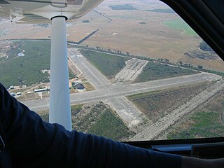
Kimberley Airport is an airport serving Kimberley, the capital city of the province of Northern Cape in South Africa. The airport is approximately 10 km away from the centre of Kimberley.
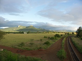
The Lebombo Mountains, also called Lubombo Mountains, are an 800 km-long (500 mi), narrow range of mountains in Southern Africa. They stretch from Hluhluwe in KwaZulu-Natal in the south to Punda Maria in the Limpopo Province in South Africa in the north. Parts of the mountain range are also found in Mozambique and Eswatini.

The Maputo River, also called Great Usutu River, Lusutfu River, or Suthu River, is a river in South Africa, Eswatini, and Mozambique. The name Suthu refers to Basotho people who lived near the source of the river, but were attacked and displaced by Swazis. It is also said to mean 'dark brown', a description of the river's muddy water.
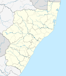
Pongola is a town on the north bank of the Phongolo River, in a fertile valley on the N2, near the Lubombo Mountains, in the valleys of Zululand, easily accessible to the Swaziland border posts. It was part of the Transvaal panhandle between the Phongolo (Natal) and Swaziland until 1994, when it was transferred to KwaZulu-Natal.

The R66 is a provincial route in KwaZulu-Natal, South Africa that connects Gingindlovu with Pongola via Eshowe, Melmoth and Ulundi. It starts and ends at a junction with the N2.

Ndumo Game Reserve is a small South African game reserve located in the far northeast district of KwaZulu-Natal known as Maputaland. It is situated on the border with Mozambique where the Pongola River joins the Great Usutu River. It is adjacent to the Tembe Elephant Park. Ndumo is relatively remote, being over 400 kilometres (250 mi) from Durban. The town of Mkuze is 110 kilometres (68 mi) away.
The General Botha Regiment is a reserve infantry regiment of the South African Army. The Regiment was named after General Louis Botha, the first prime minister of South Africa.
1305 Phongolo, provisional designation 1928 OC, is a background asteroid from the outer regions of the asteroid belt, approximately 25 kilometers in diameter. It was discovered on 19 July 1928, by English astronomer Harry Edwin Wood at the Union Observatory in Johannesburg, South Africa. The asteroid was named for the South African Pongola River.
Golela is a border town in Kwa-Zulu Natal Province, South Africa, 45 km east of Pongola on the border with Eswatini. The Golela border post was recently rebuilt to meet the increasing movement of people and goods between South Africa and Eswatini.
Palmietfontein Airport was an airport situated to the south of Johannesburg (Katlehong), South Africa, from 1945 to 1952.
Nsubane Pongola Transfrontier Conservation Area is a proposed protected area concept, that could potentially become a joint venture between South Africa and Eswatini. The concept includes the following properties:
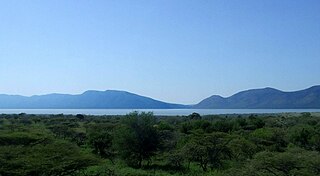
Pongolapoort Dam, commonly referred to as Jozini Dam creating Lake Jozini, is an arch type dam in northern KwaZulu-Natal, South Africa located on the Phongolo River. The dam is situated just north of the settlement of Jozini, 280 km north-east of the port city of Durban. The dam was constructed in 1973 at the eastern end of the narrow gorge separating the Lebombo and Ubombo ranges. The dam mainly serves for irrigation purposes and its hazard potential has been ranked high (3). The Phongolo River is the dam's largest feeder and outlet as well as the dam's only perennial feeder.

Severe Tropical Storm Domoina in 1984 caused 100-year floods in South Africa and record rainfall in Swaziland. The fourth named storm of the season, Domoina developed on January 16 off the northeast coast of Madagascar. With a ridge to the north, the storm tracked generally westward and later southwestward. On January 21, Domoina struck eastern Madagascar, the third storm in six weeks to affect the nation; collectively, the storms caused 242 deaths and $25 million in damage (1984 USD). After crossing the country, Domoina strengthened in the Mozambique Channel to peak 10-minute sustained winds of 95 km/h (60 mph). On January 28, the storm made landfall in southern Mozambique, and slowly weakened over land. Domoina crossed into Swaziland and later eastern South Africa before dissipating on February 2.
Cape Winelands Airport is an ex-South African Air Force airfield built circa 1943, and used to operate Lockheed Ventura bombers. It is located approximately 13 kilometres (8.1 mi) northeast of Durbanville. It has been in private ownership since 1993.
Pongola Commando was a light infantry regiment of the South African Army. It formed part of the South African Army Infantry Formation as well as the South African Territorial Reserve.

11 South African Infantry Battalion was a motorised infantry unit of the South African Army. Infantry men are soldiers who are specifically trained for the role of fighting on foot, historically this infantry has provided the most among of casualties during war.