
Radio navigation or radionavigation is the application of radio frequencies to determine a position of an object on the Earth, either the vessel or an obstruction. Like radiolocation, it is a type of radiodetermination.

In aviation, the instrument landing system (ILS) is a precision radio navigation system that provides short-range guidance to aircraft to allow them to approach a runway at night or in bad weather. In its original form, it allows an aircraft to approach until it is 200 feet (61 m) over the ground, within a 1⁄2 mile (800 m) of the runway. At that point the runway should be visible to the pilot; if it is not, they perform a missed approach. Bringing the aircraft this close to the runway dramatically increases the range of weather conditions in which a safe landing can be made. Other versions of the system, or "categories", have further reduced the minimum altitudes, runway visual ranges (RVRs), and transmitter and monitoring configurations designed depending on the normal expected weather patterns and airport safety requirements.

In aviation, distance measuring equipment (DME) is a radio navigation technology that measures the slant range (distance) between an aircraft and a ground station by timing the propagation delay of radio signals in the frequency band between 960 and 1215 megahertz (MHz). Line-of-visibility between the aircraft and ground station is required. An interrogator (airborne) initiates an exchange by transmitting a pulse pair, on an assigned 'channel', to the transponder ground station. The channel assignment specifies the carrier frequency and the spacing between the pulses. After a known delay, the transponder replies by transmitting a pulse pair on a frequency that is offset from the interrogation frequency by 63 MHz and having specified separation.

The Wide Area Augmentation System (WAAS) is an air navigation aid developed by the Federal Aviation Administration to augment the Global Positioning System (GPS), with the goal of improving its accuracy, integrity, and availability. Essentially, WAAS is intended to enable aircraft to rely on GPS for all phases of flight, including precision approaches to any airport within its coverage area. It may be further enhanced with the Local Area Augmentation System (LAAS) also known by the preferred ICAO term Ground-Based Augmentation System (GBAS) in critical areas.

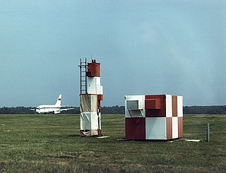
An instrument landing system localizer, or simply localizer, is a system of horizontal guidance in the instrument landing system, which is used to guide aircraft along the axis of the runway.

A precision approach path indicator (PAPI) is a system of lights on the side of an airport runway threshold that provides visual descent guidance information during final approach. It is generally located on the left-hand side of the runway approximately 300 meters beyond the landing threshold of the runway.

In aviation, an instrument approach or instrument approach procedure (IAP) is a series of predetermined maneuvers for the orderly transfer of an aircraft operating under instrument flight rules from the beginning of the initial approach to a landing, or to a point from which a landing may be made visually. These approaches are approved in the European Union by EASA and the respective country authorities and in the United States by the FAA or the United States Department of Defense for the military. The ICAO defines an instrument approach as, "a series of predetermined maneuvers by reference to flight instruments with specific protection from obstacles from the initial approach fix, or where applicable, from the beginning of a defined arrival route to a point from which a landing can be completed and thereafter, if landing is not completed, to a position at which holding or en route obstacle clearance criteria apply."

In aviation, autoland describes a system that fully automates the landing procedure of an aircraft's flight, with the flight crew supervising the process. Such systems enable airliners to land in weather conditions that would otherwise be dangerous or impossible to operate in.
A blind approach beacon system or beam approach beacon system (BABS) is an automatic radar landing system developed in the early 1940s.
The microwave landing system (MLS) is an all-weather, precision radio guidance system intended to be installed at large airports to assist aircraft in landing, including 'blind landings'. MLS enables an approaching aircraft to determine when it is aligned with the destination runway and on the correct glidepath for a safe landing. MLS was intended to replace or supplement the instrument landing systems (ILS). MLS has a number of operational advantages over ILS, including a wider selection of channels to avoid interference with nearby installations, excellent performance in all weather, a small "footprint" at the airports, and wide vertical and horizontal "capture" angles that allowed approaches from wider areas around the airport.

A marker beacon is a particular type of VHF radio beacon used in aviation, usually in conjunction with an instrument landing system (ILS), to give pilots a means to determine position along an established route to a destination such as a runway.

A transponder landing system (TLS) is an all-weather, precision landing system that uses existing airborne transponder and instrument landing system (ILS) equipment to create a precision approach at a location where an ILS would normally not be available.
In aviation, approach surveillance radar is a type of radar instrument approach provided with active assistance from air traffic control. The only airborne radio equipment required for radar approaches is a functioning radio transmitter and receiver. The radar controller vectors the aircraft to align it with the runway centerline. The controller continues the vectors to keep the aircraft on course until the pilot can complete the approach and landing by visual reference to the surface.
The AN/MPN-14K Mobile Ground Approach System can be configured as a complete Radar Approach Control (RAPCON) or Ground Controlled Approach (GCA) facility.
In aviation, a ground-controlled approach (GCA) is a type of service provided by air-traffic controllers whereby they guide aircraft to a safe landing, including in adverse weather conditions, based on primary radar images. Most commonly, a GCA uses information from either a precision approach radar or an airport surveillance radar. The term GCA may refer to any type of ground radar guided approach such as a PAR, PAR without glideslope or ASR. When both vertical and horizontal guidance from the PAR is given, the approach is termed a precision approach. If no PAR glidepath is given, even if PAR equipment is used for lateral guidance, it is considered a non-precision approach.
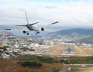
In aeronautics, the final approach is the last leg in an aircraft's approach to landing, when the aircraft is lined up with the runway and descending for landing. In aviation radio terminology, it is often shortened to "final".

An optical landing system (OLS) is used to give glidepath information to pilots in the terminal phase of landing on an aircraft carrier.
The AN/MPN is a mobile Ground-controlled approach radar first used during World War II. "MPN" is Joint Electronics Type Designation System nomenclature for (Ground) Mobile (M), Pulsed (P), Navigation aid (N).
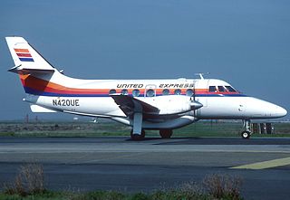
United Express Flight 2415 was a regularly scheduled flight in the northwest United States from Seattle to Pasco, Washington, operated using a BAe Jetstream 31. Late on Tuesday, December 26, 1989, Flight 2415 crashed while attempting to land at Pasco's Tri-Cities Airport, killing both pilots and all four passengers aboard.

Delta Air Lines Flight 723 was a flight operated by a McDonnell Douglas DC-9 twin-engine jetliner, operating as a scheduled domestic passenger flight from Burlington, Vermont, to Logan International Airport in Boston, Massachusetts, with an intermediate stop in Manchester, New Hampshire. On July 31, 1973, at 11:08 a.m., while on an instrument landing system (ILS) instrument approach into Logan in low clouds and fog, the aircraft descended below the glidepath, struck a seawall, and crashed. The incident killed all 89 occupants; two people initially survived, but later died of their injuries.


