
Pendleton County is a county located in the U.S. state of West Virginia. As of the 2010 census, the population was 7,695, making it the fifth-least populous county in West Virginia. Its county seat is Franklin. The county was created by the Virginia General Assembly in 1788 from parts of Augusta, Hardy, and Rockingham Counties and was named for Edmund Pendleton (1721–1803), a distinguished Virginia statesman and jurist. Pendleton County was strongly pro-Confederate during the American Civil War; however, there were pockets of Unionists who supported the state government in Wheeling.

Moorefield is a town and the county seat of Hardy County, West Virginia, USA. It is located at the confluence of the South Branch Potomac River and the South Fork South Branch Potomac River. Moorefield was originally chartered in 1777 and named for Conrad Moore, who owned the land upon which the town was laid out. The population was 2,544 at the 2010 census.

South Charleston is a city in Kanawha County, West Virginia, United States. It is located to the west of Charleston. The population was 13,450 at the 2010 census. South Charleston was established in 1906, but not incorporated until 1917. The Criel Mound built circa 0 B.C. by the Adena Culture is adjacent to the downtown business district.

The subtropical zones or subtropics are geographic and climate zones located to the north and south of the tropical zone. Geographically part of the north and south temperate zones, they cover the latitudes between 23°26′11.6″ and approximately 35° in the northern hemisphere and in the southern hemisphere.

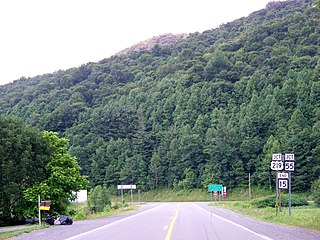
Riverton is an unincorporated community on the North Fork South Branch Potomac River in Pendleton County, West Virginia, United States. Riverton lies along U.S. Highway 33/West Virginia Route 28 in the Monongahela National Forest.

The climate of the United States varies due to changes in latitude, and a range of geographic features, including mountains and deserts. Generally, on the mainland, the climate of the U.S. becomes warmer the further south one travels, and drier the further west, until one reaches the West Coast.
Apple Grove is a census-designated place (CDP) in Mason County, West Virginia, United States, on the Ohio River located along West Virginia Route 2. Apple Grove lies just south of Gallipolis Ferry. As of the 2010 census, its population was 204. It is part of the Point Pleasant, WV–OH Micropolitan Statistical Area.
Millwood is an unincorporated community in northwestern Jackson County, West Virginia, United States, along the Ohio River at the mouth of Mill Creek. It lies along West Virginia Routes 2 and 62 northwest of the city of Ripley, the county seat of Jackson County. Its elevation is 577 feet (176 m). Although Millwood is unincorporated, it has a post office, with the ZIP code of 25262.
Belva is an unincorporated community and census-designated place in west Nicholas County and north Fayette County, West Virginia, United States; while the CDP only includes the Nicholas County portion, the Fayette County portion is considered part of the community. The town is situated at the bottomland surrounding the convergence of Bells Creek with Twentymile Creek and, subsequently, Twenty Mile Creek with the Gauley River. Belva is also the location of the convergence of two state highways: West Virginia Route 16 and West Virginia Route 39.
Neola is an unincorporated community in northeastern Greenbrier County, West Virginia, United States. It lies along West Virginia Route 92 north of the city of White Sulphur Springs. Its elevation is 2,037 feet (621 m).
Arbovale is an unincorporated community in Pocahontas County, West Virginia, United States. Arbovale is 12 miles (19 km) south of Durbin. Arbovale had a post office, which closed on March 3, 2007.
Dellslow is an unincorporated community in Monongalia County, West Virginia, United States. Dellslow was established in 1798 and is located along West Virginia Route 7 near the southern border of Brookhaven. Dellslow has a post office with ZIP code 26531.
Valley Head is a census-designated place (CDP) in Randolph County, West Virginia, United States. Valley Head is located on U.S. Route 219, 12 miles (19 km) south-southwest of Huttonsville. Valley Head has a post office with ZIP code 26294. As of the 2010 census, its population was 267.
Dailey is a census-designated place (CDP) in Randolph County, West Virginia, United States. Dailey is located on U.S. routes 219 and 250, 3 miles (4.8 km) south-southwest of Beverly. Dailey has a post office with ZIP code 26259. As of the 2010 census, its population was 114.
Hico is a census-designated place (CDP) in Fayette County, West Virginia, United States. Hico is located at the junction of U.S. routes 19 and 60, 7 miles (11 km) northeast of Fayetteville. Hico has a post office with ZIP code 25854. As of the 2010 census, its population was 272.
Sprague is an unincorporated community and coal town in Raleigh County, West Virginia, United States. Sprague is located on West Virginia Route 16, 1 mile (1.6 km) north of downtown Beckley. Sprague has a post office with ZIP code 25926.
Redstar is an unincorporated community in Fayette County, West Virginia, United States. Redstar is 2.5 miles (4.0 km) south of Oak Hill. Redstar had a post office with ZIP code 25914, which closed on January 20, 2007.
Dry Creek is an unincorporated community in Raleigh County, West Virginia, United States. Dry Creek is located on West Virginia Route 3 16 miles (26 km) west-northwest of Beckley. Dry Creek has a post office with ZIP code 25062.

Cora is an unincorporated community in Logan County, West Virginia, United States. Cora is 2 miles (3 km) southwest of Logan, along the Copperas Mine Fork. Cora has a post office with ZIP code 25614. It is part of the Mount Gay-Shamrock census-designated place.

Dante is a census-designated place in Russell and Dickenson counties, Virginia, in the United States. The population as of the 2010 Census was 649.


