Putnam County is a county located in the U.S. state of New York. As of the 2020 census, the population was 97,668. The county seat is Carmel. Putnam County formed in 1812 from Dutchess County and is named for Israel Putnam, a hero in the French and Indian War and a general in the American Revolutionary War.

Elmhurst is a city mostly in DuPage County and overlapping into Cook County in the U.S. state of Illinois, and a western suburb of Chicago. As of 2021, the city has an estimated population of 47,260.

Niles is a village in Cook County, Illinois, United States, located in the townships of Maine and Niles, directly neighboring the City of Chicago's far northwest border. Per the 2020 census, the population was 30,912. The current mayor of Niles is George Alpogianis.

Lisle is a village in DuPage County, Illinois, United States. The population was 22,390 at the 2010 census, and in 2019 the population was recorded to be 23,270. It is part of the Chicago metropolitan area and the Illinois Technology and Research Corridor. It is also the headquarters of the Nuclear Regulatory Commission Region III.

Algonquin is a village in McHenry and Kane counties, Illinois, in the United States. It is a suburb of Chicago, located approximately 40 miles (64 km) northwest of the Loop. As of the 2020 census, the village's population was 29,700.
Huntley is a village in McHenry and Kane counties, Illinois, United States. As of the 2020 census it had a population of 27,740. It is a part of the Chicago metropolitan area.

Cullom is a village in Livingston County, Illinois, United States. Cullom is situated twenty miles east of Pontiac which is the county seat, and is one mile west of the Ford County line. The population was 555 at the 2010 census.

Lake in the Hills is a village in McHenry County, Illinois, United States. As of the 2020 census, the population was 28,982.

Colfax is a village in McLean County, Illinois, United States. The population was 996 at the 2020 census. It is part of the Bloomington–Normal Metropolitan Statistical Area.

Watervliet is a city in Albany County, in the U.S. state of New York. The population was 10,375 as of the 2020 census. Watervliet is north of Albany, the capital of the state, and is bordered on the north, west, and south by the town of Colonie. The city is also known as "the Arsenal City".

Carmel is a town in Putnam County, New York, United States. As of the 2010 census, the town had a population of 34,305.

Pawling is a town in Dutchess County, New York, United States. Its population was 8,463 at the 2010 census. The town is named after Catherine Pauling, the daughter of Henry Beekman, who held the second largest land patent in the county. A misprint caused the U to change to a W and the name stuck. The town is in the southeastern part of the county, and contains a village of the same name.

St. Clair is a township in southwestern Ontario, Canada, immediately south of Sarnia in Lambton County, along the eastern shores of the St. Clair River.
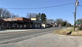
Bennett is a town in Chatham County, North Carolina, United States.
Collamer is an unincorporated community in Cleveland Township, Whitley County, Indiana, United States, located on the Eel River and at the intersection of Indiana State Road 14 and Whitley County road 900 W. Smith Rambo platted the town February 9, 1846. Collamer is named after Jacob Collamer, 13th United States Postmaster General.
Dahinda is an unincorporated community in Knox County, Illinois, United States. It is part of the Galesburg Micropolitan Statistical Area. Dahinda is in Persifer Township and lies approximately one mile north of U.S. Highway 150 and Interstate 74. Knox County Highway 15 runs from north to south through Dahinda. Once a bustling town, as time has gone on, the businesses in this community moved on, but the community still continues to exist.
Shirley is an unincorporated community located in southwestern McLean County, Illinois, United States, just off Interstate 55. It was founded in 1854 and currently has a population of 378. Shirley is home to the Funk Prairie Home & Rock Museum.
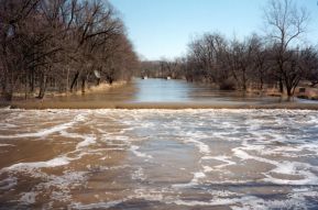
Weott is a census-designated place in Humboldt County, California. It is located 233 miles (375 km) north of San Francisco, California and 25 miles (40 km) due east of the Pacific Ocean. Lower Weott is situated at an elevation of 330 feet (100 m) along the Avenue of the Giants and in the flood plain of the South Fork of the Eel River. The population was 288 at the 2010 census. Note that Weott is not related to Camp Weeott, a fishing village established about 1925 and destroyed in the 1955 flood which was located 37 miles (60 km) northwest of Weott, near Ferndale, California.
Senachwine or Petchaho was a 19th-century Illinois River Potawatomi chieftain. In 1815, he succeeded his brother Gomo as chieftain of their band and was one of the last major Potawatomi chieftains to live in the region.
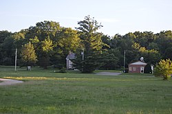
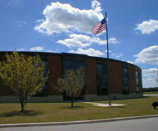
Henry-Senachwine High School, or HSHS, is a public four-year high school located at 1023 College Street in Henry, Illinois, a village in Marshall County, Illinois, in the Midwestern United States. HSHS serves the communities of Henry and Putnam. The campus is located 30 miles northeast of Peoria, Illinois, and serves a mixed village and rural residential community.