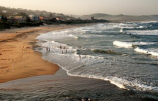
Scottburgh is a coastal resort town located on the south coast of KwaZulu-Natal, South Africa. It situated south of the mouth of the Mpambanyoni River (confuser of birds).

Ramsgate is a village on the south coast of KwaZulu-Natal in South Africa, just southwest of Margate. Ramsgate is located on the mouth of a river known by the Zulu name Bilanhlolo for the bubbles caused by strong currents making it look like the water is boiling. In 1922, there was only one person living there, Paul Buck, a painter and violin maker and he called the place Blue Lagoon.

Verulam is a town 24 kilometres north of Durban in KwaZulu-Natal, South Africa and part of the eThekwini Metropolitan area.

The R61 is a long provincial route in South Africa that connects Beaufort West with Port Shepstone via Graaff-Reinet, Komani, Mthatha and Port Edward.

The R102 is a Regional Route in South Africa. It is the route designation for all old sections of the N2, thus it is a discontinuous road that resumes in areas where a new N2 has been constructed.
The R323 is a Regional Route in South Africa that connects Riversdale in the south with Laingsburg in the north.
The R328 is a Regional Route in Western Cape, South Africa that connects Mossel Bay in the south to Prince Albert in the north via Oudtshoorn.
The R330 is a Regional Route in South Africa that connects Cape St. Francis on the south coast with Hankey to the north via Humansdorp.
The R332 is a Regional Route in South Africa that connects Willowmore with the R330 and the N2 near Humansdorp.
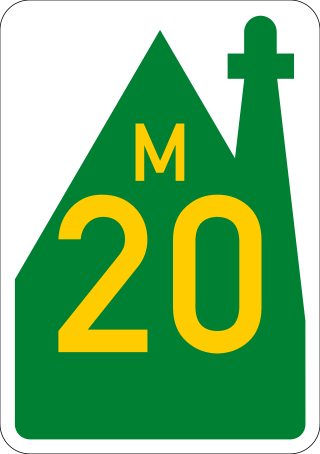
The R334 is a Regional Route in the Nelson Mandela Bay Metropolitan Municipality of South Africa that connects the N2 west of Port Elizabeth to the N2 at Coega north of Port Elizabeth via Uitenhage. The middle section of the route is also designated as the M20 metropolitan route.
The R335 is a Regional Route in South Africa that connects Nelson Mandela Bay in the south to Somerset East to the north via Addo.
The R355 is a Regional Route in South Africa that connects the R46 near Ceres with Springbok via Calvinia.

Gamtoos River or Gamptoos River is a river in the Eastern Cape Province, South Africa. It is formed by the confluence of the Kouga River and the Groot River and is approximately 645-kilometre (401 mi) long with a catchment area of 34,635 square kilometres (13,373 sq mi).
The M1 De Villiers Graaff motorway is a metropolitan route and major freeway in the City of Johannesburg, South Africa. The highway connects the southern areas with the city centre and extends further north through Sandton into the Ben Schoeman Highway towards Pretoria. Construction began in 1962 and resulted in the demolition of many properties and houses including numerous historical Parktown Mansions.
The M2 is a major highway and metropolitan route in Johannesburg, South Africa. It is named the Francois Oberholzer Freeway. It runs just to the south of the Johannesburg Central Business District eastwards where it connects with the N3 and enters Germiston, ending near its CBD. The north–south M1 intersects with the M2 just to the south-west of the Johannesburg CBD.

The N2 is a national route in South Africa that runs from Cape Town through George, Gqeberha, East London, Mthatha, Port Shepstone and Durban to Ermelo. It is the main highway along the Indian Ocean coast of the country. Its current length of 2,255 kilometres (1,401 mi) makes it the longest numbered route in South Africa.

The R62 is a provincial route in South Africa that connects Ashton with Humansdorp. The R62 runs through the Little Karoo and the Langkloof, passing through Montagu, Ladismith, Calitzdorp, Oudtshoorn, and Joubertina.

The Kouga Local Municipality is located in the Eastern Cape of South Africa, approximately 80 km west of Port Elizabeth, and forms part of the Sarah Baartman District Municipality. Its territory includes the coastal zone between the Van Stadens River in the east and the Tsitsikamma River in the west, and stretches inland towards the Baviaanskloof Mountains in the north.

Patensie is a town in Sarah Baartman District Municipality in the Eastern Cape province of South Africa. Patensie lies along the R331 road just south of Noorshoek. The Kouga Dam is located several kilometres to the west. The name is Khoi in origin, and means "cattle resting place". The town is a centre for the citrus, tobacco, and vegetable farms in the area.
