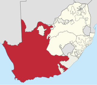
The Province of the Cape of Good Hope, commonly referred to as the Cape Province and colloquially as The Cape, was a province in the Union of South Africa and subsequently the Republic of South Africa. It encompassed the old Cape Colony, as well as Walvis Bay, and had Cape Town as its capital. In 1994, the Cape Province was divided into the new Eastern Cape, Northern Cape and Western Cape provinces, along with part of the North West.

The N3 is a national route in South Africa that connects Johannesburg and Durban, respectively South Africa's largest and third-largest cities. Johannesburg is the financial and commercial heartland of South Africa, while Durban is South Africa's key port and one of the busiest ports in the Southern Hemisphere and is also a holiday destination. Durban is the port through which Johannesburg imports and exports most of its goods. As a result, the N3 is a very busy highway and has a high volume of traffic.

The N1 is a national route in South Africa that runs from Cape Town through Bloemfontein, Johannesburg, Pretoria and Polokwane to Beit Bridge on the border with Zimbabwe. It forms the first section of the famed Cape to Cairo Road.
Carnarvon Highway is a state highway in Queensland and New South Wales, Australia, linking the township of Rolleston in Queensland's Central Highlands Region, via the town of St George, eventually to Moree in northern New South Wales. It is the main access road to the Carnarvon National Park, and serves as a strategic route to take B-doubles and other large vehicles to the Queensland ports north of Rockhampton.

Britstown is a small farming town situated in the Northern Cape province of South Africa, in the Pixley ka Seme District Municipality, Emthanjeni Local Municipality. The town is named after Hans Brits who settled here after he accompanied David Livingstone on a venture into the interior.

The R63 is a tarred provincial route in South Africa that connects Calvinia with Komga via Carnarvon, Victoria West, Graaff-Reinet, Somerset East and King William's Town. It is cosigned with the N10 between Eastpoort and Cookhouse for 24 kilometres.

The R102 is a Regional Route in South Africa. It is the route designation for all old sections of the N2, thus it is a discontinuous road that resumes in areas where a new N2 has been constructed.
The R307 is a Regional Route in South Africa that connects the R27 north of Melkbosstrand with the R45 south-west of Moorreesburg.
The R361 is a Regional Route in South Africa that connects Kenhardt with Carnarvon.
The R362 is a Regional Route in South Africa that connects Strandfontein with the N7 at Klawer.
The R398 is a Regional Route in South Africa that connects Middelburg with Britstown via Richmond.

The N12 is a national route in South Africa which runs from George through Beaufort West, Kimberley, Klerksdorp and Johannesburg to eMalahleni.

Carnarvon is a small town in the Northern Cape Province of South Africa.

The N10 is a national route in South Africa connecting Gqeberha on the Eastern Cape coast with the Namibian border at Nakop, via Cradock, De Aar and Upington.

The N14 is a national route in South Africa which runs from Springbok in the Northern Cape to Pretoria in Gauteng. It passes through Upington, Kuruman, Vryburg, Krugersdorp and Centurion. The section between Pretoria and Krugersdorp is maintained by the Gauteng Provincial government and is also designated the P158, and is also a 4-lane dual carriageway with 2 lanes in each direction.

Vosburg is a town 61 km west of Britstown, in the Northern Cape province of South Africa. The town has relatively low crime rate and features many 18th century buildings.

Strydenburg is a town in the east of the Northern Cape province in South Africa. Seventy-seven km north of Britstown, it was laid out by the Dutch Reformed Church on the farm Roodepan in 1892. It also lies on the N12, which separates the actual town from its township.

Prieska is a town on the south bank of the Orange River, in the province of the Northern Cape, in western South Africa. It is located on the southern bank of the Orange River, 130 km north-west of Britstown and 75 km south-east of Marydale.

C.H. Wheeler was a schooner-rigged unpowered lumber barge that operated during the year 1901, making only a few voyages before it was wrecked near Yaquina Bay with the loss of one life. C.H. Wheeler was the largest vessel up to that time to reach Tillamook City and the first vessel to transport a load of lumber from Tillamook to San Francisco. The circumstances of the loss of the C.H. Wheeler were controversial and resulted in the arrest of the captain of the tug that had been towing the barge before it was wrecked.
