
Klerksdorp is located in the North West Province, South Africa. Klerksdorp, the largest city in the North West Province, is located 165 km (103 mi) southeast of Mahikeng, the provincial capital. Klerksdorp was also the first capital of the then Transvaal Republic and used to be the home of the first Stock Exchange in the region. It became an important trading town linking Kimberley to Johannesburg. It became home to a mix of farmers, miners and immigrants servicing the two industries.

The R30 is a provincial route in South Africa that connects Bloemfontein with Rustenburg via Brandfort, Welkom, Bothaville, Klerksdorp and Ventersdorp. The southern part of the route is tolled, as the R30 forms the first section of the ZR Mahabane Toll Route, with the Brandfort Toll Plaza found 10 kilometres north of its Southern junction with the N1 National Route. The tolled portion ends at the junction with the R730.

The R31 is a provincial route in the Northern Cape of South Africa that connects Kimberley with the Namibian border at Rietfontein via Kuruman and Hotazel. It is co-signed with the R360 between Askham and Andriesvale.

The R33 is a provincial route in South Africa that connects Pietermaritzburg with Lephalale via Greytown, Paulpietersburg, Carolina, Belfast and Vaalwater. It is a very long road, passing through 3 provinces.

The R34 is a long provincial route in South Africa that connects Vryburg with Richards Bay via Kroonstad and Newcastle. It passes through three provinces, North West, the Free State and KwaZulu-Natal.

The R49 is a provincial route in North West, South Africa that connects Mahikeng with the Botswana border at Kopfontein near Gaborone, via Zeerust.

The R52 is a provincial route in North West, South Africa that connects Biesiesvlei with Rustenburg via Lichtenburg and Koster.

The R53 is a provincial route in South Africa that connects Swartruggens with Parys via Ventersdorp and Potchefstroom.

The R56 is a provincial route in South Africa that connects Middelburg with Pietermaritzburg via Molteno, Maclear and Kokstad. It is co-signed with the N2 between Kokstad and Stafford's Post for 39 kilometres.
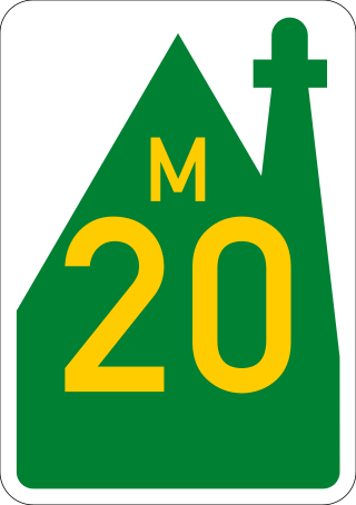
The R334 is a Regional Route in the Nelson Mandela Bay Metropolitan Municipality of South Africa that connects the N2 west of Port Elizabeth to the N2 at Coega north of Port Elizabeth via Uitenhage. The middle section of the route is also designated as the M20 metropolitan route.

The N12 is a national route in South Africa which runs from George through Beaufort West, Kimberley, Klerksdorp and Johannesburg to eMalahleni.

The N4 is a national route in South Africa that runs from Skilpadshek on the Botswana border, past Rustenburg, Pretoria, eMalahleni and Mbombela, to Komatipoort on the Mozambique border. It forms the South African section of the Trans-Kalahari Corridor, which runs from Walvis Bay to Maputo, meaning that it links the east and west coasts of Southern Africa.

The N11 is a national route in South Africa which runs from the Botswana border at Groblersbrug, through Mokopane, Middelburg, Ermelo and Newcastle to end at the N3 just after Ladysmith.

The N14 is a national route in South Africa which runs from Springbok in the Northern Cape to Pretoria in Gauteng. It passes through Upington, Kuruman, Vryburg, Krugersdorp and Centurion. The section between Pretoria and Krugersdorp is maintained by the Gauteng Provincial government and is also designated the P158.

The N18 is a national route in South Africa which runs from Warrenton through Vryburg and Mahikeng to Ramatlabama on the border with Botswana.
The R500 is a Regional Route in South Africa that connects Magaliesburg with Parys via Carletonville and Fochville.
The R505 is a Regional Route in South Africa. It connects Ottoshoop, North West Province in the north with Wesselsbron, Free State Province to the south.
The R507 is a Regional Route in South Africa.
The R511 is a Regional Route in South Africa that connects Sandton with Thabazimbi via Hartbeespoort and Brits.
The M18 road is a long metropolitan route in Gauteng, South Africa. It connects Pretoria with Thembisa via Centurion and Olifantsfontein.
