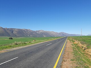
The R526 is a Regional Route in South Africa that connects Gravelotte with The Oaks via Mica. [1]
| Regional route R526 | ||||
|---|---|---|---|---|
| Route information | ||||
| Length | 64 km (40 mi) | |||
| Major junctions | ||||
| North end | ||||
| South0 end | ||||
| Location | ||||
| Country | South Africa | |||
| Highway system | ||||
| ||||
Its northern terminus is an intersection with the R71 at Gravelotte. From there it heads south-east for 33 kilometres to reach a junction with the R40. The R526 joins the R40 and they are one road southwards for 5 kilometres, through Mica, before the R526 becomes its own road south-west. It heads for 25 kilometers to reach its end at a junction with the R36 just north of The Oaks. [1]
The 25-kilometre section from Mica to The Oaks is also labelled as the R530.
Gravelotte is a small town situated in the east of the Limpopo province of South Africa.

The R27 is a provincial route in South Africa that consists of two disjoint segments. The first segment, also known as the West Coast Highway, connects Cape Town with Velddrif along the West Coast. The second runs from Vredendal via Vanrhynsdorp, Calvinia, Brandvlei and Kenhardt to Keimoes on the N14 near Upington. The connection between Velddrif and Vredendal has never been built, although it can be driven on various gravel roads.

The R30 is a provincial route in South Africa that connects Bloemfontein with Rustenburg via Brandfort, Welkom, Bothaville, Klerksdorp and Ventersdorp. The southern part of the route is tolled, as the R30 forms the first section of the ZR Mahabane Toll Route, with the Brandfort Toll Plaza found 10 kilometres north of its Southern junction with the N1 National Route. The tolled portion ends at the junction with the R730.

The R33 is a provincial route in South Africa that connects Pietermaritzburg with Lephalale via Greytown, Paulpietersburg, Carolina, Belfast and Vaalwater. It is a very long road, passing through 3 provinces.

The R34 is a long provincial route in South Africa that connects Vryburg with Richards Bay via Kroonstad and Newcastle. It passes through three provinces, North West, the Free State and KwaZulu-Natal.

The R35 is a provincial route in Mpumalanga, South Africa that connects Amersfoort with Middelburg via Morgenzon and Bethal. The R35 used to connect with the N3 near Ladysmith, but the portion of the road from Amersfoort onwards is now part of the N11.

The R36 is a provincial route in South Africa that connects the N1 with Ermelo, via Tzaneen and Lydenburg. It is co-signed with the N4 for 8 kilometres between Machadodorp and Patattanek, with a tollgate on this section. It used to extend further south past Ermelo to Amersfoort, but that section is now designated as part of the N11.

The R37 is a provincial route in South Africa that connects Polokwane with Nelspruit (Mbombela) via Burgersfort and Lydenburg.

The R38 is a provincial route in South Africa that connects Standerton with Kaapmuiden via Bethal, Carolina and Barberton. It is a main route through the province of Mpumalanga.

The R40 is a provincial route in South Africa that connects the Eswatini border at Bulembu via Barberton, Nelspruit and Hoedspruit with Phalaborwa. The route spans two provinces and passes through several private game reserves.

The R61 is a long provincial route in South Africa that connects Beaufort West with Port Shepstone via Graaff-Reinet, Komani, Mthatha and Port Edward.

The R63 is a tarred provincial route in South Africa that connects Calvinia with Komga via Carnarvon, Victoria West, Graaff-Reinet, Somerset East and King William's Town. It is cosigned with the N10 between Eastpoort and Cookhouse for 24 kilometres.

The R66 is a provincial route in KwaZulu-Natal, South Africa that connects Gingindlovu with Pongola via Eshowe, Melmoth and Ulundi. It starts and ends at a junction with the N2.

The R71 is a provincial route in Limpopo, South Africa that connects Polokwane with the Kruger National Park via the major towns of Tzaneen and Phalaborwa.

The R81 is a provincial route in Limpopo, South Africa that connects Polokwane with the R524 at Nyavani via Giyani.

The R365 is a Regional Route in South Africa that connects Piketberg and Lamberts Bay.

The N11 is a national route in South Africa which runs from the Botswana border at Groblersbrug, through Mokopane, Middelburg, Ermelo and Newcastle to end at the N3 just after Ladysmith.
The R500 is a Regional Route in South Africa that connects Magaliesburg with Parys via Carletonville and Fochville.
The R505 is a Regional Route in South Africa. It connects Ottoshoop, North West Province in the north with Wesselsbron, Free State Province to the south.

The M9 is a long metropolitan route in the City of Cape Town, South Africa. It connects Sir Lowry's Pass Village with Wynberg via Somerset West, Firgrove, Macassar, Khayelitsha and Nyanga.