The R531 is a Regional Route in South Africa. [1]
 | ||||
|---|---|---|---|---|
| Location | ||||
| Country | South Africa | |||
| Highway system | ||||
| ||||
The R531 is a Regional Route in South Africa. [1]
| | ||||
|---|---|---|---|---|
| Location | ||||
| Country | South Africa | |||
| Highway system | ||||
| ||||
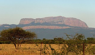
Its north-western terminus is the R527 midway between it western origin and the town of Hoedspruit in Limpopo. From there it heads south-east meeting the R40 at a staggered intersection at the village of Klaserie. It continues east and becomes the northern border between Limpopo and Mpumalanga. On the northern side of the road is Timbavati Game Reserve and on the southern Manyeleti. It ends at the Orpen Gate of the Kruger National Park.
Polokwane, also known by its former name, Pietersburg, is a city and the capital of the Limpopo Province of South Africa. It is South Africa's largest urban centre north of Gauteng. Polokwane was one of the host cities of the 2010 FIFA World Cup.

South Africa occupies the southern tip of Africa, its coastline stretching more than 2,850 kilometres from the desert border with Namibia on the Atlantic (western) coast southwards around the tip of Africa and then northeast to the border with Mozambique on the Indian Ocean. The low-lying coastal zone is narrow for much of that distance, soon giving way to a mountainous escarpment that separates the coast from the high inland plateau. In some places, notably the province of KwaZulu-Natal in the east, a greater distance separates the coast from the escarpment. Although much of the country is classified as semi-arid, it has considerable variation in climate as well as topography. The total land area is 1,220,813 km2 (471,359 sq mi). It has the 23rd largest Exclusive Economic Zone of 1,535,538 km2 (592,875 sq mi).

Limpopo is the northernmost province of South Africa. It is named after the Limpopo River, which forms the province's western and northern borders. The capital and largest city in the province is Polokwane, while the provincial legislature is situated in Lebowakgomo.

The N1 is a national route in South Africa that runs from Cape Town through Bloemfontein, Johannesburg, Pretoria and Polokwane to Beit Bridge on the border with Zimbabwe. It forms the first section of the famed Cape to Cairo Road.

The R37 is a provincial route in South Africa that connects Polokwane with Nelspruit (Mbombela) via Burgersfort and Lydenburg.

The R40 is a provincial route in South Africa that connects the Eswatini border at Bulembu via Barberton, Nelspruit and Hoedspruit with Phalaborwa. The route spans two provinces and passes through several private game reserves.

The R71 is a provincial route in Limpopo, South Africa that connects Polokwane with the Kruger National Park via the major towns of Tzaneen and Phalaborwa.

The R81 is a provincial route in Limpopo, South Africa that connects Polokwane with the R524 at Nyavani via Giyani.

The N11 is a national route in South Africa which runs from the Botswana border at Groblersbrug, through Mokopane, Middelburg, Ermelo and Newcastle to end at the N3 just after Ladysmith.
The South African National Roads Agency SOC Ltd or SANRAL is a South African parastatal responsible for the management, maintenance and development of South Africa's proclaimed National Road network which includes many National ("N") and some Provincial and Regional ("R") route segments.
The R101 is a Regional Route in South Africa that is the designation for some of the old sections of roads that were previously the N1, prior to upgrading. It only has 2 sections, from Bellville to Worcester and from Johannesburg to Polokwane.
Cassel Mathale is a South African politician who was the third Premier of Limpopo between March 2009 and July 2013. He is currently the Deputy Minister of Police in the South African government and before that was Deputy Minister of Small Business Development from February 2018 to May 2019.
The Blouberg, meaning "Blue Mountain" in Dutch, is a range of mountains in Limpopo Province, at the far north of South Africa. It is located in Blouberg Local Municipality, Capricorn District. The mountain is entrenched in the history of the local Northern Sotho people, and they have different names for its various parts.
The R511 is a Regional Route in South Africa that connects Sandton with Thabazimbi via Hartbeespoort and Brits.
The R532 is a Regional Route in South Africa.
The R533 is a Regional Route in South Africa.
The R555 is a Regional Route in South Africa that connects Springs with Ohrigstad via Delmas, Ogies, Witbank, Middelburg, Stoffberg and Burgersfort.
The R573 is a Regional Route in South Africa that connects Pretoria with Marble Hall via KwaMhlanga and Siyabuswa. As the road passes through Moloto, the entire route is known as the Moloto Road. It is maintained by the South African National Roads Agency.
The following index is provided as an overview of and topical guide to the protected areas of South Africa:
{{cite web}}: CS1 maint: url-status (link)| | This South African road or road transport-related article is a stub. You can help Wikipedia by expanding it. |