
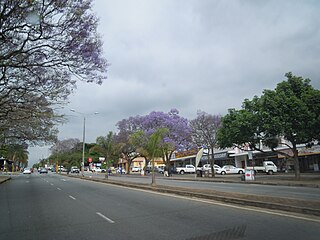
Mbombela, formerly Nelspruit, is a city in northeastern South Africa. It is the capital and the largest city of the Mpumalanga province. Located on the Crocodile River, The city lies about 110 km (68 mi) by road west of the Mozambique border, 330 km (210 mi) east of Johannesburg and 82 km (51 mi) north of the Eswatini border. The city was one of the host cities of the 2010 FIFA World Cup.
White River is a small holiday and farming town situated just north of Mbombela in Mpumalanga, South Africa. The farms in the region produce tropical fruits, macadamia nuts, vegetables, flowers and timber. As of 2011, White River had a population of 16,639.

The R23 is a provincial route in South Africa that links Benoni with Volksrust via Brakpan, Heidelberg and Standerton.

The R26 is a provincial route in Free State, South Africa that connects Rouxville with Villiers via Zastron, Wepener, Ladybrand, Ficksburg, Bethlehem & Reitz.

The R33 is a provincial route in South Africa that connects Pietermaritzburg with Lephalale via Greytown, Paulpietersburg, Carolina, Belfast and Vaalwater. It is a very long road, passing through 3 provinces.

The R34 is a long provincial route in South Africa that connects Vryburg with Richards Bay via Kroonstad and Newcastle. It passes through three provinces, North West, the Free State and KwaZulu-Natal.

The R35 is a provincial route in Mpumalanga, South Africa that connects Amersfoort with Middelburg via Morgenzon and Bethal. The R35 used to connect with the N3 near Ladysmith, but the portion of the road from Amersfoort onwards is now part of the N11.

The R37 is a provincial route in South Africa that connects Polokwane with Mbombela via Burgersfort and Lydenburg (Mashishing).

The R38 is a provincial route in South Africa that connects Standerton with Kaapmuiden via Bethal, Carolina and Barberton. It is a main route through the province of Mpumalanga.

The R40 is a provincial route in South Africa that connects the Eswatini border at Bulembu via Barberton, Mbombela, Bushbuckridge, Acornhoek and Hoedspruit with Phalaborwa. The route spans two provinces and passes through several private game reserves.

The R56 is a provincial route in South Africa that connects Middelburg with Pietermaritzburg via Molteno, Maclear and Kokstad. It is co-signed with the N2 between Kokstad and Stafford's Post for 39 kilometres.

The R59 is a provincial route in South Africa that connects Hertzogville with Alberton via Bothaville, Parys and Vereeniging. The R59 is a freeway from the R57 Junction in Sasolburg until the N12 Reading Interchange in Alberton, signposted as the Sybrand van Niekerk Freeway.

The R71 is a provincial route in Limpopo, South Africa that connects Polokwane with the Kruger National Park via Tzaneen and Phalaborwa.
The R104 is a regional route in South Africa that is the designation for some of the old sections of roads that were previously the N4, prior to upgrading. It connects Rustenburg in the North West province with eMalahleni in Mpumalanga province via Mooinooi, Hartbeespoort, Pretoria and Bronkhorstspruit. There are two additional sections in Mpumalanga province: a 50km section connecting Middelburg and Wonderfontein and a 17km section passing through Mbombela.

The N12 is a national route in South Africa which runs from George through Beaufort West, Kimberley, Klerksdorp and Johannesburg to eMalahleni.

The N4 is a national route in South Africa that runs from Skilpadshek on the Botswana border, past Rustenburg, Pretoria, eMalahleni and Mbombela, to Komatipoort on the Mozambique border. The entire route is a toll road.

The N6 is a national route in South Africa that connects East London with Bloemfontein, via Komani and Maletswai. It runs roughly from north to south, connecting the N1 with the N2.

The N11 is a national route in South Africa which runs from the Botswana border at Groblersbrug, through Mokopane, Middelburg, Ermelo and Newcastle to end at the N3 just after Ladysmith.
The R536 is a Regional Route in South Africa.
The R544 is a Regional Route in Mpumalanga, South Africa. It connects Bethal with Kwaggafontein via Witbank (eMalahleni) and Verena.
