
The Cherokee National Forest is a United States National Forest located in the U.S. states of Tennessee and North Carolina that was created on June 14, 1920. The forest is maintained and managed by the United States Forest Service. It encompasses an estimated area of 655,598 acres (2,653.11 km2).

Clearwater National Forest with headquarters on the Nez Perce Reservation at Kamiah is located in North Central Idaho in the northwestern United States. The forest is bounded on the east by the state of Montana, on the north by the Idaho Panhandle National Forest, and on the south and west by the Nez Perce National Forest and Palouse Prairie.

The Flathead National Forest is a national forest in the western part of the U.S. state of Montana. The forest lies primarily in Flathead County, south of Glacier National Park. The forest covers 2,404,935 acres of which about 1 million acres (4,000 km2) is designated wilderness. It is named after the Flathead Native Americans who live in the area.

The George Washington and Jefferson National Forests is an administrative entity combining two U.S. National Forests into one of the largest areas of public land in the Eastern United States. The forests cover 1.8 million acres (7,300 km2) of land in the Appalachian Mountains of Virginia, West Virginia, and Kentucky. Approximately 1 million acres (4,000 km2) of the forest are remote and undeveloped and 139,461 acres (564 km2) have been designated as wilderness areas, which prohibits future development.
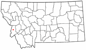
The Bitterroot Valley is located in southwestern Montana, along the Bitterroot River between the Bitterroot Range and Sapphire Mountains, in the Northwestern United States.

The Bob Marshall Wilderness Area is a congressionally-designated wilderness area located in Western Montana region of the United States. It is named after Bob Marshall (1901–1939), an early forester in the federal government, conservationist, and co-founder of The Wilderness Society. In the 1930s while working for the Forest Service, Marshall was largely responsible for designation of large areas to be preserved as roadless within lands administered by the Forest Service; he achieved this through promulgation of various regulations. Formally designated in 1964, the Bob Marshall Wilderness extends for 60 miles (97 km) along the Continental Divide and consists of 1,009,356 acres (4,084.72 km2).

Absaroka–Beartooth Wilderness was created from existing National Forest lands in 1978 and is located in Montana and Wyoming, United States. The wilderness is partly in Gallatin, Custer and Shoshone National Forests and is composed of 944,000 acres (3,820 km2). The wilderness encompasses two distinct mountain ranges, namely the Beartooth and Absaroka ranges. These ranges are completely distinct geologically speaking with the Absarokas composed primarily of volcanic and metamorphic rock, while the Beartooths are made up almost entirely of granitic rocks. The Absarokas are noted for their dark and craggy appearance, lush and heavily forested valleys and abundant wildlife. The highest peak in the range, located in Wyoming, is Francs Peak at 13,153 feet (4,009 m). The Beartooths are more alpine with huge treeless plateaus and the highest peak in the state of Montana. The wilderness contains 30 peaks over 12,000 feet (3,700 m). The wilderness is an integral part of the 20-million-acre (81,000 km2) Greater Yellowstone Ecosystem and borders Yellowstone National Park.

Bitterroot National Forest comprises 1.587 million acres (6,423 km²) in west-central Montana and eastern Idaho, of the United States. It is located primarily in Ravalli County, Montana, but also has acreage in Idaho County, Idaho (29.24%), and Missoula County, Montana (0.49%).

Lolo National Forest is a national forest located in western Montana, United States with the western boundary being the state of Idaho. The forest spans 2 million acres (8,000 km2) and includes four wilderness areas; the Scapegoat and the Selway-Bitterroot Wilderness are partially within the forest while the Welcome Creek and Rattlesnake Wildernesses are solely in Lolo National Forest. The forest was created in 1906 from 4 different previous forests which were combined for administrative purposes. Lolo National Forest is west of the Continental divide and has a biodiversity influenced by both continental and maritime weather creating a transitional forest that has a high number of different plant and tree species.
Wild Montana was founded by a group of Montana outfitters, ranchers, doctors, and friends. The organization is governed by a board of directors from across Montana, working at the local level through seven chapters in Helena, Bozeman, Missoula, Whitefish, Great Falls, Billings, and Butte. Each chapter is governed by a local board of directors. Since 1958, Wild Montana has worked to protect Montana's wilderness, wildlife habitat, and traditional recreation opportunities. The organization was instrumental in the passage of the 1964 Wilderness Act and in the designation of every Wilderness area in the state, like the Bob Marshall, Scapegoat, and Absaroka-Beartooth Wildernesses. It also helped win National Wild and Scenic Rivers System designations for the Missouri and Flathead rivers, and National Monument status for the Upper Missouri River Breaks.
The Rattlesnake Wilderness is located in the U.S. state of Montana. Created by an act of Congress in 1980, the wilderness is within Lolo National Forest and is located only 4 miles (6.5 km) north of Missoula, Montana. The wilderness area is a component of the Rattlesnake National Recreation Area. It protects much of the high country of the Rattlesnake Mountains.

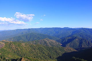
The Sapphire Mountains are a range of mountains located in southwestern Montana in the northwestern United States. From a point near the Clark Fork River and the city of Missoula, they run in a southerly direction for a distance of approximately 60 miles (100 km), making up much of the border between Ravalli County and Granite County. To the west is the Bitterroot Valley, and to the east is Rock Creek. The southern end of the range meets the larger Anaconda Range at West Pintler Peak.

The Lochsa River is in the northwestern United States, in the mountains of north central Idaho. It is one of two primary tributaries of the Middle Fork of the Clearwater River in the Clearwater National Forest. Lochsa is a Nez Perce word meaning rough water. The Salish name is Ep Smɫí, "It Has Salmon."

Lolo Peak is a mountain in the western United States, in the northern Rocky Mountains. It is located in the Bitterroot Range of western Montana in Missoula County, southwest of Missoula.
The Wild Rogue Wilderness is a wilderness area surrounding the 84-mile (135 km) Wild and Scenic portion of the Rogue River in southwestern Oregon, U.S. to protect the watershed. The wilderness was established in 1978 and now comprises 35,818 acres (14,495 ha). Because it spans part of the Rogue River-Siskiyou National Forest and the Medford district of the Bureau of Land Management (BLM), the Wild Rogue Wilderness is administered by both the BLM and the Forest Service.
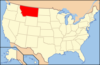
The following is an alphabetical list of articles related to the U.S. state of Montana.

Mount Jumbo, also called Mount Loyola by some locals, is a mountain that overlooks the city of Missoula in the U.S. state of Montana. The mountain is northeast of the city's downtown and, in its majority, is publicly owned. In 1996, Jumbo was purchased from private landowners and protected from development. Funding for this purchase came from an open space bond, federal and non-profit agencies and thousands of local contributors. Additional land parcels have been purchased since then, increasing the easement to 1,800 acres (730 ha).
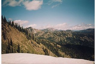
The Rattlesnake Mountains are a prominent mountain range located just 4 miles north of Missoula, Montana, USA. The highest point in the range is McLeod Peak,. Much of the range is protected in the Rattlesnake Wilderness and Rattlesnake National Recreation Area on the Lolo National Forest. An additional 36,000 acres (15,000 ha) of the range are protected on the Flathead Indian Reservation as the South Fork Tribal Primitive Area; this area is off-limits to non-tribal members. Including the Tribal Primitive Area, then, about 100,000 acres (40,000 ha) of the Rattlesnakes are roadless.

The Mount Rogers Cluster is a region recognized by The Wilderness Society for its unique high elevation mountains, vistas, trout streams and wildlife habitat. The heart of the region is Mount Rogers, the highest mountain in Virginia. The area extends over the Mount Rogers National Recreation Area and into part of the Cherokee National Forest.


