Ree Heights, South Dakota

Last updated

Ree Heights, South Dakota
Hand County South Dakota Incorporated and Unincorporated areas Ree Heights Highlighted.svg
Location in Hand County and the state of South Dakota
Coordinates: 44°30′57″N99°12′02″W / 44.51583°N 99.20056°W / 44.51583; -99.20056
Country United States
State South Dakota
County Hand
Founded1882 [1]
Area
[2]
  Total0.30 sq mi (0.77 km2)
  Land0.30 sq mi (0.77 km2)
  Water0.00 sq mi (0.00 km2)
Elevation
[3]
1,742 ft (531 m)
Population
 (2020) [4]
  Total59
  Density199.32/sq mi (76.89/km2)
Time zone UTC-6 (Central (CST))
  Summer (DST) UTC-5 (CDT)
ZIP code
57371
Area code 605
FIPS code 46-53940 [5]
GNIS feature ID1267548 [3]

Ree Heights is a town in western Hand County, South Dakota, United States. The population was 62 at the 2010 census.

Contents

History

Ree Heights was laid out in 1882. [6] The town was named after the Arikara (Ree) Indians. [7] A post office in Ree Heights has been in operation since 1882. [8]

Geography

According to the United States Census Bureau, the town has a total area of 0.30 square miles (0.78 km2), all land. [9]

Demographics

Historical population
CensusPop.Note
1930 339
1940 258−23.9%
1950 254−1.6%
1960 188−26.0%
1970 183−2.7%
1980 88−51.9%
1990 913.4%
2000 85−6.6%
2010 62−27.1%
2020 59−4.8%
U.S. Decennial Census [10] [4]

2010 census

As of the census [11] of 2010, there were 62 people, 28 households, and 18 families residing in the town. The population density was 206.7 inhabitants per square mile (79.8/km2). There were 52 housing units at an average density of 173.3 per square mile (66.9/km2). The racial makeup of the town was 100.0% White.

There were 28 households, of which 17.9% had children under the age of 18 living with them, 57.1% were married couples living together, 3.6% had a female householder with no husband present, 3.6% had a male householder with no wife present, and 35.7% were non-families. 25.0% of all households were made up of individuals, and 10.7% had someone living alone who was 65 years of age or older. The average household size was 2.21 and the average family size was 2.72.

The median age in the town was 54 years. 14.5% of residents were under the age of 18; 9.7% were between the ages of 18 and 24; 12.9% were from 25 to 44; 38.7% were from 45 to 64; and 24.2% were 65 years of age or older. The gender makeup of the town was 51.6% male and 48.4% female.

2000 census

As of the census [5] of 2000, there were 85 people, 36 households, and 24 families residing in the town. The population density was 291.7 inhabitants per square mile (112.6/km2). There were 46 housing units at an average density of 157.9 per square mile (61.0/km2). The racial makeup of the town was 97.65% White, 1.18% Asian, and 1.18% from two or more races.

There were 36 households, out of which 30.6% had children under the age of 18 living with them, 55.6% were married couples living together, 5.6% had a female householder with no husband present, and 33.3% were non-families. 22.2% of all households were made up of individuals, and 5.6% had someone living alone who was 65 years of age or older. The average household size was 2.36 and the average family size was 2.79.

In the town, the population was spread out, with 23.5% under the age of 18, 5.9% from 18 to 24, 22.4% from 25 to 44, 29.4% from 45 to 64, and 18.8% who were 65 years of age or older. The median age was 42 years. For every 100 females, there were 112.5 males. For every 100 females age 18 and over, there were 116.7 males.

The median income for a household in the town was $27,083, and the median income for a family was $27,083. Males had a median income of $23,750 versus $20,000 for females. The per capita income for the town was $10,276. There were 4.8% of families and 3.8% of the population living below the poverty line, including no under eighteens and 25.0% of those over 64.

Notable person

See also

Related Research Articles

<span class="mw-page-title-main">Ryland Heights, Kentucky</span> City in Kentucky, United States

Ryland Heights is a home rule-class city in Kenton County, Kentucky, in the United States. The population was 922 at the 2020 census.

<span class="mw-page-title-main">Hammond, Maine</span> Town in the state of Maine, United States

Hammond is a town in Aroostook County, Maine, United States. The population was 91 at the 2020 census.

<span class="mw-page-title-main">Westfield, Maine</span> Town in the state of Maine, United States

Westfield is a town in Aroostook County, Maine, United States. The population was 455 at the 2020 census.

Crawford is a town in Washington County, Maine, United States. The town was named after William H. Crawford, Secretary of the Treasury. The population was 93 at the 2020 census.

<span class="mw-page-title-main">Wykoff, Minnesota</span> City in Minnesota, United States

Wykoff is a city in Fillmore County, Minnesota, United States. The population was 444 at the 2010 census.

Normania Township is a township in Yellow Medicine County, Minnesota, United States. The population was 188 at the 2000 census.

<span class="mw-page-title-main">Inkster, North Dakota</span> City in North Dakota, United States

Inkster is a small city in Grand Forks County, North Dakota, United States, with a population of 38 as of the 2020 census. Inkster was founded in 1884, in an area that had been settled by George T. Inkster in 1878.

<span class="mw-page-title-main">Elko, South Carolina</span> Town in South Carolina, United States

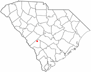
Elko is a town in Barnwell County, South Carolina, United States. According to the 2010 census the population was 193.

<span class="mw-page-title-main">Westport, South Dakota</span> Town in South Dakota, United States

Westport is a town in western Brown County, South Dakota, United States. The population was 88 at the 2020 census.

<span class="mw-page-title-main">Mound City, South Dakota</span> Town in South Dakota, United States

Mound City is a town in and the county seat of Campbell County, South Dakota, United States. The population was 69 at the 2020 census.

<span class="mw-page-title-main">Wagner, South Dakota</span> City in South Dakota, United States

Wagner is a city in Charles Mix County, South Dakota, United States. The population was 1,490 at the 2020 census. The city is served by Wagner Municipal Airport as well as YST Transit buses.

<span class="mw-page-title-main">Florence, South Dakota</span> Town in South Dakota, United States

Florence is a town in northwestern Codington County, South Dakota, United States. It is part of the Watertown, South Dakota Micropolitan Statistical Area. The population was 337 at the 2020 census.

<span class="mw-page-title-main">Fairburn, South Dakota</span> Town in South Dakota, United States

Fairburn is a town in Custer County, South Dakota, United States. The population was 60 at the 2020 census.

<span class="mw-page-title-main">Orient, South Dakota</span> Town in South Dakota, United States

Orient is a town in Faulk County, South Dakota, United States. The population was 51 at the 2020 census.

<span class="mw-page-title-main">Harrold, South Dakota</span> Town in South Dakota, United States

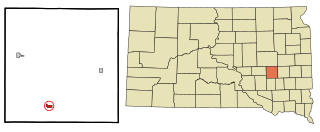
Harrold is a town in Hughes County, South Dakota, United States. It is part of the Pierre, South Dakota Micropolitan Statistical Area. The population was 101 at the 2020 census.

<span class="mw-page-title-main">Wood, South Dakota</span> Town in South Dakota, United States

Wood is a town in Mellette County, South Dakota, United States. The population was 41 at the 2020 census.

<span class="mw-page-title-main">Ashland Heights, South Dakota</span> CDP in South Dakota, United States

Ashland Heights is a census-designated place (CDP) and unincorporated community in Pennington County, South Dakota, United States. The population was 678 at the 2020 census.

<span class="mw-page-title-main">Letcher, South Dakota</span> Town in South Dakota, United States

Letcher is a town in Sanborn County, South Dakota, United States. The population was 159 at the 2020 census.

<span class="mw-page-title-main">Vance Creek, Wisconsin</span> Town in Wisconsin, United States

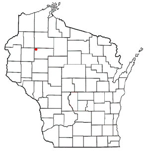
Vance Creek is a town in Barron County in the U.S. state of Wisconsin. The population was 669 at the 2010 census. The unincorporated community of Reeve is located in the town. The unincorporated community of Graytown is located partially in the town.

<span class="mw-page-title-main">Wilson, Rusk County, Wisconsin</span> Town in Wisconsin, United States

Wilson is a town in Rusk County, Wisconsin, United States. The population was 84 at the 2000 census.

References

  1. "SD Towns" (PDF). South Dakota State Historical Society . Retrieved February 15, 2010.
  2. "ArcGIS REST Services Directory". United States Census Bureau. Retrieved October 15, 2022.
  3. 1 2 U.S. Geological Survey Geographic Names Information System: Ree Heights, South Dakota
  4. 1 2 "Census Population API". United States Census Bureau. Retrieved October 15, 2022.
  5. 1 2 "U.S. Census website". United States Census Bureau . Retrieved January 31, 2008.
  6. Federal Writers' Project (1940). South Dakota place-names, v.1-3. University of South Dakota. p. 58.
  7. Chicago and North Western Railway Company (1908). A History of the Origin of the Place Names Connected with the Chicago & North Western and Chicago, St. Paul, Minneapolis & Omaha Railways. p. 117.
  8. "Hand County". Jim Forte Postal History. Retrieved March 26, 2015.
  9. "US Gazetteer files 2010". United States Census Bureau. Archived from the original on January 25, 2012. Retrieved June 21, 2012.
  10. "Census of Population and Housing". Census.gov. Retrieved June 4, 2015.
  11. "U.S. Census website". United States Census Bureau . Retrieved June 21, 2012.
  12. "Dr. Riley W. Gardner Obituary". The Topeka Capital-Journal. Retrieved October 3, 2012.

Further reading

Commons-logo.svg Media related to Ree Heights, South Dakota at Wikimedia Commons