Reevesville, South Carolina

Last updated

Reevesville, South Carolina
SCMap-doton-Reevesville.PNG
Location of Reevesville, South Carolina
Coordinates: 33°12′15″N80°38′50″W / 33.20417°N 80.64722°W / 33.20417; -80.64722
Country United States
State South Carolina
County Dorchester
Organized1875
Government
  MayorPaul Wimberly
Area
[1]
  Total1.63 sq mi (4.22 km2)
  Land1.61 sq mi (4.17 km2)
  Water0.02 sq mi (0.05 km2)
Elevation
108 ft (33 m)
Population
 (2020) [2]
  Total201
  Density124.92/sq mi (48.24/km2)
Time zone UTC-5 (Eastern (EST))
  Summer (DST) UTC-4 (EDT)
ZIP code
29471
Area code(s) 843, 854
FIPS code 45-59380 [3]
GNIS feature ID1250333 [4]

Reevesville is a town in Dorchester County, South Carolina, United States. The population was 196 at the 2010 census. As defined by the U.S. Office of Management and Budget, and used by the U.S. Census Bureau for statistical purposes only, Reevesville is included within the Charleston-North Charleston-Summerville metropolitan area.

Contents

Geography

Reevesville is located at 33°12′15″N80°38′50″W / 33.20417°N 80.64722°W / 33.20417; -80.64722 (33.204144, -80.647228). [5]

According to the United States Census Bureau, the town has a total area of 1.6 square miles (4.2 km2), of which, 1.6 square miles (4.1 km2) of it is land and 0.04 square miles (0.1 km2) of it (1.23%) is water.

History

L. Pressley Reeves, South Carolina's first game warden. Warden L. Pressley Reeves.jpg
L. Pressley Reeves, South Carolina's first game warden.

Reevesville is a predominantly agrarian community located between the banks of Cattle Creek and Polk Swamp near the Edisto River in Upper Dorchester County. The town’s name originates from its time as a once bustling railroad community known as “Reeves Station”. South Carolina Canal and Railroad Company built a railroad through the area in 1832 and shortly after, became known as “Reeves Station” for local farmer, David D. Reeves. Reeves hailed from one of the area’s original settling families and supplied wood as a source of fuel to the first locomotives to pass through the area. The Reeves name is associated with the area as early as 1825 as seen on Robert Mills Atlas Map.


In 1904, an African-American man called General Lee was lynched by a mob after he knocked on a white woman's door. [6]

Demographics

Historical population
CensusPop.Note
1890 109
1900 13725.7%
1910 20549.6%
1920 200−2.4%
1930 181−9.5%
1940 21719.9%
1950 28531.3%
1960 268−6.0%
1970 247−7.8%
1980 241−2.4%
1990 2441.2%
2000 207−15.2%
2010 196−5.3%
2020 2012.6%
U.S. Decennial Census [2]

As of the census [3] of 2000, there were 207 people, 90 households, and 62 families residing in the town. The population density was 129.0 inhabitants per square mile (49.8/km2). There were 114 housing units at an average density of 71.1 per square mile (27.5/km2). The racial makeup of the town was 77.78% White, 21.74% African American, and 0.48% from two or more races.

There were 90 households, out of which 24.4% had children under the age of 18 living with them, 52.2% were married couples living together, 14.4% had a female householder with no husband present, and 31.1% were non-families. 28.9% of all households were made up of individuals, and 17.8% had someone living alone who was 65 years of age or older. The average household size was 2.30 and the average family size was 2.82.

In the town, the population was spread out, with 19.3% under the age of 18, 5.8% from 18 to 24, 24.2% from 25 to 44, 31.4% from 45 to 64, and 19.3% who were 65 years of age or older. The median age was 46 years. For every 100 females, there were 86.5 males. For every 100 females age 18 and over, there were 74.0 males.

The median income for a household in the town was $26,667, and the median income for a family was $38,750. Males had a median income of $31,875 versus $30,357 for females. The per capita income for the town was $17,555. About 8.8% of families and 14.0% of the population were below the poverty line, including 29.4% of those under the age of eighteen and 14.5% of those 65 or over.

Related Research Articles

<span class="mw-page-title-main">Dorchester County, Maryland</span> County in Maryland, United States

Dorchester County is a county located in the U.S. state of Maryland. At the 2020 census, the population was 32,531. Its county seat is Cambridge. The county was formed in 1669 and named for the Earl of Dorset, a family friend of the Calverts.

<span class="mw-page-title-main">Dorchester County, South Carolina</span> County in South Carolina, United States

Dorchester County is a county located in the U.S. state of South Carolina. As of the 2020 census, the population was 161,540. Its county seat is St. George.

<span class="mw-page-title-main">Lynch, Kentucky</span> City in Kentucky, United States

Lynch is a home rule-class city in Harlan County, Kentucky, United States. In the 2020 census the city population was 658, down from 747 in 2010.

<span class="mw-page-title-main">Marion, Mississippi</span> Town in Mississippi, United States

Marion is a town in Lauderdale County, Mississippi, United States. It is a northeastern suburb of Meridian, the county seat. The population of Marion was 1,479 at the 2010 census.

<span class="mw-page-title-main">Artesia, Mississippi</span> Town in Mississippi, United States

Artesia is a town in Lowndes County, Mississippi. The population was 304 at the 2020 census, down from 440 at the 2010 census.

<span class="mw-page-title-main">Martinsburg, Missouri</span> City in Missouri, United States

Martinsburg is a city in Audrain County, Missouri, United States. The population was 304 at the 2010 census.

<span class="mw-page-title-main">Crete, Nebraska</span> City in Saline County, Nebraska, United States

Crete is a city in and the most populous municipality of Saline County, Nebraska, United States. The population was 7,099 at the 2020 census. The city is home to Doane University.

<span class="mw-page-title-main">Richland, Pennsylvania</span> Borough in Pennsylvania, United States

Richland is a borough in Lebanon County, Pennsylvania. It is part of the Lebanon County, Pennsylvania metropolitan statistical area. The population was 1,490 at the 2020 census.

<span class="mw-page-title-main">Wilmington Township, Mercer County, Pennsylvania</span> Township in Pennsylvania, United States

Wilmington Township is a township in Mercer County, Pennsylvania, United States. The population was 1,416 at the 2020 census, an increase from 1,415 in 2010.

<span class="mw-page-title-main">Salley, South Carolina</span> Town in South Carolina, United States of America

Salley is a town in Aiken County, South Carolina, United States. The population was 398 at the 2010 census. It is part of the Augusta, Georgia metropolitan area. Salley is known for hosting the Chitlin Strut, a town-wide festival, every November.

<span class="mw-page-title-main">Lincolnville, South Carolina</span> Town in South Carolina, United States

Lincolnville is a town in Charleston County, South Carolina, United States. A very small portion of the town extends into Dorchester County. The population was 1,139 at the 2010 census, up from 904 in 2000.

<span class="mw-page-title-main">Harleyville, South Carolina</span> Town in Dorchester County, South Carolina, United States

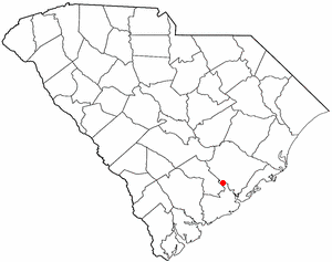
Harleyville is a town in Dorchester County, South Carolina, United States. The population was 677 at the 2010 census, up from 594 at the 2000 census. Harleyville is part of the Charleston-North Charleston-Summerville metropolitan area. As of 2018 the population is 696.

<span class="mw-page-title-main">Ridgeville, South Carolina</span> Town in South Carolina, United States

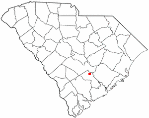
Ridgeville is a town in Dorchester County, South Carolina, United States. The population was 1,979 at the 2010 census, up from 1,690 at the 2000 census. Ridgeville is part of the Charleston-North Charleston-Summerville metropolitan area.

<span class="mw-page-title-main">St. George, South Carolina</span> Town in South Carolina, United States

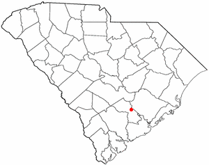
Saint George is a town in Dorchester County, South Carolina, United States. The population was 2,084 at the 2010 census, eight fewer than in 2000 census. It has been the county seat of Dorchester County since the county was formed from Colleton County in 1897.

<span class="mw-page-title-main">Branchville, South Carolina</span> Town in South Carolina, United States

Branchville is a town in Orangeburg County, South Carolina, United States. The population was 1,024 at the 2010 census.

<span class="mw-page-title-main">Norway, South Carolina</span> Town in South Carolina, United States

Norway is a town in Orangeburg County, South Carolina, United States. The population was 337 at the 2010 census.

<span class="mw-page-title-main">Santee, South Carolina</span> Town in South Carolina, United States

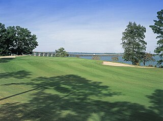
Santee is a town in Orangeburg County along the Santee River Valley in central South Carolina, United States. It has become a resort town of note located centrally north-south along the Atlantic Seaboard of South Carolina. The region has been rural, with a primarily agricultural economy typical of Orangeburg County, but is now known primarily for its several golf courses in proximity to Lake Marion, Santee State Park and other Lake Marion attractions. Interstate 95 connects its attractions easily with tourists traveling by automobile. I-95 crosses a narrow arm of the lake into the town lands, along a causeway. Lake Marion is a man-made hydroelectric reservoir, which at 110,000 acres is one of the fifty largest lakes in the country.

<span class="mw-page-title-main">Pringle, South Dakota</span> Town in South Dakota, United States

Pringle is a town in Custer County, South Dakota, United States. The population was 109 at the 2020 census.

<span class="mw-page-title-main">Ridgeland, Wisconsin</span> Village in Wisconsin, United States

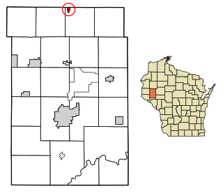
Ridgeland is a village in Dunn County, Wisconsin, United States. The population was 258 at the 2021 census.

<span class="mw-page-title-main">Ladson, South Carolina</span> Census-designated place in South Carolina, United States

Ladson is a census-designated place (CDP) in Berkeley, Charleston and Dorchester counties in the U.S. state of South Carolina. The population was 13,790 at the 2010 census. It is named in honor of the Ladson family, one of the oldest planter and merchant families in the Charleston area; one of its members was lieutenant governor James Ladson.

References

  1. "ArcGIS REST Services Directory". United States Census Bureau. Retrieved October 15, 2022.
  2. 1 2 "Census Population API". United States Census Bureau. Retrieved October 15, 2022.
  3. 1 2 "U.S. Census website". United States Census Bureau . Retrieved January 31, 2008.
  4. "US Board on Geographic Names". United States Geological Survey. October 25, 2007. Retrieved January 31, 2008.
  5. "US Gazetteer files: 2010, 2000, and 1990". United States Census Bureau. February 12, 2011. Retrieved April 23, 2011.
  6. Lynching in America: Confronting the Legacy of Racial Terror: Second Edition: Report Summary (PDF). Montgomery, Alabama: Equal Justice Initiative. 2015. p. 15. General Lee, a black man, was lynched by a white mob in 1904 for merely knocking on the door of a white woman's house in Reevesville, South Carolina.