
The Cannon House Office Building, often called the "Old House Office Building", completed in 1908, is the oldest office building of the United States Congress in Washington, D.C. A significant example of the Beaux-Arts style of architecture, it occupies a site south of the United States Capitol bounded by Independence Avenue, First Street, New Jersey Avenue, and C Street S.E. In 1962 the building was named for former Speaker of the United States House of Representatives Joseph Gurney Cannon.
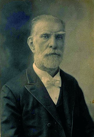
Adolf Ludwig Cluss also known as Adolph Cluss was a German-born American immigrant who became one of the most important, influential and prolific architects in Washington, D.C., in the late 19th century, responsible for the design of numerous schools and other notable public buildings in the capital. Today, several of his buildings are still standing. He was also a City Engineer and a Building Inspector for the Board of Public Works.

The Longworth House Office Building (LHOB) is one of five office buildings used by the United States House of Representatives. The building is located south of the Capitol, bounded by Independence Avenue, New Jersey Avenue, C Street S.E., and South Capitol Street, in southeast Washington. It has a floor area of 599,675 square feet (55,711.6 m2) and has a total of 251 congressional offices and suites, five large committee rooms, seven small committee rooms, and a large assembly room now used by the Ways and Means Committee.
The United States Coast and Geodetic Survey, known from 1807 to 1836 as the Survey of the Coast and from 1836 until 1878 as the United States Coast Survey, was the first scientific agency of the United States Government. It existed from 1807 to 1970, and throughout its history was responsible for mapping and charting the coast of the United States, and later the coasts of U.S. territories. In 1871, it gained the additional responsibility of surveying the interior of the United States and geodesy became a more important part of its work, leading to it being renamed the U.S. Coast and Geodetic Survey in 1878.

USC&GS A. D. Bache (1901-1927), often referred to only as Bache, continued the name of the Bache of 1871 and has been confused, including in the Dictionary of American Naval Fighting Ships, with that ship even though an entirely new hull and boiler were built in 1901 and only the name and some machinery and instruments were transferred to the new hull. The Bache of 1901 was transferred to the U.S. Navy for World War I service between 24 September 1917 through 21 June 1919 when she was returned to the Coast and Geodetic Survey.
The Office of Coast Survey is the official chartmaker of the United States. It is an element of the National Ocean Service in the National Oceanic and Atmospheric Administration, which is part of the United States Department of Commerce.
USC&GS Arago was a survey ship that served in the United States Coast Survey from 1854 to 1878 and in the United States Coast and Geodetic Survey from 1878 to 1881. From October 1861 into 1863 Arago was at times attached to the Navy's South Atlantic Blockading Squadron off South Carolina to provide hydrographic support. She was the first ship of the Coast Survey or Coast and Geodetic Survey to bear the name.

USC&GS Natoma was built as the private motorboat Natoma in 1913 for Charles H. Foster, President of the Cadillac Motor Car Company of Chicago. In 1917 the United States Navy acquired the boat for use in World War I. The vessel was commissioned USS Natoma for Section Patrol duties and designated SP-666. Natoma spent the war years patrolling New York harbor and approaches. On 9 April 1919 the boat was transferred to United States Coast and Geodetic Survey surveying on both coasts until 1935.

The second USC&GS Fathomer was a steamer that served as a survey ship in the United States Coast and Geodetic Survey from 1905 to 1942.

USC&GS Marinduque was a steamer, owned by the Philippine Insular Government, that served exclusively in the Philippines. The ship was purchased by the Philippine Bureau of Coast Guard and Transportation to support both government logistical and administrative travel needs as well as the usual functions of a coast guard vessel. The vessel was transferred to the United States Coast and Geodetic Survey serving as a survey ship from 1905 to 1932. Marinduque and Romblon were sister ships, both built in Japan.

USC&GS Romblon was a steamer, owned by the Philippine Insular Government, that served exclusively in the Philippines. The ship was purchased by the Philippine Bureau of Coast Guard and Transportation to support both government logistical and administrative travel needs as well as the usual functions of a coast guard vessel. The vessel was transferred to the United States Coast and Geodetic Survey serving as a survey ship from 1905 to 1932. Romblon and Marinduque were sister ships, both built in Japan.

USC&GSS Research was a survey vessel owned by the Philippine Insular Government to be the first vessel operated by the United States Coast and Geodetic Survey in the Philippines from 1901 until 1918.

The first USC&GSS Pathfinder, also noted in some NOAA histories as "old Pathfinder", was a United States Coast and Geodetic Survey ship in service from 1899 to 1941, when she was beached in sinking condition on January 30, 1942, after 40 years service in the Philippines.

The L'Enfant Plan for the city of Washington is the urban plan developed in 1791 by Major Pierre (Peter) Charles L'Enfant for George Washington, the first president of the United States.
The United States Hydrographic Office prepared and published maps, charts, and nautical books required in navigation. The office was established by an act of 21 June 1866 as part of the Bureau of Navigation, Department of the Navy. It was transferred to the Department of Defense on 10 August 1949. The office was abolished on 10 July 1962, replaced by the Naval Oceanographic Office.

USC&GS George S. Blake, in service 1874–1905, is, with the U.S. Fish Commission steamer Albatross, one of only two US oceanographic vessels with her name inscribed in the façade of the Oceanographic Museum, Monaco due to her being "the most innovative oceanographic vessel of the Nineteenth Century" with development of deep ocean exploration through introduction of steel cable for sounding, dredging and deep anchoring and data collection for the "first truly modern bathymetric map of a deep sea area."

USC&GS A. D. Bache (1871–1900), the second steamer of the U.S. Coast and Geodetic Survey, was named for the former superintendent Alexander Dallas Bache and launched August 1871 at Wilmington, Delaware.
USC&GS Drift was a United States Coast Survey schooner built in 1876 specifically to anchor in offshore waters to undertake current measurements. She was transferred to the United States Lighthouse Board on May 20, 1893 to become the lightship Light Vessel # 97 or (LV-97) on the Bush Bluff station until retirement and sale in 1918 to become the W. J. Townsend which was scrapped in 1945.

The first USC&GS Explorer was a steamer that served as a survey ship in the US Coast & Geodetic Survey (USCGS) from 1904-1939 with brief time 1918-1919 assigned to Navy for patrol in Alaskan waters. After initial service in the Atlantic the ship transferred to Seattle in 1907 to begin survey work in Alaskan waters during summer and more southern waters in winter. On return from the Navy the ship was condemned and due to be sold. Instead the ship was retained as a survey vessel into the fall of 1939 and existed into World War II when it saw service with the United States Army Corps of Engineers as Atkins.
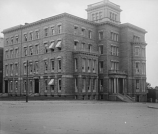
The Butler Building was a mansion in Washington, D.C., constructed by Benjamin Franklin Butler. It served as the headquarters of the U.S. Marine Hospital Service and its successor, the Public Health Service, from 1891 until 1929. It also contained a purpose-built fireproof unit to store archives of the U.S. Coast and Geodetic Survey. It was demolished in 1929 to construct the Longworth House Office Building.


