Riverfront Streetcar Line

Last updated
Riverfront
NewOrleansHUDRedStreetcarRiverfrontCanal.jpg
A 457 Series Perley Thomas replica streetcar operating on the Riverfront line
Overview
StatusPartially operating, closed south of Canal Street and interlined with Route 49
Owner New Orleans Regional Transit Authority
Line number2
Locale New Orleans, Louisiana
Termini
  • French Market
  • John Churchill Chase
Stations9
Service
Type Heritage streetcar
System Streetcars in New Orleans
Depot(s)A. Philip Randolph Operations Facility
Rolling stock457 Series Perley Thomas replica streetcars
History
OpenedAugust 14, 1988;35 years ago (1988-08-14) [1]
Technical
Line length2 mi (3.2 km) (total)
Number of tracks2
CharacterExclusive right-of-way
Track gauge 5 ft 2+12 in (1,588 mm)
Old gauge4 ft 8+12 in (1,435 mm) standard gauge
Electrification Overhead line,  600 V DC
Route map

Contents

BSicon uKHSTa.svg
French Market
BSicon uHST.svg
Ursulines Street
BSicon uHST.svg
Dumaine Street
BSicon uHST.svg
Toulouse Street
BSicon uHST.svg
Bienville Street
BSicon uHST.svg
Canal Street
BSicon ueABZgl.svg
BSicon uexdCONTfq.svg
Route 3 to Convention Center (closed)
BSicon uHST.svg
Harrah's Casino
47 48
BSicon uHST.svg
Peters Street
BSicon uHST.svg
Magazine/Decatur
BSicon uHST.svg
Camp/Chartres
BSicon uHST.svg
St. Charles/Royal
BSicon uHST.svg
Carondelet/Bourbon
BSicon uHST.svg
Baronne/Dauphine
BSicon uexdCONTgq.svg
BSicon ueABZg+r.svg
Route 49 to Elysian Fields (closed)
BSicon uHST.svg
Rampart
BSicon udCONTgq.svg
BSicon uABZgr+r.svg
BSicon uHST.svg
Poydras Street
BSicon uHST.svg
Hyatt Regency
BSicon uHST.svg
Julia Street
BSicon uKINTe.svg
Union Passenger Terminal (UPT)
BSicon LOGO Amtrak2.svg Greyhound no dog.svg
Normal routing (closed)
BSicon uKHSTa.svg
French Market
BSicon uHST.svg
Ursulines Street
BSicon uHST.svg
Dumaine Street
BSicon uHST.svg
Toulouse Street
BSicon uHST.svg
Bienville Street
BSicon uHST.svg
Canal Street
47 48 Ferry symbol.svg
BSicon udCONTgq.svg
BSicon uxABZgr.svg
to depot via Canal St
BSicon uexHST.svg
Poydras Street
BSicon uexHST.svg
Julia Street
BSicon uexKHSTe.svg
John Churchill Chase

The Riverfront Streetcar Line is a historic streetcar line in New Orleans, Louisiana. It is operated by the New Orleans Regional Transit Authority (RTA). It was built along the east bank of the Mississippi River, in an area with many amenities catering to tourists. It opened August 14, 1988, making it the first new streetcar route in New Orleans in 62 years. The line runs 2 miles (3.2 km) [2] from Julia Street at the upper end of the New Orleans Convention Center to the downriver (far) end of the French Quarter at the foot of Esplanade Avenue. Unlike the other three lines, it travels on an exclusive right-of-way, along the river levee beside New Orleans Belt Railway tracks, making it more akin to a light rail line. The line was regauged in 1997 from standard gauge to broad gauge. Officially, the Riverfront Line is designated Route 2 and is designated with a blue color on most RTA publications.

History

Riverfront Streetcar in 1988, the line's first year of operation. RiverfrontRedcar1988.jpg
Riverfront Streetcar in 1988, the line's first year of operation.

Two retired Perley Thomas streetcars, formerly running along the Canal line until 1964, were repurchased and refurbished, along with two W2-type streetcars originally from Melbourne, Australia. It was the city's first accessible streetcar line, using the Melbourne cars; the historic landmark status of the Saint Charles route prevented the modification of the cars on that line.

From the time it opened in 1988, the Riverfront line was originally single-track, 4 ft 8+12 in (1,435 mm) standard gauge , with one passing siding. But the line proved to be so popular that this was inadequate, so in 1990, it was temporarily closed and a second track was added. At the same time, another repurchased Perley Thomas streetcar and another ex-Melbourne streetcar were added to the fleet. The six cars in the fleet were all renumbered into a common series before entering service, with the three original New Orleans (Perley Thomas) cars being numbered 450, 451, and 456 (ex-924, 919, and 952, in that order). [3] The W2-type cars were numbered 452, 454, and 455 for Riverfront service, and were formerly Melbourne cars 626, 478, and 331, respectively. [1]

By 1997, RTA felt the need for additional wheelchair access on the Riverfront line. It was decided to build new streetcars, which would be replicas of the venerable Perley Thomas cars, but would have more modern trucks and controls. The first such car used the body shell of another repurchased Perley Thomas streetcar, number 957 (renumbered 457), with a wheelchair access door cut into its side. Six additional replica car bodies, which became cars 458–463, were built from scratch in the venerable Carrollton Shops. After some experimentation with secondhand PCC trucks and controls salvaged from retired Philadelphia streetcars, initially installed in two cars (457–458), [4] [5] [6] eventually all seven new cars were equipped with trucks and controls from the Czech builder ČKD Tatra. [7]

At the same time, it was decided to regauge the Riverfront line to broad gauge ( 5 ft 2+12 in or 1,588 mm) to conform to the St. Charles track gauge, and to build a connecting track on Canal Street from St. Charles to Riverfront. This would make it much easier to service Riverfront cars at Carrollton Station, and they could even be housed at Carrollton rather than out in the open at the ends of the Riverfront line.

The last day of standard gauge operation of Riverfront was September 6, 1997, [8] after which the line was again temporarily closed and the track gauge changed. The three Perley Thomas cars and the three ex-Melbourne cars were retired at this time. The ex-Melbourne cars were sold to the Memphis Area Transit Authority, for use on that city's Main Street Trolley line. [8] One of the Perley Thomas cars was sent to the San Francisco Municipal Railway, and the other two were stored at Carrollton Station. The Riverfront line reopened on December 13, 1997, [6] with the new cars running on the broad-gauge track.

Operation

The Riverfront Streetcar normally operates 24 hours a day. Frequencies range from 20 minutes 6 a.m. to 10 p.m., to 40 minutes nightly after 10 p.m. [9]

Because of complaints regarding infrequency of service on the Riverfront line, NORTA has installed LCD screens at each of the stops along the route to show approximate incoming times in each direction, as well as an animated display showing destinations and stops in both directions along the line. These times have often proven inaccurate due to fluctuations in the time required to traverse the track length. Recently, many of the displays have stopped working due to vandalism.

Due to construction on the World Trade Center building, service is suspended between Canal Street and the Julia Street end of the Riverfront line. [10]

On October 12, 2019, a building under construction at the corner of Canal Street and N. Rampart Street collapsed, blocking the Canal line (see Hard Rock hotel collapse). For a while, the Riverfront line provided service on Canal Street through the business district, operating from the French Market terminal to Canal Street, then out Canal to Carondelet Street. [11]

Currently, the operable portion of the Riverfront line is combined with the operable portion of the Rampart-St. Claude line as Route 49. From the French Market terminal, it runs to Canal Street, then out Canal to University Place (Loyola Avenue), and out Loyola to the terminal at UPT. [12]

Stop listing

Typical streetcar station design throughout the Riverfront line New Orleans Streetcars 2009 06.jpg
Typical streetcar station design throughout the Riverfront line

From the French Quarter to the Convention Center area

StopNeighborhood(s)Other streetcar linesNotes
French Market French Quarter Near the intersection of Peters Street and Esplanade Avenue.
Serves French Market and New Orleans Mint.
Ursulines StreetFrench QuarterServes French Market.
Dumaine StreetFrench QuarterServes Jackson Square, Preservation Hall, St. Louis Cathedral and Woldenberg Park.
Toulouse StreetFrench QuarterServes Jax Brewery and Woldenberg Park.
Bienville StreetFrench QuarterServes Woldenberg Park.
Canal Street Downtown, Central Business District, French Quarter 47 48 Connects with Canal Street Ferry Terminal.
Serves Audubon Aquarium of the Americas, Harrah's Casino, Woldenberg Park, and World Trade Center.
Poydras Street Downtown, Central Business DistrictServes The Outlet Collection at Riverwalk.
Julia StreetDowntown, Central Business DistrictServes Port of New Orleans, The Outlet Collection at Riverwalk, and Morial Convention Center.
John Churchill ChaseCentral Business DistrictServes Morial Convention Center.
Named for John Churchill Chase.

Related Research Articles

<span class="mw-page-title-main">Tram</span> Street-running light railcar

A tram is a type of urban rail transit consisting of a rail vehicle, either individual railcars or self-propelled trains coupled by a multiple unit, that runs on tramway tracks on urban public streets; some include segments on segregated right-of-way. The tramlines or networks operated as public transport are called tramways or simply trams/streetcars. Many recently built tramways use the contemporary term light rail.

<span class="mw-page-title-main">Light rail</span> Form of passenger urban rail transit

Light rail transit (LRT) is a form of passenger urban rail transit characterized by a combination of tram and rapid transit features. While its rolling stock is similar to that of a traditional tram, it operates at a higher capacity and speed and often on an exclusive right-of-way. In many cities, light rail transit systems more closely resemble, and are therefore indistinguishable from, traditional underground or at-grade subways and heavy-rail metros.

<span class="mw-page-title-main">New Orleans Regional Transit Authority</span> Public transit operator in New Orleans, Louisiana

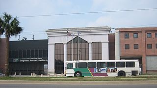
The New Orleans Regional Transit Authority is a public transportation agency based in New Orleans. The agency was established by the Louisiana State Legislature in 1979, and has operated bus and historic streetcar service throughout the city since 1983. In 2023, the system had a ridership of 9,707,300, or about 29,700 per weekday as of the fourth quarter of 2023, making the Regional Transit Authority the largest public transit agency in the state of Louisiana.

<span class="mw-page-title-main">Heritage railway</span> Railway used for heritage/historical/tourism purposes

A heritage railway or heritage railroad is a railway operated as living history to re-create or preserve railway scenes of the past. Heritage railways are often old railway lines preserved in a state depicting a period in the history of rail transport.

<span class="mw-page-title-main">Streetcars in New Orleans</span>

Streetcars in New Orleans have been an integral part of the city's public transportation network since the first half of the 19th century. The longest of New Orleans' streetcar lines, the St. Charles Avenue line, is the oldest continuously operating street railway system in the world. Today, the streetcars are operated by the New Orleans Regional Transit Authority (RTA).

<span class="mw-page-title-main">RTA Rapid Transit</span> Public transit network in Cleveland, Ohio

RTA Rapid Transit is a rapid transit and light rail system owned and operated by the Greater Cleveland Regional Transit Authority (GCRTA).

<span class="mw-page-title-main">Perley A. Thomas Car Works</span> Rolling stock manufacturer

Perley A. Thomas Car Works, Inc. was an American manufacturer of streetcars based in High Point, North Carolina. Following the liquidation of Southern Car Works, its engineer Perley A. Thomas in 1916 founded the new company named for himself. Along with the manufacture of complete streetcars, Thomas Car Works also renovated and repaired existing cars to supplement its production.

<span class="mw-page-title-main">Horsecar</span> Animal-powered tram or streetcar

A horsecar, horse-drawn tram, horse-drawn streetcar (U.S.), or horse-drawn railway (historical), is an animal-powered tram or streetcar.

<span class="mw-page-title-main">F Market & Wharves</span> San Francisco heritage streetcar line

The F Market & Wharves line is one of several light rail lines in San Francisco, California. Unlike most other lines in the system, the F line runs as a heritage streetcar service, almost exclusively using historic equipment both from San Francisco's retired fleet as well as from cities around the world. While the F line is operated by the San Francisco Municipal Railway (Muni), its operation is supported by Market Street Railway, a nonprofit organization of streetcar enthusiasts which raises funds and helps to restore vintage streetcars.

<span class="mw-page-title-main">St. Charles Streetcar Line</span> Streetcar line in New Orleans, Louisiana

The St. Charles Streetcar Line is a historic streetcar line in New Orleans, Louisiana. Running since 1835, it is the oldest continuously operating streetcar line in the world. It is operated by the New Orleans Regional Transit Authority (RTA). Officially the St. Charles Streetcar line is designated as Route 12, and it runs along its namesake, St. Charles Avenue. It is the busiest route in the RTA system as it is heavily used by local commuters and tourists. On most RTA maps and publications, it is denoted in green, which is also the color of the streetcars on this line.

The Texas Transportation Company was an electrified, Class III, short-line railroad in San Antonio, Texas, that operated from 1897 until 2001. It served the Pearl Brewery and several other businesses, moving carloads between those businesses and the Southern Pacific yard. Service ended on June 30, 2000, shortly before the Pabst Brewing Company closed the Pearl Brewery, in early 2001.

<span class="mw-page-title-main">Light rail in North America</span> Mode of public transit

Light rail is a commonly used mode of public transit in North America. The term light rail was coined in 1972 by the Urban Mass Transportation Administration to describe new streetcar transformations which were taking place in Europe and the United States. The Germans used the term Stadtbahn, which is the predecessor to North American light rail, to describe the concept, and many in UMTA wanted to adopt the direct translation, which is city rail. However, in its reports, UMTA finally adopted the term light rail instead.

<span class="mw-page-title-main">Streetcars in North America</span> History of street cars

Streetcars or trolley(car)s were once the chief mode of public transit in hundreds of North American cities and towns. Most of the original urban streetcar systems were either dismantled in the mid-20th century or converted to other modes of operation, such as light rail. Today, only Toronto still operates a streetcar network essentially unchanged in layout and mode of operation.

<span class="mw-page-title-main">Canal Streetcar Line</span> Historic streetcar line in New Orleans, Louisiana

The Canal Streetcar Line is a historic streetcar line in New Orleans, Louisiana. It is operated by the New Orleans Regional Transit Authority (RTA). It originally operated from 1861 to 1964. It was redesigned and rebuilt between 2000 and 2004, and operation was reinstated in 2004 after a 40-year hiatus. Primarily running along its namesake street, Canal Street, it consists of two branches named for their outer terminals, totaling about 5+12 miles (8.9 km) in length: "Canal–Cemeteries" and "Canal–City Park/Museum". Each branch is denoted with the red and light green colors respectively on most RTA publications.

<span class="mw-page-title-main">MATA Trolley</span> Streetcar system in Memphis, Tennessee

The MATA Trolley is a heritage streetcar transit system operating in Memphis, Tennessee. It began operating on April 29, 1993. Service was suspended in June 2014, following fires on two cars. After nearly four years and repeated postponements, the reopening of the Main Street Line took place on April 30, 2018. The system's two other lines remained suspended as of December 2022, but with reopening of both planned. In 2023, the system had a ridership of 365,400.

<span class="mw-page-title-main">History of tram and light rail transit systems by country</span>

Although tram systems date to the late 19th and early 20th centuries, many old systems were closed during the mid-20th century because of the advent of automobile travel. This was especially the case in North America, but postwar reductions and shutdowns also occurred on British, French and other Western European urban rail networks. However, traditional tramway systems survived, and eventually even began to thrive from the late 20th century onward, some eventually operating as much as when they were first built over a century ago. Their numbers have been augmented by modern tramway or light rail systems in cities which had discarded this form of transport.

<span class="mw-page-title-main">New Orleans and Carrollton Railroad</span> Short-line rail system connecting New Orleans with surrounding neighborhoods

The New Orleans and Carrollton Railroad was one of six short-line rail systems built to connect the city of New Orleans, Louisiana, with surrounding neighborhoods, in this case, four-and-a-half miles to the resort village of Carrollton. It was one of the first public transit trolley systems built in the urban United States.

<span class="mw-page-title-main">Track gauge in North America</span>

The vast majority of North American railroads are standard gauge. Exceptions include some streetcar, subway and rapid transit systems, mining and tunneling operations, and some narrow-gauge lines particularly in the west, e.g. the isolated White Pass and Yukon Route system, and the former Newfoundland Railway.

The Gomaco Trolley Company is a manufacturer of vintage-style streetcars, located in Ida Grove, Iowa, United States. The company has supplied replica-vintage streetcars to several transit systems in the US, and has also restored and rebuilt authentic vintage streetcars for some systems.

<span class="mw-page-title-main">Rampart–St. Claude Streetcar Line</span>

The Rampart–St. Claude Streetcar Line is a historic streetcar line in New Orleans, Louisiana. It is operated by the New Orleans Regional Transit Authority (RTA). It is the newest streetcar line in the system, as it opened on October 2, 2016, with the total length of the line being 2.4 mi (3.9 km). The line is officially designated Route 49 and is denoted with a gold color on most RTA publications.

References

  1. 1 2 Wilkins, Van (Autumn 1994). "Veterans From Down Under". The New Electric Railway Journal . Free Congress Foundation: 23–24. ISSN   1048-3845 . Retrieved 2014-12-08.
  2. "APTA Streetcar and Heritage Trolley Site - New Orleans Overview". American Public Transportation Association . Retrieved July 16, 2013.
  3. Sebree, Mac, ed. (1993). 1993 North American Light Rail Annual and User's Guide. Glendale, CA: Interurban Press. p. 42. ISSN   0160-6913.
  4. Lietwiler, C. J. (December 2004). "New Orleans: Streetcars return to Canal Street". Tramways & Urban Transit . Hersham, Surrey, UK: Ian Allan Publishing/Light Rail Transit Association. pp. 452–456.
  5. Rice, Walter E. (November 1997). "New Orleans: Where Perley Thomas streetcars still rule". Light Rail and Modern Tramway . Ian Allan Publishing/Light Rail Transit Association. pp. 422–425.
  6. 1 2 "Systems News" section, Tramways & Urban Transit magazine, February 1998, p. 79.
  7. Korbel, Viktor (November 1999). "T6C5: A Czech tram for North America". Tramways & Urban Transit . Ian Allan Publishing/Light Rail Transit Association. p. 408.
  8. 1 2 TNERJ staff (Autumn 1997). "The New Ladies in Red". The New Electric Railway Journal . 10 (1). CityRail Ltd.: 36–37. ISSN   1048-3845 . Retrieved 2014-12-08.
  9. "New Orleans RTA". New Orleans RTA. Retrieved September 24, 2019.
  10. Evans, Beau. "Streetcars to run all night along Canal Street, Riverfront". Nola.com - The Times Picayune. Retrieved October 1, 2018.
  11. "New Orleans RTA". New Orleans RTA. Retrieved January 1, 2021.
  12. "New Orleans Regional Transit Authority". New Orleans Regional Transit Authority. Retrieved August 3, 2022.
Template:Attached KML/Riverfront Streetcar Line
KML is from Wikidata