Rocky Creek, Florida

Last updated
Rocky Creek, Florida
Unincorporated community
USA Florida location map.svg
Red pog.svg
Rocky Creek
Location within the state of Florida
Usa edcp location map.svg
Red pog.svg
Rocky Creek
Rocky Creek (the US)
Coordinates: 28°0′15″N82°34′47″W / 28.00417°N 82.57972°W / 28.00417; -82.57972 Coordinates: 28°0′15″N82°34′47″W / 28.00417°N 82.57972°W / 28.00417; -82.57972
Country United States
State Florida
County Hillsborough
Time zone Eastern (EST) (UTC-5)
  Summer (DST) EDT (UTC-4)

Rocky Creek is an unincorporated community in Hillsborough County, Florida, United States. Although a separate community, it is a part of the census-designated place (CDP) of Town 'n' Country. [1] [2] The ZIP code for the community is 33615.

Unincorporated area Region of land not governed by own local government

In law, an unincorporated area is a region of land that is not governed by a local municipal corporation; similarly an unincorporated community is a settlement that is not governed by its own local municipal corporation, but rather is administered as part of larger administrative divisions, such as a township, parish, borough, county, city, canton, state, province or country. Occasionally, municipalities dissolve or disincorporate, which may happen if they become fiscally insolvent, and services become the responsibility of a higher administration. Widespread unincorporated communities and areas are a distinguishing feature of the United States and Canada. In most other countries of the world, there are either no unincorporated areas at all, or these are very rare; typically remote, outlying, sparsely populated or uninhabited areas.

Hillsborough County, Florida county in Florida, United States of America

Hillsborough County is a county in the U.S. state of Florida. In the 2010 census, the population was 1,229,226, making it the fourth-most populous county in Florida and the most populous county outside the Miami Metropolitan Area. A 2017 estimate has the population of Hillsborough County at 1,408,566 people, which itself is greater than the populations of 10 states according to their 2017 population estimates. Its county seat and largest city is Tampa.

Florida State of the United States of America

Florida is the southernmost contiguous state in the United States. The state is bordered to the west by the Gulf of Mexico, to the northwest by Alabama, to the north by Georgia, to the east by the Atlantic Ocean, and to the south by the Straits of Florida. Florida is the 22nd-most extensive, the 3rd-most populous, and the 8th-most densely populated of the U.S. states. Jacksonville is the most populous municipality in the state and the largest city by area in the contiguous United States. The Miami metropolitan area is Florida's most populous urban area. Tallahassee is the state's capital.

Contents

Geography

Rocky Creek is located at 28° 0' 15" north, 82° 34' 47" west (28.004, -82.57972); [3] or approximately eight miles northwest of Tampa. [4] The elevation for the community is three feet above sea level. [5]

Tampa, Florida City in Central Florida

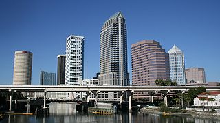
Tampa is a major city in, and the county seat of, Hillsborough County, Florida, United States. It is on the west coast of Florida on Tampa Bay, near the Gulf of Mexico, and is the largest city in the Tampa Bay Area. The bay's port is the largest in the state, near downtown's Channel District. Bayshore Boulevard runs along the bay, and is east of the historic Hyde Park neighborhood.

Elevation Height of a geographic location above a fixed reference point

The elevation of a geographic location is its height above or below a fixed reference point, most commonly a reference geoid, a mathematical model of the Earth's sea level as an equipotential gravitational surface . The term elevation is mainly used when referring to points on the Earth's surface, while altitude or geopotential height is used for points above the surface, such as an aircraft in flight or a spacecraft in orbit, and depth is used for points below the surface.

Sea level Average level for the surface of the ocean at any given geographical position on the planetary surface

Mean sea level (MSL) is an average level of the surface of one or more of Earth's oceans from which heights such as elevation may be measured. MSL is a type of vertical datum – a standardised geodetic datum – that is used, for example, as a chart datum in cartography and marine navigation, or, in aviation, as the standard sea level at which atmospheric pressure is measured to calibrate altitude and, consequently, aircraft flight levels. A common and relatively straightforward mean sea-level standard is the midpoint between a mean low and mean high tide at a particular location.

Education

The community of Rocky Creek is served by Hillsborough County Schools.

Hillsborough County Public Schools (HCPS) is a school district that runs the public school system of Hillsborough County in west central Florida and is headquartered in Tampa, Florida. It is frequently referred to as the School District of Hillsborough County (SDHC).

See also

Related Research Articles

Lutz, Florida Census-designated place in Florida, United States

Lutz is an unincorporated census-designated place (CDP) in Hillsborough County, Florida, United States. It is fifteen miles north of Tampa. The northern part of Lutz also makes up a portion of south Pasco County. The population was 19,344 at the 2010 census.

Pebble Creek, Florida Census-designated place in Florida, United States

Pebble Creek is a census-designated place (CDP) in Hillsborough County, Florida, United States. The population was 7,622 at the 2010 census, up from 4,824 at the 2000 census. Pebble Creek is located in the unincorporated portion of New Tampa.

Town n Country, Florida Census-designated place in Florida, United States

Town 'n' Country is a census-designated place (CDP) in Hillsborough County, Florida, United States. The population was 78,442 at the 2010 census.
Carrollwood (CDP), Florida Census-designated place in Florida, United States

Carrollwood is a census-designated place (CDP) in northwestern Hillsborough County, Florida, United States. The population was 33,365 at the 2010 census. The census area includes the unincorporated communities of Carrollwood and Carrollwood Village. For the 2000 census the area was enumerated under the name "Greater Carrollwood" and had a population of 33,519. A similar area was listed as "Lake Carroll" in 1970 and 1980; for the 1990 census it was split into the smaller Carrollwood and Carrollwood Village CDPs.

Highpoint, Florida Unincorporated community in Florida, United States

Highpoint is an unincorporated community in eastern Pinellas County, Florida, United States, near Tampa Bay. It is situated between Feather Sound and Largo. The area includes the census-designated place of South Highpoint.

East Tampa, Florida Unincorporated community in Florida, United States

East Tampa is an unincorporated community in Hillsborough County, Florida, United States. It is partially within the census-designated place (CDP) of Gibsonton. The ZIP code for East Tampa is 33619.

Carrollwood, Florida Unincorporated community in Florida, United States

Carrollwood is an unincorporated community in Hillsborough County, Florida, United States. It is part of the larger census-designated place (CDP) of Carrollwood, which also includes the neighborhood of Carrollwood Village. A census-designated place corresponding just to Carrollwood existed during the 1990 census, with a population of 7,195. The ZIP code for Carrollwood is 33618.

Fort Lonesome, Florida Unincorporated community in Florida, United States

Fort Lonesome is a rural area located in southeastern Hillsborough County, Florida, United States, 36 miles (58 km) southeast of Tampa. A sawmill briefly revived the area with a few houses and three stores in the early 1930s. It was short-lived: a fire destroyed the mill and eventually the "town" disappeared. Today, it is mainly a farming region.

Carrollwood Village, Florida Unincorporated community in Florida, United States

Carrollwood Village is an unincorporated community in Hillsborough County, Florida, United States. Along with neighboring Carrollwood, it is part of the Carrollwood census-designated place. The ZIP codes for the community are 33624 and 33618. Carrollwood Village was its own census-designated place during the 1990 census, with a recorded population of 15,051.

Turkey Creek, Florida Unincorporated community in Florida, United States

Turkey Creek is a rural unincorporated community located in eastern Hillsborough County, Florida, United States. The community is served by the 33527 ZIP Code.

Leto, Florida Unincorporated community in Florida, United States

Leto is an unincorporated community in northwestern Hillsborough County, Florida, United States. Along with Egypt Lake, it is a part of the census-designated place (CDP) of Egypt Lake-Leto. It was a separate CDP from 1970 to 1990, and was known as West Park in 1990. The population as of the 1990 census was 10,347.

Orient Park, Florida Unincorporated community in Florida, United States

Orient Park is an unincorporated community in Hillsborough County, Florida, United States. Along with East Lake, it is a part of the census-designated place (CDP) of East Lake-Orient Park. The ZIP code for the community is 33619.

Nowatney, Florida Unincorporated community in Florida, United States

Nowatney is an unincorporated community in northern Hillsborough County, Florida, United States. The community is within the census-designated place of University. The ZIP code for the community is 33613.

Sweetwater Creek, Florida Unincorporated community in Florida, United States

Sweetwater Creek is an unincorporated community in Hillsborough County, Florida, United States. It is part of the census-designated place (CDP) of Town 'n' Country. The ZIP code for the community is 33634.

Lake Fern, Florida Unincorporated community in Florida, United States

Lake Fern is an unincorporated community in Hillsborough County, Florida, United States. Although a separate community, it is a part of the census-designated place (CDP) of Keystone. The ZIP code for the community is 33556. In 2000, it was part of the Citrus Park-Fern Lake [sic] census county division (CCD), which recorded an estimate population of 117,574 in 2007.

Keysville, Florida Unincorporated community in Florida, United States

Keysville is an unincorporated community in southeastern Hillsborough County, Florida, United States, adjacent to Lithia.

Adamsville, Hillsborough County, Florida Unincorporated community in Florida, United States

Adamsville is a rural, unincorporated community located in southeastern Hillsborough County, Florida. The community is served by a 33534 ZIP Code. Although a separate community, it is a part of the census-designated place (CDP) of Gibsonton.

Bay Crest Park, Florida Unincorporated community in Florida, United States

Bay Crest Park is an unincorporated community in Hillsborough County, Florida, United States.

Port Sutton, Florida Unincorporated community in Florida, United States

Port Sutton is an unincorporated community located in the industrial section of southeastern Hillsborough County, Florida, United States. The community is served by a 33619 ZIP Code. It is adjacent to the census-designated place (CDP) of Palm River-Clair Mel and the city limits of Tampa.

North Ruskin, Florida Unincorporated community in Florida, United States

North Ruskin is an unincorporated community located in southeastern Hillsborough County, Florida, United States, north of Ruskin. The community is served by a 33572 ZIP Code. It is part of the census-designated place (CDP) of Apollo Beach.

References