
Hillsborough County is located in the west-central portion of the U.S. state of Florida. In the 2020 census, the population was 1,459,762, making it the fourth-most populous county in Florida and the most populous county outside the Miami metropolitan area. A 2021 estimate has the population of Hillsborough County at 1,512,070 people with a yearly growth rate of 1.34%, which itself is greater than the populations of 12 states according to their 2019 population estimates. Its county seat and largest city is Tampa. Hillsborough County is part of the Tampa–St. Petersburg–Clearwater Metropolitan Statistical Area.

Egypt Lake-Leto is a census-designated place in an unincorporated part of Hillsborough County, Florida, United States. The population was 36,644 as of the 2020 census. The area is located just north of Tampa International Airport. The ZIP code for Egypt Lake-Leto is 33614.

Northdale is an unincorporated census-designated place in Hillsborough County, Florida, United States. Northdale was named by the combination of the words in North Dale Mabry, the main highway through the Northdale area. The population was 22,079 at the 2010 census.

Keystone is an unincorporated census-designated place in Hillsborough County, Florida, United States. The Keystone area was first settled in the middle 1800s by the W.M. Mobley Family who migrated from Savannah, Georgia. The region has evolved from citrus and farming into a rural retreat of many lake homes and ranches. The population was 24,039 at the 2010 census, up from 14,627 at the 2000 census. The ZIP Codes encompassing the CDP area are 33556 and 33558.
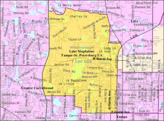
Lake Magdalene is a census-designated place (CDP) in Hillsborough County, Florida, United States. The population was 28,509 at the 2010 census.

Lutz is an unincorporated community in Hillsborough County and Pasco County, Florida, United States, 15 miles (24 km) north of Tampa. While there is a census-designated area of Lutz, the community itself extends beyond those boundaries into other census-designated areas.

University is an unincorporated census-designated place in Hillsborough County, Florida, United States. The population was 41,163 at the 2010 census, up from 30,736 at the 2000 census. The University of South Florida is located just southeast of the community, within the Tampa city limits. The community is also known as "University West", mainly due to its location in relation to the university. The community is often notoriously referred to by locals as "Suitcase City" due to the high rate of transients.

East Lake is a census-designated place (CDP) in Pinellas County, Florida, United States. The population was 30,962 at the 2010 census. It was one of the last areas in the densely populated county to develop. It is often confused with East Lake in neighboring Hillsborough County.

Carrollwood is a census-designated place (CDP) in northwestern Hillsborough County, Florida, United States. The population was 33,365 at the 2010 census. The census area includes the unincorporated communities of Carrollwood and Carrollwood Village. For the 2000 census the area was enumerated under the name "Greater Carrollwood" and had a population of 33,519. A similar area was listed as "Lake Carroll" in 1970 and 1980; for the 1990 census it was split into the smaller Carrollwood and Carrollwood Village CDPs.
East Tampa is an unincorporated community in Hillsborough County, Florida, United States. It is partially within the census-designated place (CDP) of Gibsonton. The ZIP code for East Tampa is 33619.

Carrollwood is an unincorporated community in Hillsborough County, Florida, United States. It is part of the larger census-designated place (CDP) of Carrollwood, which also includes the neighborhood of Carrollwood Village. A census-designated place corresponding just to Carrollwood existed during the 1990 census, with a population of 7,195. The ZIP code for Carrollwood is 33618.
Carrollwood Village is an unincorporated community in Hillsborough County, Florida, United States. Along with neighboring Carrollwood, it is part of the Carrollwood census-designated place. The ZIP codes for the community are 33624 and 33618. Carrollwood Village was its own census-designated place during the 1990 census, with a recorded population of 15,051.
Egypt Lake is an unincorporated community in northwestern Hillsborough County, Florida, United States. It is located within the census-designated place of Egypt Lake-Leto. It was a separate census-designated place from 1970 to 1990. The population as of the 1990 census was 14,580. The ZIP code for Egypt Lake is 33614.
Leto is an unincorporated community in northwestern Hillsborough County, Florida, United States. Along with Egypt Lake, it is a part of the census-designated place (CDP) of Egypt Lake-Leto. It was a separate CDP from 1970 to 1990, and was known as West Park in 1990. The population as of the 1990 census was 10,347.
Orient Park is an unincorporated community in Hillsborough County, Florida, United States. Along with East Lake, it is a part of the census-designated place (CDP) of East Lake-Orient Park. The ZIP code for the community is 33619.
Nowatney is an unincorporated community in northern Hillsborough County, Florida, United States. The community is within the census-designated place of University. The ZIP code for the community is 33613.
Sweetwater Creek is an unincorporated community in Hillsborough County, Florida, United States. It is part of the census-designated place (CDP) of Town 'n' Country. The ZIP code for the community is 33634.
Rocky Creek is an unincorporated community in Hillsborough County, Florida, United States. Although a separate community, it is a part of the census-designated place (CDP) of Town 'n' Country. The ZIP code for the community is 33615.
Bay Crest Park is an unincorporated community in Hillsborough County, Florida, United States.
North Ruskin is an unincorporated community located in southeastern Hillsborough County, Florida, United States, north of Ruskin. The community is served by a 33572 ZIP Code. It is part of the census-designated place (CDP) of Apollo Beach.


