
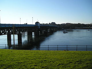
Millom is a town and civil parish on the north shore of the estuary of the River Duddon in southernmost Cumberland, Cumbria, England. It is situated just outside the Lake District National Park, about six miles north of Barrow-in-Furness and 26 mi (42 km) south of Whitehaven.

Barrow-in-Furness is a port town in Cumbria, England. Historically in Lancashire, it was incorporated as a municipal borough in 1867 and merged with Dalton-in-Furness Urban District in 1974 to form the Borough of Barrow-in-Furness. In 2023, the borough merged with Eden and South Lakeland districts to form a new unitary authority: Westmorland and Furness. At the tip of the Furness peninsula, close to the Lake District, it is bordered by Morecambe Bay, the Duddon Estuary and the Irish Sea. In 2011, Barrow's population was 56,745, making it the second largest urban area in Cumbria after Carlisle, and the largest in the Westmorland and Furness unitary authority.
Roa Island lies just over half a mile (1 km) south of the village of Rampside at the southernmost point of the Furness Peninsula in Westmorland and Furness, though formerly in the county of Lancashire north of the sands. It is located at 54°5′N3°10′W. It is one of the Islands of Furness in northern England. It has an area of about three hectares.
Walney Island, also known as the Isle of Walney, is an island off the west coast of England, at the western end of Morecambe Bay in the Irish Sea. It is part of Barrow-in-Furness, separated from the mainland by Walney Channel, which is spanned by the Jubilee Bridge. Walney is the largest island of the Furness Islands group, both in population and size, as well as the largest English island in the Irish Sea. Its population at the 2011 UK Census was 10,651, distributed evenly across the island's two Wards of Walney North and Walney South.

Rampside is a village in Cumbria, England. Historically in Lancashire, it is located a few miles south-east of the town of Barrow-in-Furness, in the north-western corner of Morecambe Bay on the Furness peninsula.
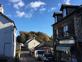
Broughton in Furness is a market town in the civil parish of Broughton West in the Westmorland and Furness district of Cumbria, England. It had a population of 529 at the 2011 Census. It is located on the south western boundary of England's Lake District National Park, and in the Furness region, which is within the historic boundaries of Lancashire.

Muchland is a medieval manor in Low Furness in the county of Cumbria in northern England. The manor was the seat of the Lords of Aldingham, and included at its peak the villages of Bardsea, Urswick, Scales, Stainton, Sunbrick, Baycliff, Gleaston, Aldingham, Dendron, Leece and Newbiggin. The area also features the historic remains of Gleaston Castle, Aldingham Castle, Gleaston Water Mill, the Druids' Temple at Birkrigg, plus many prehistoric remains around Urswick and Scales.

Holbeck is an inner city area of Leeds, West Yorkshire, England. It begins on the southern edge of Leeds city centre and mainly lies in the LS11 postcode district. The M1 and M621 motorways used to end/begin in Holbeck. Now the M621 is the only motorway that passes through the area since the end of the M1 moved to Hook Moor near Aberford. Since large parts of Holbeck have been vacated in preparation for the regeneration of the area, the district has in large parts suffered from a population exodus. Holbeck had a population of 5,505 in 2011. The district currently falls within the Beeston and Holbeck ward of Leeds City Council.

Furness General Hospital (FGH) is a hospital located in the Hawcoat area of Barrow-in-Furness, Cumbria, England. It is managed by the University Hospitals of Morecambe Bay NHS Foundation Trust.
Hawcoat is an area and electoral ward of Barrow-in-Furness, Cumbria, England. Historically part of Lancashire, it is one of Barrow's most northerly wards and is bordered by Roose, Newbarns, Parkside, Ormsgill and the town of Dalton-in-Furness to the north.

Roosecote Power Station was a gas-fired, originally coal-fired power station, situated in the Roosecote district of Barrow-in-Furness in Cumbria, North West England. The gas-fired station opened in 1991 and was the first CCGT power station to supply electricity to the United Kingdom's National Grid, but was mothballed in 2012 after a proposed biomass power station was cancelled. It was situated directly adjacent to Rampside Gas Terminal. The plant was demolished between 2014 and 2015. The site is now a 49 MW battery storage facility.

Rampside Gas Terminal is a gas terminal situated in Barrow-in-Furness, Cumbria on the Irish Sea coast. It connects to gas fields in Morecambe Bay. It is situated adjacent to the former Roosecote Power Station.

The Port of Barrow refers to the enclosed dock system within the town of Barrow-in-Furness, England. Morecambe Bay is to the east of the port and the Irish Sea surrounds it to the south and west. The port is currently owned and operated by Associated British Ports Holdings, but some land is shared with BAE Systems Submarine Solutions. Currently consisting of four large docks, the Port of Barrow is one of North West England's most important ports. The docks are as follows: Buccleuch Dock, Cavendish Dock, Devonshire Dock and Ramsden Dock. The port of Barrow is the only deep water port between the Mersey and the Clyde.

Risedale is an area and ward of Barrow-in-Furness, Cumbria, England. It is bordered by Barrow town centre, Parkside, Newbarns and Roose and had a population of 5,663 in 2001,increasing to 6,294 at the 2011 Census.

The Waterfront Barrow-in-Furness is a £200 million development under construction in and around the Port of Barrow, England. The site covers an area of some 400 acres (160 ha) and was due for completion in 2020. The internal road network is already complete, with construction of a large business park complex ongoing and work on a 400-berth marina and 650 home Marina Village due to start thereafter. In 2010, The Waterfront Barrow-in-Furness ranked as the ninetieth most costly regeneration project in the United Kingdom by Regeneration & Renewal. Progress on the project stalled between 2010 and 2016 due to complications with funding following the disabandonment of the North West Regional Development Agency. BAE Systems opened a large logistics warehouse named the Resolution Building on Dova Way within the designated Business Park Area in October 2016, while and construction of a new access road from Salthouse Road to the Marina Village commenced in May 2017.
The Manor of Hougun is the historic name for an area which now forms part of the county of Cumbria in North West England. Only the southern band of land in the south of Cumbria was surveyed in the Domesday Book. The westernmost entries for Cumbria, covering the Duddon and Furness Peninsulas are largely recorded as part of the Manor of Hougun. The entry in Domesday Book covering Hougun refers to the time when it was held by Tostig Godwinson, Earl of Northumbria.
St. George's Square, in Barrow-in-Furness, Cumbria, England is a public space that acted as the centre of the town during the late 19th century. The square now lies in the southernmost fringes of the Central ward close to the Port of Barrow.
The following is a timeline of the history of Barrow-in-Furness, England, United Kingdom.
Rampside railway station was located on the Piel Branch of the Furness Railway in the Rampside area of Barrow-in-Furness, England.

The Yarlside Iron Mines tramway or Parkhouse Mineral Railway was built as a one-mile (1.6 km) long innovative railway from the Parkhouse Haematite Ore Mines to the Roose railway station on the Furness Railway, then in North Lancashire, now in Cumbria, England. Similar to a monorail, it had stabilising side rollers, invented and patented by John Barraclough Fell.


