Related Research Articles

A roundabout, a rotary and a traffic circle are all, with certain distinctions between them, a type of circular intersection or junction in which road traffic is permitted to flow in one direction around a central island, and priority is typically given to traffic already in the junction.

An intersection or an at-grade junction is a junction where two or more roads converge, diverge, meet or cross at the same height, as opposed to an interchange, which uses bridges or tunnels to separate different roads. Major intersections are often delineated by gores and may be classified by road segments, traffic controls and lane design.
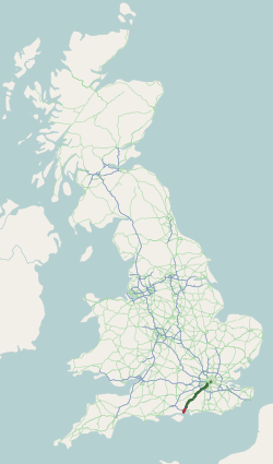
The A3, known as the Portsmouth Road or London Road in sections, is a major road connecting the City of London and Portsmouth passing close to Kingston upon Thames, Guildford, Haslemere and Petersfield. For much of its 67-mile (108 km) length, it is classified as a trunk road and therefore managed by National Highways. Almost all of the road has been built to dual carriageway standards or wider. Apart from bypass sections in London, the road travels in a southwest direction and, after Liss, south-southwest.

Traffic calming uses physical design and other measures to improve safety for motorists, car drivers, pedestrians and cyclists. It has become a tool to combat speeding and other unsafe behaviours of drivers. It aims to encourage safer, more responsible driving and potentially reduce traffic flow. Urban planners and traffic engineers have many strategies for traffic calming, including narrowed roads and speed humps. Such measures are common in Australia and Europe, but less so in North America. Traffic calming is a calque of the German word Verkehrsberuhigung – the term's first published use in English was in 1985 by Carmen Hass-Klau.

Left-hand traffic (LHT) and right-hand traffic (RHT) are the practices, in bidirectional traffic, of keeping to the left side and to the right side of the road, respectively. They are fundamental to traffic flow, and are sometimes called the rule of the road. The terms right- and left-hand drive refer to the position of the driver and the steering wheel in the vehicle and are, in automobiles, the reverse of the terms right- and left-hand traffic. The rule also includes where on the road a vehicle is to be driven, if there is room for more than one vehicle in the one direction, and the side on which the vehicle in the rear overtakes the one in the front. For example, a driver in an LHT country would typically overtake on the right of the vehicle being overtaken.

The A4 is a major road in England from Central London to Avonmouth via Heathrow Airport, Reading, Bath and Bristol. It is historically known as the Bath Road with newer sections including the Great West Road and Portway. The road was once the main route from London to Bath, Bristol and the west of England and formed, after the A40, the second main western artery from London.

The Magic Roundabout in Swindon, England, is a ring junction constructed in 1972 consisting of five mini-roundabouts arranged in a circle. Located near the County Ground, home of Swindon Town F.C., its name comes from the popular children's television series The Magic Roundabout. In 2009, it was voted the fourth-scariest junction in Britain.

The Edinburgh City Bypass, designated as A720, is one of the most important trunk roads in Scotland. Circling around the south of Edinburgh, as the equivalent of a ring road for the coastal city, it links together the A1 towards north-east England, the A702 towards north-west England, the M8 through the Central Belt towards Glasgow, the A7 through south-east Scotland and north-west England as well as the A8 leading to the M9 for Stirling and the Queensferry Crossing.

A traffic island is a solid or painted object in a road that channels traffic. It can also be a narrow strip of island between roads that intersect at an acute angle. If the island uses road markings only, without raised curbs or other physical obstructions, it is called a painted island or ghost island. Traffic islands can be used to reduce the speed of cars driving through, or to provide a central refuge to pedestrians crossing the road.

Overtaking or passing is the act of one vehicle going past another slower moving vehicle, travelling in the same direction, on a road. The lane used for overtaking another vehicle is often a passing lane farther from the road shoulder, which is to the left in places that drive on the right and to the right in places that drive on the left.

The A127, also known as the Southend Arterial Road, is a major road in Essex, England. It was constructed as a new arterial road project in the 1920s, linking Romford with Southend-on-Sea, replacing the older A13. Formerly classified as a trunk road, it was "de-trunked" in 1997. It is known as the Southend Arterial Road except for part of its length in Southend-on-Sea. It is also streetlit for its whole length despite its majority coverage through rural land.

The A43 is a primary route in the English Midlands and northern South East England, that runs from the M40 motorway near Ardley in Oxfordshire to Stamford in Lincolnshire. Through Northamptonshire it bypasses the towns of Northampton, Kettering and Corby which are the three principal destinations on the A43 route. The A43 also links to the M1 motorway.

The A120 is an A-road in England, which runs between Puckeridge in Hertfordshire and Harwich in Essex.

The A591 is a major road in Cumbria, which lies almost entirely within the Lake District national park. A 2009 poll by satellite navigation firm Garmin named the stretch of the road between Windermere and Keswick as the most popular road in Britain. The 29.8 mile stretch between Kendal and Keswick was also named the UK's best driving road, according to a specially devised driving ratio formulated by car rental firm Avis.

The A29 is a major road in Northern Ireland; it is mostly a single carriageway and goes through a number of main towns and connects in several places to other major roads.

The A380 is a road in South West England, connecting the Torbay area to the Devon Expressway, and hence to the rest of Great Britain's main road network.

The A726 road in Scotland is a major route with several distinct sections with different characteristics and names; owing to its stages of construction, since 2005 it has two separate parts, the first running between Strathaven in South Lanarkshire and Junction 5 of the M77 motorway south of Newton Mearns in East Renfrewshire via East Kilbride, and the other running between Junction 3 of the M77 and the M898 motorway near the Erskine Bridge, via Paisley and Junction 29 of the M8 motorway near Glasgow International Airport.

An all-way stop – also known as a four-way stop – is a traffic management system which requires vehicles on all the approaches to a road intersection to stop at the intersection before proceeding through it. Designed for use at low traffic-volume locations, the arrangement is common in the United States, Canada, Mexico, South Africa, and Liberia, as well as in a number of, usually rural, locations in Australia where visibility on the junction approaches is particularly poor. The stop signs at such intersections may be supplemented with additional plates stating the number of approaches.

Traffic Light Tree is a public sculpture in between Poplar and Blackwall, London, England, created by the French sculptor Pierre Vivant following a competition run by the Public Art Commissions Agency for the London Docklands Development Corporation under their Public Art programme. Originally situated on a roundabout in Limehouse, near Canary Wharf and Millwall, at the junction of Heron Quay, Marsh Wall and Westferry Road, it is now located on a different roundabout near Billingsgate Market in Poplar.

A protected intersection or protected junction, also known as a Dutch-style junction, is a type of at-grade road junction in which cyclists and pedestrians are separated from cars. The primary aim of junction protection is to help pedestrians and cyclists be and feel safer at road junctions.
References
- ↑ "A spike in traffic? Truro roundabout featuring hedgehog sculptures named best traffic island in UK". ITV News. Retrieved 29 September 2019.
- ↑ "Hedgehog roundabout named best in UK". 26 September 2019. Retrieved 29 September 2019.
- ↑ "Roundabout magic". 2 November 2004. Retrieved 29 September 2019.
- ↑ "'I founded the Roundabout Appreciation Society' | Financial Times". www.ft.com. Retrieved 23 August 2023.