Royston, Georgia

Last updated
Royston, Georgia
Royston-Church-St-ga.jpg
Church Street (SR 17)
Franklin County Georgia Incorporated and Unincorporated areas Royston Highlighted.svg
Location in Franklin County and the state of Georgia
Coordinates: 34°17′8″N83°6′35″W / 34.28556°N 83.10972°W / 34.28556; -83.10972 Coordinates: 34°17′8″N83°6′35″W / 34.28556°N 83.10972°W / 34.28556; -83.10972
Country United States
State Georgia
Counties Franklin, Hart, Madison
City of Royston1879
Government
   Mayor Keith Turman
   City Manager Pending
Area
[1]
  Total3.30 sq mi (8.54 km2)
  Land3.28 sq mi (8.50 km2)
  Water0.02 sq mi (0.05 km2)
Elevation
899 ft (274 m)
Population
 (2020)
  Total2,649
  Density807.62/sq mi (311.78/km2)
Time zone UTC-5 (Eastern (EST))
  Summer (DST) UTC-4 (EDT)
ZIP code
30662
Area code 706
FIPS code 13-67452 [2]
GNIS feature ID0321981 [3]
Website cityofroyston.com

Royston is a city in Franklin, Hart, and Madison counties in the U.S. state of Georgia. The population was 2,649 at the 2020 census.

Contents

History

A post office called Royston has been in operation since 1878. [4] The community was named after W.A. Royston, a local merchant. [5]

The Georgia General Assembly first incorporated Royston in 1879. [6]

Geography

Royston is located in the southeast corner of Franklin County and the southwest corner of Hart County at 34°17′8″N83°6′35″W / 34.28556°N 83.10972°W / 34.28556; -83.10972 (34.285592, -83.109841). [7] A small portion extends south into Madison County. U.S. Route 29 passes through the center of town, leading northeast 12 miles (19 km) to Hartwell and southwest 30 miles (48 km) to Athens. Georgia State Route 17 leads north from Royston 11 miles (18 km) to Lavonia and southeast 19 miles (31 km) to Elberton.

According to the United States Census Bureau, Royston has a total area of 3.4 square miles (8.8 km2), of which 0.02 square miles (0.05 km2), or 0.51%, is water. [8]

Demographics

Historical population
CensusPop.
1880 127
1890 340167.7%
1900 57970.3%
1910 1,422145.6%
1920 1,68118.2%
1930 1,447−13.9%
1940 1,5497.0%
1950 2,03931.6%
1960 2,33314.4%
1970 2,4284.1%
1980 2,404−1.0%
1990 2,75814.7%
2000 2,493−9.6%
2010 2,5823.6%
2020 2,6492.6%
U.S. Decennial Census [9]

As of the census [2] of 2000, there were 2,493 people, 1,016 households, and 610 families residing in the city. The population density was 728.4 inhabitants per square mile (281.2/km2). There were 1,135 housing units at an average density of 331.6 per square mile (128.0/km2). The racial makeup of the city was 74.25% White, 23.23% African American, 0.08% Native American, 0.68% Asian, 0.36% from other races, and 1.40% from two or more races. Hispanic or Latino of any race were 1.24% of the population.

There were 1,016 households, out of which 27.2% had children under the age of 18 living with them, 37.3% were married couples living together, 19.7% had a female householder with no husband present, and 39.9% were non-families. 35.9% of all households were made up of individuals, and 20.1% had someone living alone who was 65 years of age or older. The average household size was 2.27 and the average family size was 2.97.

In the city, the population was spread out, with 23.4% under the age of 18, 8.5% from 18 to 24, 22.7% from 25 to 44, 20.1% from 45 to 64, and 25.4% who were 65 years of age or older. The median age was 40 years. For every 100 females, there were 78.6 males. For every 100 females age 18 and over, there were 68.6 males.

The median income for a household in the city was $22,024, and the median income for a family was $31,845. Males had a median income of $27,500 versus $21,580 for females. The per capita income for the city was $14,750. About 19.7% of families and 24.7% of the population were below the poverty threshold, including 25.7% of those under age 18 and 23.1% of those age 65 or over.

Culture

Notable people

Related Research Articles

<span class="mw-page-title-main">Franklin County, Georgia</span> County in Georgia, United States

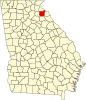
Franklin County is a county located in the northeastern part of the U.S. state of Georgia. As of the 2010 census, the population was 22,084. The county seat is Carnesville. On February 25, 1784, Franklin and Washington became Georgia's eighth and ninth counties, with Franklin named in honor of patriot Benjamin Franklin.

<span class="mw-page-title-main">Tucson Estates, Arizona</span> CDP in Arizona, United States

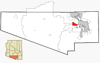
Tucson Estates is a census-designated place (CDP) in Pima County, Arizona, United States. The population was 9,755 at the 2000 census.

<span class="mw-page-title-main">Strong, Arkansas</span> City in Arkansas, United States

Strong is a city in Union County, Arkansas, United States. The population was 558 at the 2010 census.

<span class="mw-page-title-main">Gillsville, Georgia</span> City in Georgia, United States

Gillsville is a city in Banks and Hall counties in the U.S. state of Georgia. The population was 235 at the 2010 census.

<span class="mw-page-title-main">Lula, Georgia</span> City in Georgia, United States

Lula is a city in Hall and Banks counties in the U.S. state of Georgia. Most of the city is in Hall County, with a small eastern portion of the city located in Banks County. The population was 2,758 at the 2010 census. The Hall County portion of Lula is part of the Gainesville, GA Metropolitan Statistical Area. Lula is the home of RailRoad Days, a yearly festival held usually every May. Lula is the railroad junction between the Atlanta northeast line and the Athens north line of Norfolk Southern Railway.

<span class="mw-page-title-main">Auburn, Georgia</span> City in Georgia, United States

Auburn is a city in Barrow and Gwinnett counties in the U.S. state of Georgia. As of the 2020 census, the city had a population of 7,495.

<span class="mw-page-title-main">Statham, Georgia</span> City in Georgia, United States

Statham is a city in Barrow County, Georgia, United States. The population was 2,408 at the 2010 census.

<span class="mw-page-title-main">Norman Park, Georgia</span> City in Georgia, United States

Norman Park is a city in Colquitt County, Georgia, United States. The population was 972 at the 2010 census.

<span class="mw-page-title-main">Bowman, Georgia</span> City in Georgia, United States

Bowman is a city in Elbert County, Georgia, United States. As of the 2020 census, the city had a population of 872.

<span class="mw-page-title-main">Canon, Georgia</span> City in Georgia, United States

Canon is a city in Franklin and Hart counties in the U.S. state of Georgia. The population was 804 at the 2010 census.

<span class="mw-page-title-main">Franklin Springs, Georgia</span> City in Georgia, United States

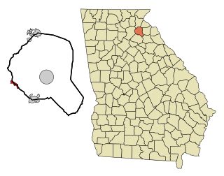
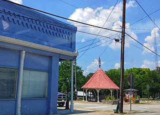
Franklin Springs is a city in Franklin County, Georgia, United States. The population was 952 at the 2010 census, up from 762 in 2000. Emmanuel College is located here.

<span class="mw-page-title-main">Union Point, Georgia</span> City in Georgia, United States

Union Point is a city in Greene County, Georgia, United States. As of the 2020 census, the city population was 1,597.

<span class="mw-page-title-main">Arcade, Georgia</span> City in Georgia, United States

Arcade is a city in Jackson County, Georgia, United States. As of the 2010 census it had a population of 1,786.

<span class="mw-page-title-main">Pendergrass, Georgia</span> City in Georgia, United States

Pendergrass is a city in Jackson County, Georgia, United States. The population was 1692 at the time of the 2020 census.

<span class="mw-page-title-main">Meigs, Georgia</span> City in Georgia, United States

Meigs is a city in Mitchell and Thomas counties in the U.S. state of Georgia. The population was 1,035 at the 2010 census.

<span class="mw-page-title-main">Golden, Illinois</span> Village in Illinois, United States

Golden is a village in Adams County, Illinois, United States. The population was 648 at the 2010 census. It is part of the Quincy, IL–MO Micropolitan Statistical Area.

<span class="mw-page-title-main">La Fayette, Illinois</span> Village in Illinois, United States

La Fayette is a village in Stark County, Illinois. It is located south of Kewanee off Route 78 on Route 17|IL-17. The population was 223 at the 2010 census, down from 227 in 2000. It is part of the Peoria, Illinois Metropolitan Statistical Area. Once a prominent strip coal mine and farming village with; a general store, high school(until 1970), hotel, bank, grain elevator, train depot, and many other features and amenities. Once the coal mines shut down and railroad was removed in the early 1980s, it slowly became a low income and high poverty village with many people moving away and it eventually diminished to the hollow shell of what it once was.

<span class="mw-page-title-main">Crown City, Ohio</span> Village in Ohio, United States

Crown City is a village in Gallia County, Ohio, United States, along the Ohio River. The population was 413 at the 2010 census. It is part of the Point Pleasant, WV–OH Micropolitan Statistical Area.

<span class="mw-page-title-main">West Hamlin, West Virginia</span> Town in West Virginia, United States

West Hamlin is a town in Lincoln County, West Virginia, United States, along the Guyandotte River. The population was 519 at the 2020 census, and is now down to 509, according to the 2021 census. West Hamlin is a part of the Huntington-Ashland, WV-KY-OH, Metropolitan Statistical Area (MSA). West Hamlin is west of the county seat at Hamlin, hence the name.

<span class="mw-page-title-main">Bohners Lake, Wisconsin</span> CDP in Wisconsin, United States

Bohners Lake is a census-designated place (CDP) in Racine County, Wisconsin, United States. Its first syllable is pronounced as in "bone". The population of the CDP was 2,444 at the 2010 census. It is politically part of the Town of Burlington, together with Browns Lake, Wisconsin. There has been discussion of incorporating Bohners Lake as a village to prevent annexation by the City of Burlington. It was named for Antony Bohner, a French immigrant who established a resort on the lake of the same name.

References

  1. "2020 U.S. Gazetteer Files". United States Census Bureau. Retrieved December 18, 2021.
  2. 1 2 "U.S. Census website". United States Census Bureau . Retrieved 2008-01-31.
  3. "US Board on Geographic Names". United States Geological Survey. 2007-10-25. Retrieved 2008-01-31.
  4. "Post Offices". Jim Forte Postal History. Retrieved 27 May 2019.
  5. Krakow, Kenneth K. (1975). Georgia Place-Names: Their History and Origins (PDF). Macon, GA: Winship Press. p. 194. ISBN   0-915430-00-2.
  6. "Royston". GeorgiaGov. Retrieved 27 May 2019.
  7. "US Gazetteer files: 2010, 2000, and 1990". United States Census Bureau. 2011-02-12. Retrieved 2011-04-23.
  8. "Geographic Identifiers: 2010 Census Summary File 1 (G001), Royston city, Georgia". American FactFinder. U.S. Census Bureau. Archived from the original on February 13, 2020. Retrieved April 28, 2016.
  9. "Census of Population and Housing". Census.gov. Retrieved June 4, 2015.