Tsaile is a census-designated place (CDP) in Apache County, Arizona, United States, on the Navajo Nation. The population was 1,205 at the 2010 census.

Pelican Bay is a census-designated place (CDP) in Collier County, Florida, United States. The population was 6,346 at the 2010 census. It is part of the Naples–Marco Island Metropolitan Statistical Area.

Pine Ridge is a census-designated place (CDP) in Collier County, Florida, United States. The population was 1,918 at the 2010 census. It is part of the Naples–Marco Island Metropolitan Statistical Area.

Hernando Beach is a census-designated place (CDP) in Hernando County, Florida, United States. The population was 2,299 at the 2010 census.

Waikōloa Village is a census-designated place (CDP) in Hawaiʻi County, Hawaii, United States. The population was 6,362 at the 2010 census, up from 4,806 at the 2000 census. The name Waikoloa is used by the local post office.

Pinardville is a census-designated place (CDP) in the town of Goffstown, Hillsborough County, New Hampshire, United States. It is a suburban neighborhood adjacent to the city of Manchester. The population was 5,034 at the 2020 census. Pinardville has existed since 1906.

Nixon is a census-designated place (CDP) in Penn Township, Butler County, Pennsylvania, United States. The population was 1,373 at the 2010 census.

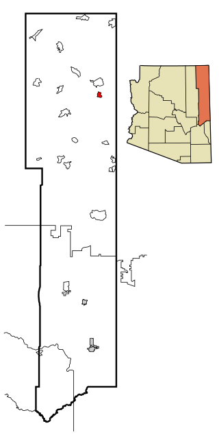
Riceville is a census-designated place in Crawford County, Pennsylvania, United States. The population was 68 at the 2010 census.

Welcome is a census-designated place (CDP) in Greenville County, South Carolina, United States. The population was 6,668 at the 2010 census. It is part of the Greenville–Mauldin–Easley Metropolitan Statistical Area. Welcome has been noted for its colorful place name.

Merrifield is a census-designated place (CDP) in Fairfax County, Virginia, United States. The population was 20,488 at the 2020 census.

Gloucester Point is a census-designated place (CDP) in Gloucester County, Virginia, United States. The population was 9,402 at the 2010 census. It is home to the College of William & Mary's Virginia Institute of Marine Science, a graduate school for the study of oceanography.

Neilton is an unincorporated community and census-designated place (CDP) in Grays Harbor County, Washington, United States. The population was 315 at the 2010 census.

Van Buren is a census-designated place (CDP) comprising the main village within the town of Van Buren in Aroostook County, Maine, United States. The population of the CDP was 1,937 at the 2010 census, out of a population of 2,171 for the entire town.

Winchester is a census-designated place (CDP) and the main village in the town of Winchester in Cheshire County, New Hampshire, United States. The population of the CDP was 1,606 at the 2020 census, compared to 4,150 in the entire town.

Plymouth is a census-designated place (CDP) and the main village in the town of Plymouth in Grafton County, New Hampshire, United States. Its population was 4,730 at the 2020 census, out of 6,682 in the entire town. The CDP includes the campus of Plymouth State University.

Exeter is a census-designated place (CDP) and the main village in the town of Exeter, Rockingham County, New Hampshire, United States. The population of the CDP was 10,109 at the 2020 census, out of 16,049 in the entire town.

Durham is a census-designated place (CDP) and the main village in the town of Durham in Strafford County, New Hampshire, United States. The population of the CDP was 11,147 at the 2020 census, out of 15,490 in the entire town. The CDP is home to the University of New Hampshire.
Bainbridge is a census-designated place (CDP) in Bainbridge Township, Geauga County, Ohio, United States. As of the 2020 census, the CDP had a population of 9,242.

West Stewartstown is a census-designated place in the town of Stewartstown in Coös County, New Hampshire, United States. It had a population of 263 at the 2020 census, down from 386 at the 2010 census.

Colebrook is a census-designated place (CDP) and the main village in the town of Colebrook, Coös County, New Hampshire, United States. The population of the CDP was 1,201 at the 2020 census, out of 2,084 in the entire town. The CDP population had dropped from 1,394 at the 2010 census.


