
Ankole was a traditional Bantu kingdom in Uganda and lasted from the 15th century until 1967. The kingdom was located in south-western Uganda, east of Lake Edward.

Ntungamo District is a district in Western Uganda. Like most Ugandan districts, it is named after its 'chief town', Ntungamo, the location of the district headquarters. Ntungamo was elevated to a district on 5th May 1993.

Mbarara District is a district in South Western Uganda. In 2019, the Ugandan Cabinet approved part of Mbarara District, the then-Mbarara municipality, to be upgraded to city status effective July 2020.
Mbarara City is a city in the Western Region of Uganda and the second largest city in Uganda after Kampala. The city is divided into 6 boroughs of Kakoba Division, Kamukuzi Division, Nyamitanga Division, Biharwe Division, Kakiika Division, Nyakayojo Division. It is the main commercial centre of most of south western districts of Uganda and the site of the district headquarters. In May 2019, the Uganda's cabinet granted Mbarara a city status, which started on 1 July 2020.
Bugamba is an urban centre in the Western Region of Uganda. It is one of the trading centres in Mbarara District.

Isingiro District is a district in the Western Region of Uganda. The town of Isingiro is the district's main municipal, administrative, and commercial center.
Ibanda is a town in the Western Region of Uganda. It is the main political, administrative, and commercial centre of Ibanda District and the site of the district headquarters. It started way back in the 1990s and was elevated from a trading centre to a town board, town council and in 2016 it was granted the municipality status. The Municipal Council has three Divisions of Kagongo, Bisheshe and Bufunda with 21 wards of Kyaruhanga, Bufunda, Nyamirima, Nsasi, Kayenje, Kashangura, Rwenshuri, Kigarama, Rugazi, Rwobuzizi, Kakatsi, Bugarama, Karangara, Kabaare, Kanyansheko, Nyakatookye, Kyeikucu, Kikoni, Kagongo, Ruyonza and Katongore ward. Ibanda Municipal Council has over 230 villages. Ibanda Municipal council commenced its operations on 1 July 2016 after being elevated from a Town Council and other sub counties that were annexed to..
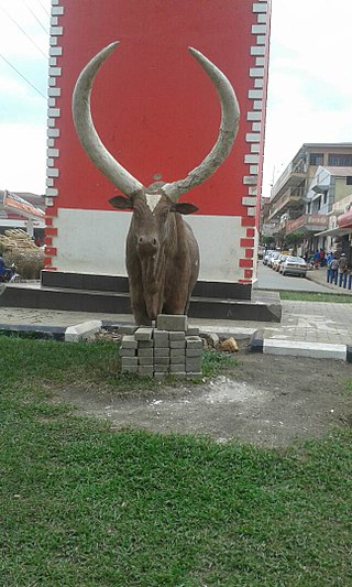
Isingiro is a town in the Western Region of Uganda. It is the main municipal, administrative, and commercial center of Isingiro District and the site of the district's headquarters.
Kikagati is a town in the Western Region of Uganda. It sits across the Kagera River from the town of Murongo, in the Kagera Region of Tanzania.
The Mbarara–Kikagati Road is in southwestern Uganda, connecting the city of Mbarara in Mbarara District and the town of Kikagati in Isingiro District, at the border between Uganda and Tanzania. The road continues into Tanzania as Highway B182.
Ankole sub-region is a region in the Western Region of Uganda that consists of the following districts:

Rubirizi District is a district in Western Uganda. Like most Ugandan districts, the district is named after its 'chief town', Rubirizi, where the district headquarters are located.

Mitooma District is a district in Western Uganda. It is named after its main municipal, administrative and commercial center, Mitooma.

Sheema District is a district in Western Uganda.
Nyakayojo Division is one of the six administrative divisions that make up Mbarara Municipality. The six divisions that make Mbarara Municipality include, Kamukuzi Division, Nyamitanga Division, Kakoba Division, Biharwe Division, Kakiika Division and Nyakayojo Division.
Kazo is a district in Uganda's Western Region. It is located approximately 200 square kilometres (77 sq mi) west of Uganda's capital Kampala. It covers an area of 1,556 square kilometres (601 sq mi) and recorded a population of 177,054 in the 2014 Ugandan census. The capital of the district is the town of Kazo.
Rugaaga is a town in Isingiro District in the Western Region of Uganda.
Isingiro Water Supply and Sanitation Project (IWSSP), also Isingiro Water Supply and Sewerage System is a water intake, purification, distribution and waste water collection and disposal system in Isingiro District, in the Western Region of Uganda. The project is intended to meet the water supply and sanitation needs of 340,000 people of the 550,000 inhabitants of the district. The beneficiaries include the 100,000 occupants of Nakivale Refugee Settlement and the 32,000 occupants of Oruchinga Refugee Settlement. The work is to be carried out by the Uganda Ministry of Water and Environment through the parastatal utility company, National Water and Sewerage Corporation (NWSC). Funding, have been provided by the French Development Agency and the European Union.
Masaka–Mbarara Water Supply and Sanitation Project (MMWSSP), is a water intake, purification, distribution and waste water collection and disposal system in the cities of Masaka and Mbarara in the Central Region and the Western Region of Uganda. The project is intended to meet the water supply and sanitation needs of approximately 1,055,000 by 2030. The work is to be carried out by the Uganda Ministry of Water and Environment through the parastatal utility company, National Water and Sewerage Corporation (NWSC). Funding, have been provided by the French Development Agency and the European Union.
Bugamba Central Forest reserve is a natural forest located in the Rwampara district, in southwestern Uganda. It has been referred to as an intensive soil conservation zone. The Reserve is one of the few softwood plantations where spacing is practiced. It is managed and is maintained on behalf of the Government of Uganda by the National Forestry Authority (NFA) under the National Forestry Authority and Tree Planting Act 8/2003.