The municipalities of Puerto Rico are the second-level administrative divisions in the Commonwealth of Puerto Rico. There are 78 such administrative divisions covering all 78 incorporated towns and cities. Each municipality is led by a mayor and divided into barrios, third-level administrative divisions, though the latter are not vested with any political authority. Every municipality is governed as stated by the Autonomous Municipalities Act of 1991, which establishes that every municipality must have an elected strong mayor with a municipal legislature as the form of government. Each legislature must be unicameral, with the number of members related to adequate representation of the total population of the municipality. In contrast to other jurisdictions, both the mayors and the municipal legislators are elected on the same date and for the same term of four years in office.

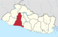
Baoruco, alternatively spelt Bahoruco, is a province of the Dominican Republic located in the southwest of the country, part of the Enriquillo Region, along with the provinces of Barahona, Independencia and Pedernales. Before 1952 it included what is now Independencia Province.

Independencia is a province of the Dominican Republic, located in the west, on the border with Haiti. Its capital is Jimani. The province was created in 1948 but was made official in 1950. Before its creation, it was part of the Baoruco Province. The name was given in remembrance of the National Independence of February 27, 1844.

María Trinidad Sánchez is a province of the Dominican Republic. It was split from Samaná Province in September 1959 as Julia Molina Province; in November 1961, it got its current name. The name commemorates a distinguished female soldier in the wars of independence. María Trinidad Sánchez was the first woman incarcerated and executed by Pedro Santana, a Dominican annexionist president.
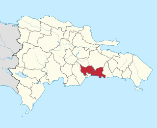
Peravia is a province in the southern region of the Dominican Republic. Before January 1, 2002 it was included in what is the new San José de Ocoa province, and published statistics and maps generally relate it to the old, larger, Peravia.

San José de Ocoa is a province in the southern region of the Dominican Republic, and also the name of the province's capital city. It was split from Peravia on January 1, 2000. Published statistics and maps generally include this province in the old, larger, Peravia.
Santo Domingo is a province of the Dominican Republic. It was split from the Distrito Nacional on October 16, 2001.

Boca Chica is a municipality (municipio) of the Santo Domingo province in the Dominican Republic. Within the municipality there is one municipal district : La Caleta. As of the 2012 census it had 123,510 inhabitants, 70,184 living in the city itself and 53,326 in its rural districts (Secciones).

This is a list of the 50 largest cities in the Americas by population residing within city limits as of 2015, the most recent year for which official population census results, estimates or short-term projections are available for most of these cities. These figures do not reflect the population of the urban agglomeration or metropolitan area which typically do not coincide with the administrative boundaries of the city. For a list of the latter, see List of metropolitan areas in the Americas by population. These figures refer to mid-2015 populations with the following exceptions:
- Mexican cities, whose figures derive from the 2015 Intercensal Survey conducted by INEGI with a reference date of 15 March 2015;
- Calgary, whose 2015 municipal census had a reference date of April 1.
- Brazilian cities, whose figures originate from the 2021 estimate given by the IBGE, with a reference date of July 1, 2021.

El Hatillo Municipality is an administrative division of the State of Miranda, Venezuela; along with Baruta, Chacao, Libertador and Sucre, it is one of the five municipalities of Caracas, the capital of Venezuela. It is located in the southeastern area of Caracas, and in the northwestern part of the State of Miranda.

Santo Domingo Este is a municipality and the provincial capital of the Santo Domingo province in the Dominican Republic. It has one municipal district, San Luis.
Santo Domingo Norte is a municipality of the Santo Domingo Province in the Dominican Republic. There is one municipal district within the municipality: La Victoria.
Coyotepec is a municipality in State of Mexico, Mexico. The municipality covers an area of 12.30 km² and, in 2005, had a total population of 39,341.

Arizpe (municipality) is a municipality in Sonora in north-western Mexico. The Municipality of Arizpe is one of the 72 municipalities of the Mexican state of Sonora, located in the north-central region of the state in the Sierra Madre Occidental area. It has 72 localities within the municipality, its municipal seat and the most populated locality is the homonymous town of Arizpe, while other important ones are: Sinoquipe, Bacanuchi and Chinapa. It was named for the first time as a municipality in 1813 and according to the 14th Population and Housing Census carried out in 2020 by the National Institute of Statistics and Geography (INEGI) the municipality has a total population of 2,788 inhabitants. This municipality has an area of 1,186.56 square miles (3,073.17 km²). Its Gross Domestic Product per capita is USD 11,012, and its Human Development Index (HDI) is 0.8292.
The barrios of Puerto Rico are the primary legal divisions of the seventy-eight municipalities of Puerto Rico. Puerto Rico's 78 municipios are divided into geographical sections called barrios and, as of 2010, there were 902 of them. In the US Census a barrio sometimes includes a division called a comunidad or subbarrio. In Puerto Rico, barrios are composed of sectors. The types of sectors, (sectores) may vary, from normally sector to urbanización to reparto to barriada to residencial, among others.

The mayors of Puerto Rico encompass the different mayors of the municipalities of Puerto Rico; each mayor being the highest-ranking officer of their corresponding municipality. Several laws existed that created the post of mayor in each municipality but they were all repealed in favor of a broad and encompassing law known as the Autonomous Municipalities Act of 1991.
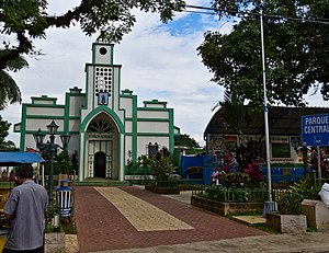
San Víctor is a municipality (municipio) of the Espaillat Province in the Dominican Republic. The District Municipality became a municipality on May 23, 2013.