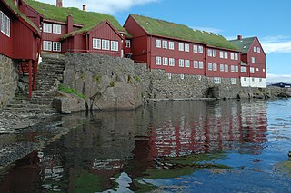
Tórshavn, usually locally referred to as simply Havn, is the capital and largest city of the Faroe Islands. It is located in the southern part on the east coast of Streymoy. To the northwest of the city lies the 347-meter-high (1,138 ft) mountain Húsareyn, and to the southwest, the 350-meter-high (1,150 ft) Kirkjubøreyn. They are separated by the Sandá River. The city itself has a population of 14,099 (2024), and the greater urban area has a population of 23,194, including the suburbs of Hoyvík and Argir.

Hanstholm is a small town and a former island, now elevated area in Thisted municipality of Region Nordjylland, located in northern Denmark. The population of the town is 2,088.

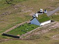
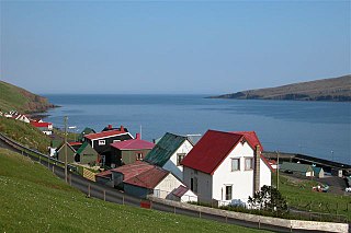
Fámjin is a village located on the western side of Suðuroy, the southernmost island in Faroe Islands. Fámjin is looking directly out to the North Atlantic Ocean.

Froðba is a village located farthest out on the north brink of Trongisvágsfjørður, an inlet on the east coast of the island of Suðuroy in the Faroe Islands.

Norðragøta, also just referred to as Gøta, is a village on Eysturoy island, Faroe Islands.

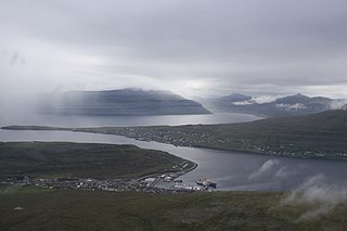
Tvøroyri is a village on the north side of the Trongisvágsfjørður on the east coast of Suðuroy island in the Faroe Islands. Together with Froðba, Trongisvágur, Líðin and Øravík it forms Tvøroyri Municipality.

Lamba, is a small village in the bottom of the inlet of Lambavík on the east coast of Eysturoy, Faroe Islands.
Hov is a village located on Suduroy's east coast, in the Faroe Islands; it is frequently mentioned in the country's history.

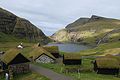
Hvalba is a village and a municipality in the Faroe Islands, which consists of Hvalba, Nes-Hvalba and Sandvík.

Trongisvágur is a village on the island of Suduroy in the Faroe Islands.

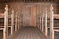
Koltur is an island in the Faroe Islands, located to the west of Streymoy and to the north-west of Hestur. The name 'Koltur' means 'colt', in contrast with the name of the larger island to the south-east, 'Hestur', which means 'horse'. The island has just one settlement, Koltur. It was abandoned in the 1980s by the sheep-farmers whose flocks grazed on the southern part of the island. Since then only two people have returned. Koltur has two mountains, Kolturshamar and Fjallið (101m) which strictly speaking is not a mountain, the name however translates directly as "The Mountain" and is considered by many as the smallest mountain in the country.

Killary Harbour or Killary Fjord is a fjord or fjard on the west coast of Ireland, in northern Connemara. To its north is County Mayo and the mountains of Mweelrea and Ben Gorm; to its south is County Galway and the Maumturk Mountains.

Streymoy is the largest and most populated island of the Faroe Islands. The capital, Tórshavn, is located on its southeast coast. The name means "island of currents". It also refers to the largest region of the country that also includes the islands of Hestur, Koltur and Nólsoy.

Vágar is one of the 18 islands in the archipelago of the Faroe Islands and the most westerly of the large islands. With a size of 178 square kilometres, it ranks third in size, behind Streymoy and Eysturoy. Vágar region also comprises the island of Mykines.

Sørvágur is a village on the island of Vágar in the Faroe Islands.

Sandur is a village on the south coast of the island of Sandoy in the Faroe Islands. The Sandur hoard of silver coins, dating to the end of the 11th century, attests to the long history of the village. In January 2024, the population stood at 529.

Sumba is the southernmost village of the Faroe Islands, located on the island of Suðuroy. It is located in Sumbiar Municipality.

Vágur, meaning bay, is a town and municipality on the island of Suðuroy, part of the Faroe Islands.

Sunda is a municipality in the Faroe Islands, loosely centered around the Sundini sound between the islands of Streymoy and Eysturoy.
The Faroe Islands consist of 18 islands, several of which are deeply incised by fjords.
This page is based on this
Wikipedia article Text is available under the
CC BY-SA 4.0 license; additional terms may apply.
Images, videos and audio are available under their respective licenses.