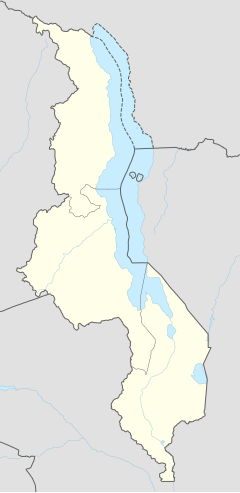
Lilongwe is the capital and largest city of Malawi. It has a population of 989,318 as of the 2018 Census, up from a population of 674,448 in 2008. In 2020 that figure was 1,122,000. The city is located in the central region of Malawi, in the district of the same name, near the borders with Mozambique and Zambia, and it is an important economic and transportation hub for central Malawi. It is named after the Lilongwe River.

Blantyre is Malawi's centre of finance and commerce, and its second largest city, with a population of 800,264 as of 2018. It is sometimes referred to as the commercial and industrial capital of Malawi as opposed to the political capital, Lilongwe. It is the capital of the country's Southern Region as well as the Blantyre District.

Nkhotakota (Un-kho-tah-kho-tuh) is a town and one of the districts in the Central Region of Malawi. It is on the shore of Lake Malawi and is one of the main ports on Lake Malawi. As of 2018, Nkhotakota had a population estimated at 28,350. The district had a population of 301.000.
Balaka is a township in Southern Region, Malawi and headquarters for the Balaka District. The township was formerly a boma of Machinga District, before the Balaka District was created in 1998.

The Central Region of Malawi, population 7,523,340 (2018), covers an area of 35,592 km2. Its capital city is Lilongwe, which is also the national capital. The region has an outlet on Lake Malawi and borders neighbouring countries Zambia and Mozambique. The Chewa people make up the majority of the population today.
Dedza is a district in the Central Region of Malawi. It covers an area of 3,624 km.² to the south of the Malawi capital, Lilongwe, between Mozambique and Lake Malawi. The capital is Dedza.

Dowa is a district in the Central Region of Malawi. The capital is Dowa.
The Mangochi District is a hub of commerce. It is a transit point, with roads leading to all areas of Malawi and Mozambique to the east. In fact, the border is not far once you cross the Shire River. To the north, the road bifurcates into the Salima or Monkey Bay roads. To the west, is the hilly region of Dedza. Traveling south, the road climbs up the Machinga escarpment to Zomba, the former colonial capital of Nyasaland, and from there to Malawi's commercial hub of Blantyre. It is fiercely hot in summer and ambient in winter. It is on the flood-plain for Lake Malawi. The lake is the third largest and most southerly in the Rift Valley lake system, and is unofficially known as the Lake of Stars. The lake was named by David Livingston as he discovered it on September 18, 1859, for the effect of the reflection of the sun on the water's surface. It is also known as the Calendar Lake as it is approx 365 miles (587 km) long and 52 wide.

Ntcheu is a district in the Central Region of Malawi. It borders with the country of Mozambique. The district headquarters is Ntcheu, known as BOMA in the local language, but is most commonly called Mphate. It is run by Yeneya, the village headman. The district covers an area of 3,424 km.² and has a population of 659,608 people according to the 2018 Malawi Population and Housing Census. The Ntcheu district lies around halfway between Malawi's majors cities of Blantyre and Lilongwe - the capital city.
Nkhotakota is a district in the Central Region of Malawi. The capital is Nkhotakota. The district covers an area of 4,259 km² and has a population of 395,897. The word Nkhotakota means "zig-zag" in Chichewa. It is located along the shore of Lake Malawi.
Salima is a district in the Central Region of Malawi. The city of Salima is the district's capital. The district covers an area of 2,196 km.² and has a population of 478,346. The beach at Senga Bay is the weekend retreat of many from the capital, Lilongwe, and has hosted the annual Lake of Stars festival since 2008, when it was moved from Chintheche in order to be less remote. There is a range of accommodation options in the area, though most are a few kilometers off the main road.
Chipoka is a town located in the Central Region district of Salima, in Malawi. It is one of the main ports on Lake Malawi and is the closest port to the capital city of Lilongwe. Chipoka is located on the western shore of Kasangha Bay across from Cape Maclear.
Ntchisi is a town located in the Central Region of Malawi. It is the administrative capital of Ntchisi District.
Ntcheu is a town located in the Central Region of Malawi. It is the administrative capital of Ntcheu District. Ntcheu is known for its produce, including Irish potatoes.
The 1989 Malawi earthquake occurred on 10 March in central Malawi, with a moment magnitude of 6.3 and a maximum Mercalli intensity of VIII (Severe). It was preceded by a number of foreshocks, the largest being a 5.7 shock on the previous day. The earthquake was felt strongly throughout central Malawi, and also felt in parts of Mozambique and Zambia. Nine people were killed, with many others injured or left homeless.
Malawi Railways is the national rail network in Malawi, run by a government corporation until privatisation in 1999. As of 1 December 1999 the Central East African Railways, a consortium led by Railroad Development Corporation, won the right to operate the network.

Lilongwe River is a river in Malawi; it flows through Lilongwe, the capital of the country.
The Gospelink Agricultural Training Center is an outreach and mission center along Lake Malawi in the Salima District of Malawi.

Sena railway, also called Shire Highlands railway, Dondo-Malawi railway and North-South Malawi railway, is a railway that connects Dondo, Mozambique, to Chipata, in Zambia. It is c. 1000 km long, in a 1067 mm gauge.


