San Diego Country Estates, California

Last updated

San Diego Country Estates
Nickname: 
the Estates
San Diego County California Incorporated and Unincorporated areas San Diego Country Estates Highlighted.svg
Location in San Diego County and the state of California
Usa edcp location map.svg
Red pog.svg
San Diego Country Estates
Location in the United States
Coordinates: 33°0′9″N116°47′56″W / 33.00250°N 116.79889°W / 33.00250; -116.79889
Country Flag of the United States.svg  United States
State Flag of California.svg  California
County San Diego
Area
[1]
  Total16.850 sq mi (43.641 km2)
  Land16.850 sq mi (43.641 km2)
  Water0 sq mi (0 km2)  0%
Elevation
1,516 ft (462 m)
Population
 (2010)
  Total10,109
  Density600/sq mi (230/km2)
Time zone UTC-8 (PST)
  Summer (DST) UTC-7 (PDT)
ZIP code
92065
Area codes 442/760
FIPS code 06-66004
GNIS feature ID1867055

San Diego Country Estates, commonly referred to as the Estates, is a valley resort populace composed of several neighborhoods associated with the unincorporated community of Ramona, California. The Estates are a census-designated place in North County, a region of the San Diego metropolitan area. The Estates is just east of the North County city of Poway and southeast of Ramona; 38 miles (61 km) northeast of San Diego and 46 miles (74 km) from the regional center of Carlsbad. San Diego Country Estates had a population of 10,109 at the 2010 census, up from 9,262 at the 2000 census.

Contents

History

Early history

Before the development of the Estates, the area was inhabited by the northern Ipai, a semi-nomadic people and a group of the Kumeyaay. These people are known by many names, some of which include the Digueno, Tipai-Ipai, or Kamia. The San Vicente Valley was home to the temporary settlements of these people who traveled the region between Escondido and Lake Henshaw. Grinding stones, commonly found in large boulders throughout the valley alongside creeks and used to create acorn meal for bread, are testament to their historic presence in the area.

In the 1700s the valley in which San Diego Country Estates is located received its name when Father Mariner of Mission San Diego de Alcalá discovered the location, proclaiming it a constant and beautiful valley, and named it in honor of Saint Vincent. [2] As the area became colonized by the Spanish and later fell under Mexican jurisdiction, the land of the San Vicente Valley became a part of the Mexican land-grant known as Rancho Cañada de San Vicente y Mesa del Padre Barona in 1846. Under the grant prominent persons such as William Augustus Barnett and families, the Dukes, settled the region. [3]

In 1970 Raymond A. Watt, a national award-winning builder, purchased 3,250 acres in the San Vicente Valley with the intent of building a new community that became San Diego Country Estates. [2]

Contemporary history

San Diego Country Estates, on May 13, 1973, hosted former 55-year-old tennis player Bobby Riggs and then 30-year-old women's world number one player, Margaret Court. Court was challenged to a tennis match by Riggs and the game was held at the San Vicente Country Club and Golf Course Resort. Riggs won the match 6-2, 6-1.

The area is well known for its history with Southern California wildfires. Several fires including the Witch Fire and Cedar Fire have begun near the Estates. On October 23, 2003, the Cedar Fire began approximately 3 miles east of the Estates in Cleveland National Forest. [4]

Also beginning near the Estates, the Witch Fire began October 21, 2007 and was part of a series of fires that ravaged Southern California. The Witch Creek fire caused the evacuation of the thousands of residents of the Estates area and evacuating cars were bottlenecked on the San Vicente Highway, a main artery leading to San Diego Country Estates from Ramona. It was feared that the fire would sweep west from the ridge separating the Estates and Ramona, catching vehicles evacuating west through North County, however, the wind changed the course of the fire. The Witch Creek fire was initially feared to be larger than the Cedar Fire but instead resulted in becoming the second largest fire in California history. Ultimately the Witch Creek burned 197,990 acres (801 km2) and forced the evacuation of an estimated 1,000,000 people in the San Diego metropolitan area, the largest evacuation in California history. [5]

Geography

According to the United States Census Bureau, the Estates has a total area of 16.9 square miles (43.6 km2), all land.

San Diego Country Estates is in the San Vicente Valley 33°0′9″N116°47′56″W / 33.00250°N 116.79889°W / 33.00250; -116.79889 (33.002636, -116.799005). [6] bordered on all sides by rolling hills with the exception of the prominent Mount Gower, in Cleveland National Forest. There are only three main entrances and exits into the estates via the San Vicente Highway, Old Julian Highway, and Wildcat Canyon Highway leading to Barona, and eventually South Bay.

To the west of San Diego Country Estates are Poway and Ramona, to the south is Lakeside, to the east is Cleveland National Forest and to the north is the Palomar Mountain Range.

Demographics

2010

At the 2010 census San Diego Country Estates had a population of 10,109. The population density was 599.9 inhabitants per square mile (231.6/km2). The racial makeup of San Diego Country Estates was 9,107 (90.1%) White, 91 (0.9%) African American, 90 (0.9%) Native American, 147 (1.5%) Asian, 34 (0.3%) Pacific Islander, 276 (2.7%) from other races, and 364 (3.6%) from two or more races. Hispanic or Latino of any race were 1,126 persons (11.1%). [7]

The census reported that 10,096 people (99.9% of the population) lived in households, 13 (0.1%) lived in non-institutionalized group quarters, and no one was institutionalized.

There were 3,441 households, 1,380 (40.1%) had children under the age of 18 living in them, 2,479 (72.0%) were opposite-sex married couples living together, 253 (7.4%) had a female householder with no husband present, 142 (4.1%) had a male householder with no wife present. There were 145 (4.2%) unmarried opposite-sex partnerships, and 29 (0.8%) same-sex married couples or partnerships. 421 households (12.2%) were one person and 154 (4.5%) had someone living alone who was 65 or older. The average household size was 2.93. There were 2,874 families (83.5% of households); the average family size was 3.17.

The age distribution was 2,559 people (25.3%) under the age of 18, 832 people (8.2%) aged 18 to 24, 2,208 people (21.8%) aged 25 to 44, 3,376 people (33.4%) aged 45 to 64, and 1,134 people (11.2%) who were 65 or older. The median age was 41.1 years. For every 100 females, there were 101.1 males. For every 100 females age 18 and over, there were 98.0 males.

There were 3,686 housing units at an average density of 218.8 per square mile, of the occupied units 3,056 (88.8%) were owner-occupied and 385 (11.2%) were rented. The homeowner vacancy rate was 1.5%; the rental vacancy rate was 4.0%. 8,787 people (86.9% of the population) lived in owner-occupied housing units and 1,309 people (12.9%) lived in rental housing units.

2000

At the 2000 census there were 9,262 people, 2,992 households, and 2,650 families residing in the Estates. The population density was 545.9 inhabitants per square mile (210.8/km2). There were 3,102 housing units at an average density of 182.8 per square mile (70.6/km2). The racial makeup of the Estates was 92.92% White, 0.72% African American, 0.49% Native American, 1.12% Asian, 0.27% Pacific Islander, 1.72% from other races, and 2.76% from two or more races. Hispanic or Latino of any race were 7.70%. [8]

Of the 2,992 households, 47.5% had children under the age of 18 living with them, 80.0% were married couples living together, 6.0% had a female householder with no husband present, and 11.4% were non-families. 8.4% of households were one person, and 3.6% were one person aged 65 or older. The average household size was 3.10 and the average family size was 3.27.

In the Estates the population was spread out, with 31.6% under the age of 18, 5.5% from 18 to 24, 29.5% from 25 to 44, 23.2% from 45 to 64, and 10.2% 65 or older. The median age was 38 years. For every 100 females, there were 98.3 males. For every 100 females age 18 and over, there were 96.4 males.

The median household income was in San Diego Country Estates was $77,547, and the median family income was $79,409. Males had a median income of $55,825 versus $34,472 for females. The per capita income for the Estates was $27,685. About 2.6% of families and 3.4% of the population were below the poverty line, including 3.3% of those under age 18 and 1.0% of those age 65 or over.

Government

In the California State Legislature, San Diego Country Estates is in the 38th Senate District , represented by Democrat Catherine Blakespear, and in the 71st Assembly District , represented by Republican Kate Sanchez. [9]

In the United States House of Representatives, San Diego Country Estates is in California's 50th congressional district , represented by Democrat Scott Peters. [10]

Education

San Diego Country Estates is served by the Ramona Unified School District. These schools include:

Communities

Rancho San Vicente Rancho San Vicente, San Diego Country Esates.jpg
Rancho San Vicente

Tourism

San Diego Country Estates is home to the San Vicente Country Club and Golf Course Resort. Located in the Valley of the Sun, the resort is one of the county's premier country resorts, 30 miles from the city of San Diego. The Estates is also a 15-minute ride from the Barona Casino. In the valley there lies the San Diego Country Estates International Equestrian Center, Barona Oaks Motocross Park, and numerous outdoor recreational opportunities present in Cleveland National Forest and the surrounding state parks.

Transportation

The Estates are accessible via two major North County high ways and numerous smaller roads. The two main arteries are the San Vicente Highway that begins from the terminus California State Highway 78 and the Old Julian Highway by way of California State Route 67. The Estates receive air transport via the Ramona Airport, though San Diego International Airport is the more commonly used airport. Also nearby is the North County hub McClellan-Palomar Airport.

Related Research Articles

<span class="mw-page-title-main">Middletown, California</span> Census-designated place in California, United States

Middletown is a census-designated place (CDP) in Lake County, California, United States. Its population was 725 at the 2020 census down from 1,323 at the 2010 census, which was up slightly from 1,020 at the 2000 census. Middletown was given its name because it is halfway between Lower Lake and Calistoga, which is 17 miles (27 km) to the south. The town was severely damaged by the 2015 Valley Fire.

<span class="mw-page-title-main">Calistoga, California</span> City in California, United States

Calistoga is a city in Napa County, California, United States. Located in the North Bay region of the Bay Area, the city had a population of 5,228 as of the 2020 census.

<span class="mw-page-title-main">Palm Desert, California</span> City in California, United States

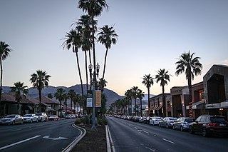
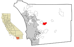
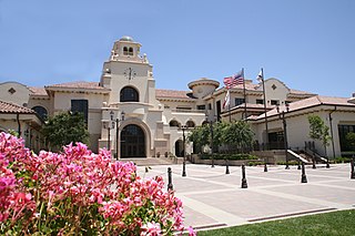
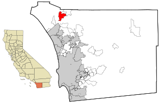
Palm Desert is a city in Riverside County, California, United States, in the Coachella Valley, approximately 14 miles (23 km) east of Palm Springs, 121 miles (195 km) northeast of San Diego and 122 miles (196 km) east of Los Angeles. The population was 48,445 at the 2010 census. The city has been one of the state's fastest growing since 1980, when its population was 11,801.

<span class="mw-page-title-main">San Jacinto, California</span> City in Riverside County in southern California, USA

San Jacinto is a city in Riverside County, California. It is located at the north end of the San Jacinto Valley, with Hemet to its south and Beaumont, California, to its north. The mountains associated with the valley are the San Jacinto Mountains. The population was 44,199 at the 2010 census. The city was founded in 1870 and incorporated on April 20, 1888, making it one of the oldest cities in Riverside County.

<span class="mw-page-title-main">Temecula, California</span> City in California, United States

Temecula is a city in southwestern Riverside County, California, United States. The city had a population of 110,003 as of the 2020 census and was incorporated on December 1, 1989. The city is a tourist and resort destination, with the Temecula Valley Wine Country, Old Town Temecula, the Temecula Valley Balloon & Wine Festival, the Temecula Valley International Film Festival, championship golf courses, and resort accommodations contributing to the city's economic profile.

<span class="mw-page-title-main">Wrightwood, California</span> Unincorporated community in California, United States

Wrightwood is a census-designated place in San Bernardino County, California. It sits at an elevation of 6,000 feet (1,800 m). The population was 4,525 at the 2010 census, up from the population of 3,837 at the 2000 census. Wrightwood is located 77 miles (124 km) northeast of Los Angeles. Wrightwood is on the Pacific Crest Trail.

<span class="mw-page-title-main">Yucca Valley, California</span> City in California, United States

Yucca Valley is an incorporated town in San Bernardino County, California, United States. The population was 20,700 as of the 2010 census. Yucca Valley lies 17 miles (27 km) west of Twentynine Palms, 27 miles (43 km) north of Palm Springs, 62 miles (100 km) south of Barstow via State Route 247 and 55 miles (89 km) east of San Bernardino.

<span class="mw-page-title-main">Fallbrook, California</span> CDP in California, United States

Fallbrook is a CDP in northern San Diego County, California. Fallbrook had a population of 30,534 at the 2010 census, up from 29,100 at the 2000 census.

<span class="mw-page-title-main">Jamul, California</span> Census designated place in California, United States

Jamul is a census-designated place (CDP) in San Diego County, California, United States. Jamul had a population of 6,163 at the 2010 census.

<span class="mw-page-title-main">Julian, California</span> Census-designated place in California, United States

Julian is a census-designated place (CDP) in San Diego County, California. As of the 2020 census, the population was 1,768, up from 1,502 at the time of the 2010 census.

<span class="mw-page-title-main">Lakeside, California</span> Census designated place in California, United States

Lakeside is a census-designated place (CDP) in the East County region of San Diego County, California. The population was 21,152 at the 2020 census, up from 20,648 as of the 2010 census.

<span class="mw-page-title-main">Poway, California</span> City in California, United States

Poway is a city in San Diego County, California, United States. The unincorporated community became a city on December 1, 1980. Poway's rural roots influenced its motto "The City in the Country". The city has a population of 48,841 as of the 2020 United States census.

<span class="mw-page-title-main">Ramona, San Diego County, California</span> Census designated place in California, United States

Ramona is a census-designated place (CDP) in San Diego County, California. The population was 20,292 at the 2010 census.

<span class="mw-page-title-main">Valley Center, California</span> Census-designated place in California, United States

Valley Center is a census-designated place (CDP) in northern San Diego County, California. The population was 9,277 at the 2010 census.

<span class="mw-page-title-main">Brookdale, California</span> Census-designated place in California, United States

Brookdale is a census-designated place (CDP) in Santa Cruz County, California. Brookdale sits at an elevation of 405 feet (123 m). It is located in the San Lorenzo Valley between Boulder Creek and Ben Lomond on Highway 9. The 2010 United States census reported Brookdale's population was 1,991.

<span class="mw-page-title-main">Witch Fire</span> October 2007 Wildfire in California, United States

The Witch Creek Fire, also known as the Witch Fire and the Witch-Guejito–Poomacha Complex Fire, was the second-largest wildfire of the 2007 California wildfire season, and the largest one of the October 2007 California wildfires. Although the Witch Creek Fire was individually smaller than the Zaca Fire of 2007, burning 197,990 acres (801 km2) acres alone, after merging with the Poomacha and McCoy Fires, the Witch–Guejito–Poomacha Complex Fire had a total burn area of 247,800 acres (1,003 km2), surpassing the Zaca Fire to become the largest complex fire of 2007. Initially igniting in Witch Creek Canyon, near Santa Ysabel, the Witch Creek Fire rapidly spread westward, fanned by powerful Santa Ana winds, and consumed large portions of San Diego County. On October 25, the Witch Fire merged with the Poomacha Fire to the north, near Palomar Mountain, before also merging with the smaller McCoy Fire on the next day. The Witch–Poomacha Complex Fire was the second-to-last fire of the 2007 October wildfires to be extinguished, with the Poomacha Fire being contained on November 13. The last remaining fire, the Harris Fire, was fully extinguished on November 16. During its duration, 80–100 feet-high flames were reported by fire officials in the Witch Fire, and the Witch Fire exhibited the characteristics of a firestorm at its height.

Rancho Cañada de San Vicente y Mesa del Padre Barona was a 13,316-acre (53.89 km2) Mexican land grant in present-day San Diego County, California given in 1846 by Governor Pío Pico to Juan Bautista Lopez. The grant was located in the San Vicente and Padre Barona Valleys, which lie south of Ramona. The area served as grazing lands for the Mission San Diego. Father José Barona served at the Mission San Diego from 1798 to 1810, before moving to the Mission San Juan Capistrano.

<span class="mw-page-title-main">Barona Group of Capitan Grande Band of Mission Indians</span> Native Kumeyaay Indians in Southern California

The Barona Group of Capitan Grande Band of Mission Indians of the Barona Reservation is a federally recognized tribe of Kumeyaay Indians, who are sometimes known as Mission Indians.

<span class="mw-page-title-main">East County, San Diego</span> Region of the San Diego Metro Area in San Diego County

East County is a region of San Diego County, California, east of San Diego.

<span class="mw-page-title-main">October 2007 California wildfires</span> Series of wildfires in California

The October 2007 California wildfires, also known as the Fall 2007 California firestorm, were a series of about thirty wildfires that began igniting across Southern California on October 20. At least 1,500 homes were destroyed and approximately 972,147 acres of land was burned from Santa Barbara County to the U.S.–Mexico border, surpassing the October 2003 California wildfires in scope, which were estimated to have burned 800,000 acres (3,200 km2). The wildfires killed a total of 14 people, with nine of them dying directly from the fires; 160 others were injured, including at least 124 firefighters. At their height, the raging fires were visible from space. These fires included the vast majority of the largest and deadliest wildfires of the 2007 California wildfire season. The only wildfire in 2007 that surpassed any of the individual October 2007 fires in size was the Zaca Fire.

References

  1. "2010 Census U.S. Gazetteer Files – Places – California". United States Census Bureau.
  2. 1 2 "San Diego Country Estates History". www.sdcea.net. San Diego Country Estates Association. December 2016. Archived from the original on December 20, 2016. Retrieved May 30, 2012.
  3. Beck, Darrel (September 1, 2009), Augustus and Martha Barnett, Their Descendants and Legacy , retrieved May 30, 2012
  4. "Firestorm 2003: The story of a catastrophe". San Diego Union-Tribune. November 16, 2003. Retrieved January 31, 2020.
  5. McLean, Demian; Peter J. Brennan (October 24, 2007). "California Fires Rout Almost 1 Million People, Kill 5 (Update7)". Bloomberg.
  6. "US Gazetteer files: 2010, 2000, and 1990". United States Census Bureau. February 12, 2011. Retrieved April 23, 2011.
  7. "2010 Census Interactive Population Search: CA - San Diego Country Estates CDP". U.S. Census Bureau. Archived from the original on July 15, 2014. Retrieved July 12, 2014.
  8. "U.S. Census website". United States Census Bureau . Retrieved January 31, 2008.
  9. "Statewide Database". UC Regents. Retrieved December 8, 2014.
  10. "California's 50th Congressional District - Representatives & District Map". Civic Impulse, LLC.