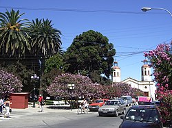
Demographics
According to the 2002 census of the National Statistics Institute, San Vicente spans an area of 475.8 km2 (184 sq mi) and had 40,253 inhabitants (20,095 men and 20,158 women). Of these, 21,965 (54.6%) lived in urban areas and 18,288 (45.4%) in rural areas. The population grew by 14.5% (5,086 persons) between the 1992 and 2002 censuses. [2] The 2012 census reported 44,046 inhabitants, an increase of 9.4% from 2002 to 2012. [3]
Archaeology
Tagua-Tagua represents a very early Paleo-Indian archaeological site, and it is dated to 11,380 ±380 14C yr BP (before present). [6]
This is an ancient pleistocene site where humans butchered large animals that they hunted. The site was discovered in the 1860s.
An upper, younger stratum is about 1 m below the surface. The older stratum is about 2.4 m below the surface, and contains chipped stone tools. Horse and mastodon remains are represented, as well as smaller animals. [6]

Parral is a city and commune in the Linares Province of Chile's Maule Region.

Santo Domingo is a Chilean coastal city and commune in San Antonio Province, Valparaíso Region. It was founded as Rocas de Santo Domingo.
Rengo is a city and commune located in the Zona Central of Chile, situated in the Cachapoal Province of the O'Higgins Region at a distance of 28 km (17 mi) south of the city of Rancagua and 114 km (71 mi) south of the national capital Santiago. It was named after the courageous Toqui Rengo for his particular bravery at the Battle of Lagunillas.
Pencahue is a town and commune in Chile, located in Talca Province, in the seventh region of Maule. The commune spans and area of 956.8 km2 (369 sq mi).

Cachapoal Province is one of three provinces of the central Chilean region of O'Higgins (VI). Its capital is the city of Rancagua.

Buin is a city and commune of Chile, in the Maipo Province, Metropolitan Region of Santiago, which forms part of Greater Santiago. It is a city composed of the towns of Maipo, Viluco, Linderos, Valdivia de Paine, Alto Jahuel, Los Guindos and El Recurso. Buin is located about 35 km (22 mi) south of Santiago in the Maipo Valley wine region.

San José de Maipo is the name of a commune in Chile and the city within it, located in Cordillera Province, Santiago Metropolitan Region, some 48 kilometers south-east of capital Santiago, bordered on the east by Argentina, across the Andes.

Olivar is a commune in Chile, located in the O'Higgins Region, 10 km south of Rancagua, and administered by the municipality of Olivar. The main economic activities range from agriculture and food production, especially apples for exportation.

Mostazal is a Chilean commune in Cachapoal Province, O'Higgins Region. The capital of the commune is the city of San Francisco de Mostazal.
Codegua is a Chilean commune and city in Cachapoal Province, O'Higgins Region. According to the 2002 census, the commune population was 10,796 and has an area of 286.9 km2.

Machalí is a Chilean commune and city in Cachapoal Province, O'Higgins Region.

Requínoa is a Chilean commune and city in Cachapoal Province, O'Higgins Region.

Malloa is a Chilean commune and town in Cachapoal Province, O'Higgins Region.

Quinta de Tilcoco is a Chilean commune and city in Cachapoal Province, O'Higgins Region.
Pichidegua is a Chilean commune and town in Cachapoal Province, O'Higgins Region.

Peumo is a Chilean city and commune in Cachapoal Province, O'Higgins Region. It is believed that Peumo was named for the vast amount of Cryptocarya alba, or Peumo trees, that grow there.
Coltauco is a Chilean commune and town in Cachapoal Province, O'Higgins Region. According to the 2002 census, the commune population was 16,228 and has an area of 224.7 km².

Coinco is a Chilean commune and town in Cachapoal Province, O'Higgins Region. According to the 2012 census, the commune population was 6,709 and has an area of 98.2 km2 (38 sq mi).

Las Cabras is a Chilean commune and city in Cachapoal Province, O'Higgins Region. This commune is known for agriculture and handcrafts. The commune's name comes from the many goats that used to be in the mountains.
Calera de Tango is a Chilean commune in the Maipo Province, Santiago Metropolitan Region.
This page is based on this
Wikipedia article Text is available under the
CC BY-SA 4.0 license; additional terms may apply.
Images, videos and audio are available under their respective licenses.