Sanford, Manitoba

Last updated

Sanford
Community of Sanford
Canada Manitoba location map 2.svg
Red pog.svg
Sanford
Location of Sanford in Manitoba
Coordinates: 49°40′57″N97°26′39″W / 49.68250°N 97.44417°W / 49.68250; -97.44417
Country Canada
Province Manitoba
Region Pembina Valley
Area
[1]
  Total6.29 km2 (2.43 sq mi)
Elevation
[2]
268 m (879 ft)
Population
 (2016) [1]
  Total937
  Density150/km2 (390/sq mi)
Time zone UTC-6 (CST)
  Summer (DST) UTC-5 (CDT)
Postal Code
R0G 2J0
Area code(s) Area codes 204 and 431

Sanford is an unincorporated community in the Rural Municipality of Macdonald in Manitoba.

Contents

Sanford lies approximately 12 kilometres southwest of the provincial capital, Winnipeg. While it is generally considered a bedroom community with many residents commuting to Winnipeg for work, Sanford is also home to many farming families and small businesses. These businesses include the grocery store, the liquor/lumber store, Family Physio Therapy, carwash, insurance, accounting, and construction service provided. Sanford is also home to Meadowbrook (a small retirement community), a United Church, and a Recreation Center.[ citation needed ]

Sanford is the site of the Water Treatment Plant that serves the R.M. of Macdonald. [3]

Demographics

In the 2021 Census of Population conducted by Statistics Canada, Sanford had a population of 991 living in 390 of its 398 total private dwellings, a change of

Education

Sanford Collegiate educates approximately 300 students, ranging from 9th to 12th grade. Many students are bused in from surrounding communities including LaSalle, Oak Bluff, Domain, Starbuck, and Brunkild. The principal of the Sanford Collegiate is Ms. Jaynie Burnell and the vice-principal is Ryan Ogilvie.

J.A. Cuddy School houses kindergarten to grade 8 students, and also has a daycare facility. The principal of J.A. Cuddy school is Mr. Scott Thomson. J.A. Cuddy school was named after Dr. James A. Cuddy. He was born in the Sanford area in 1892, where he also received his elementary schooling. Later in life, he spent more than 20 years as a member of the Manitoba School Trustees Association and was president for six years. He sat on the advisory board of education from 1946 to 1949 and was a member and vice-chairman of the Manitoba Teachers Pension Fund from 1948 to 1959, plus a member of two provincial municipal committees of the legislature for three years. In 1952, the University of Manitoba recognized his services to the province by bestowing an Honorary LL.D. (doctor of laws) on him. In 1953, he was awarded the coronation medal by Queen Elizabeth. [5] Outside the front of the school, there is an old school bell. This bell was the original bell from the Sanford Consolidated School, built in 1914. This bell used to be rung every day, but now it sits as a symbol, in front of the school, as a monument to the school's history. Due to an increased number of students, the school expanded to include four new classrooms, a new computer lab, and a large new gym. The school playground includes a play structure, swing set, soccer field, and baseball diamond.

High-School Sports

The premier sport at Sanford Collegiate is hockey.

Men's team Championships: 2013-14 and 2017-18 Winnipeg Free Press Division Champions

Related Research Articles

<span class="mw-page-title-main">Rural Municipality of Gimli</span> Rural municipality in Manitoba, Canada

The Rural Municipality of Gimli is a rural municipality located in the Interlake Region of south-central Manitoba, Canada, on the western shore of Lake Winnipeg. It is about 75 kilometres (47 mi) north of the provincial capital Winnipeg. The rural municipality's population in the 2016 Canadian Census was 6,181, making it the 12th largest rural municipality by population. The RM of Gimli has an area of 318.75 km2 (123.07 sq mi), making it the sixth smallest rural municipality by area.

<span class="mw-page-title-main">Rural Municipality of Rosser</span> Rural municipality in Manitoba, Canada

Rosser is a rural municipality (RM) in the Canadian province of Manitoba, lying adjacent to the northwest side of Winnipeg and part of the Winnipeg Metro Region. Its population as of the 2016 Census was 1,372.

<span class="mw-page-title-main">Niverville, Manitoba</span> Place in Manitoba, Canada

Niverville is a town in the Eastman Region, Manitoba, Canada. The town lies between the northwest corner of the Rural Municipality of Hanover and the southeastern portion of the Rural Municipality of Ritchot. Niverville's population as of the 2021 census is 5,947, the largest town and 10th-largest community in Manitoba.

<span class="mw-page-title-main">Rural Municipality of West St. Paul</span> Rural municipality in Manitoba

West St. Paul is a rural municipality (RM) in Manitoba, Canada. It lies adjacent to the north side of Winnipeg, and directly west of the Red River. It is part of the Winnipeg Metro Region, and had a population of 5,368 at the 2016 census.

<span class="mw-page-title-main">Rural Municipality of Alexander</span> Rural municipality in Manitoba, Canada

The Rural Municipality of Alexander is a rural municipality in the Eastman Region of Manitoba, Canada. The town of Powerview-Pine Falls lies adjacent to the municipality, as does the Sagkeeng First Nation Indian reserve.

<span class="mw-page-title-main">Rural Municipality of East St. Paul</span> Rural municipality in Manitoba, Canada

East St. Paul is a rural municipality (RM) in Manitoba, Canada. It is located north-east of and adjacent to the city of Winnipeg, and is part of the Winnipeg Metropolitan Area. The municipality was formed on 3 November 1915 when the municipality of St. Paul (1888-1914) was subdivided into West St. Paul and East St. Paul, with the Red River acting as the dividing line.

<span class="mw-page-title-main">Rural Municipality of St. Andrews</span> Rural municipality in Manitoba, Canada

St. Andrews is a rural municipality (RM) in Manitoba, Canada. It lies west of the Red River; its southern border is approximately 8 kilometres (5.0 mi) north of Winnipeg.

<span class="mw-page-title-main">Rural Municipality of Headingley</span> Rural municipality in Manitoba, Canada

Headingley is a rural municipality in Manitoba, Canada. It is located directly west of Winnipeg and had a population of 3,579 people as of the 2016 census.

<span class="mw-page-title-main">Rural Municipality of St. Clements</span> Rural municipality in Manitoba, Canada

St. Clements is a rural municipality (RM) in Manitoba, Canada. It is located to the north-east of Winnipeg, stretching from East St. Paul and Birds Hill Provincial Park in the south to Lake Winnipeg and Grand Beach Provincial Park to the north. The Red River demarcates the western boundary of the municipality. St. Clements contains the communities of East Selkirk, and Lockport east of the Red River. It almost completely surrounds the Brokenhead 4 Indian reserve, with the exception of a small lakefront on Lake Winnipeg.

<span class="mw-page-title-main">Rural Municipality of Cartier</span> Rural municipality in Manitoba, Canada

Rural Municipality of Cartier is a rural municipality in the Central Plains and Metro Regions of Manitoba, Canada. The municipality is bordered on the west by the RM of Portage la Prairie, to the east by the RM of Headingley, and to the north by the Assiniboine River. It is mainly flat rich farmland. Its main town is Elie.

<span class="mw-page-title-main">Stonewall, Manitoba</span> Town in Manitoba, Canada

Stonewall is a town in the Canadian province of Manitoba with a population of 5,046 as of the 2021 census. The town is situated approximately 25 kilometres (16 mi) north of Winnipeg on PTH 67. It is known for its limestone quarries. The local festival is the Quarry Days which is usually held over three days in August on Main Street. The town is surrounded by the R.M. of Rockwood.

<span class="mw-page-title-main">Rural Municipality of Taché</span> Rural municipality in Manitoba, Canada

Taché is a rural municipality in Manitoba, Canada, incorporated in 1880.

<span class="mw-page-title-main">Lorette, Manitoba</span> Place in Manitoba, Canada

Lorette is a local urban district in the Rural Municipality of Taché, located 25 km southeast of Winnipeg, in the province of Manitoba, Canada.

<span class="mw-page-title-main">Rural Municipality of Springfield</span> Rural municipality in Manitoba, Canada

Springfield is a rural municipality (RM) in Manitoba, Canada. It stretches from urban industrial development on the eastern boundary of the city of Winnipeg, through urban, rural residential, agricultural and natural landscapes, to the Agassiz Provincial Forest on the municipality's eastern boundary. Birds Hill Provincial Park nestles into the north-western corner of Springfield.

<span class="mw-page-title-main">Rural Municipality of Ritchot</span> Rural municipality in Manitoba, Canada

The Rural Municipality of Ritchot is a rural municipality (RM) in the Winnipeg Capital Region, bordering the south side of Winnipeg in Manitoba, Canada. The separately-administered town of Niverville lies adjacent to its southeast, between it and the Rural Municipality of Hanover.

<span class="mw-page-title-main">Rural Municipality of Macdonald</span> Rural Municipality in Southern Manitoba

Macdonald is a rural municipality lying adjacent to the southwest side of Winnipeg, Manitoba, Canada. It is part of the Winnipeg Metro Region, but is not part of the smaller Winnipeg census metropolitan area. Macdonald's population as of the 2016 census was 7,162.

<span class="mw-page-title-main">St. Adolphe, Manitoba</span> Place in Manitoba, Canada

St. Adolphe, or Saint Adolphe, originally called Pointe-Coupée, is a community in the Rural Municipality of Ritchot, Manitoba, Canada. It is located along the east bank of the Red River, approximately 12 kilometres south of Winnipeg.

<span class="mw-page-title-main">Teulon</span> Town in Manitoba, Canada

Teulon is a town located approximately 59 kilometres north of Winnipeg, Manitoba, Canada, on Provincial Trunk Highway 7. Located between Stonewall and Gimli, Teulon is commonly referred to as "The Gateway to the Interlake". Teulon is surrounded by the Rural Municipality of Rockwood.

<span class="mw-page-title-main">Municipality of Killarney-Turtle Mountain</span> Rural municipality in Manitoba, Canada

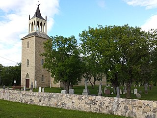
Killarney-Turtle Mountain is a rural municipality (RM) located in the Westman Region of Manitoba, Canada. It is located to the immediate north of the Canada–United States border opposite Rollete and Towner Counties, North Dakota.

Oak Bluff is an incorporated community located in the Rural Municipality of Macdonald, Manitoba, Canada. It is situated seven kilometres southwest of the City of Winnipeg, between Manitoba Highway (PTH) 3's intersections with PTH 2 and PTH 100. The community has a population of 1,442 as of the 2021 Canadian census

References

  1. 1 2 "Census Profile - 2016 Census - Sanford, Manitoba". statcan.gc.ca.
  2. "Elevation of Sanford". earthtools.org.
  3. "Macdonald Upgrades Notice of Alteration for the Manitoba Water Services Board & the RM Macdonald Water Treatment Plant" (PDF). gov.mb.ca. June 22, 2016. Retrieved February 13, 2020.
  4. "Population and dwelling counts: Canada and designated places". Statistics Canada. February 9, 2022. Retrieved September 3, 2022.
  5. "Home". jacuddy.rrvsd.ca. Retrieved February 13, 2020.