Santa Ana del Chiquiburitac Mission Site | |
| Nearest city | Tucson, Arizona |
|---|---|
| Area | 80 acres (32 ha) |
| Built | 1811 |
| NRHP reference No. | 75000357 [1] |
| Added to NRHP | September 18, 1975 |
Santa Ana del Chiquiburitac Mission Site is a historic mission site located in Ironwood Forest National Monument, west of Tucson, Arizona.
It was built in 1811 and added to the National Register in 1975.
The site is within the Ironwood Forest National Monument. [2]

The Wupatki National Monument is a United States National Monument located in north-central Arizona, near Flagstaff. Rich in Native American archaeological sites, the monument is administered by the National Park Service in close conjunction with the nearby Sunset Crater Volcano National Monument. Wupatki was established as a national monument in 1924 and was listed on the National Register of Historic Places on October 15, 1966. The listing included three contributing buildings and 29 contributing structures on 35,422 acres (14,335 ha).

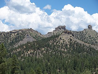
The Chiricahua Mountains massif is a large mountain range in southeastern Arizona which is part of the Basin and Range province of the west and southwestern United States and northwest Mexico; the range is part of the Coronado National Forest. The highest point, Chiricahua Peak, rises 9,759 feet (2,975 m) above sea level, approximately 6,000 feet (1,800 m) above the surrounding valleys. The range takes its name from the Chiricahua Apaches native to the region.

The Avra Valley is a 50-mile (80 km) long northwest–southeast valley, bordering the west of Tucson, Arizona. The Tucson Mountains are at the valley's center-east, with suburbs ranging east of the Tucson Mountains and trending northwest to the Avra Valley's northeast. This entire northwest stretch from Tucson contains the northwest trending Interstate 10, the route to Casa Grande and Phoenix. The northeast of the valley contains Marana on I-10, the Pinal Airpark, an aircraft storage park, and other communities along I-10. Avra Valley Airport is a general aviation airport in Marana, located about 15 miles (24 km) northwest of Tucson and being used for storage of classic propeller-era airliners.

The Salinas Pueblo Missions National Monument is a complex of three Spanish missions located in the U.S. state of New Mexico, near Mountainair. The main park visitor center is in Mountainair. Construction of the missions began in 1622 and was completed in 1635.

The Spanish Missions in New Mexico were a series of religious outposts in the Province of Santa Fe de Nuevo México — present day New Mexico. They were established by Franciscan friars under charter from the monarchs of the Spanish Empire and the government of the Viceroyalty of New Spain in a policy called Reductions to facilitate the conversion of Native Americans into Christianity.

Ironwood Forest National Monument is located in the Sonoran Desert of Arizona. Created by Bill Clinton by Presidential Proclamation 7320 on June 9, 2000, the monument is managed by the Bureau of Land Management, an agency within the United States Department of the Interior. The monument covers 129,055 acres (52,227 ha), of which 59,573 acres (24,108 ha) are non-federal and include private land holdings and Arizona State School Trust lands.

The following is an alphabetical list of articles related to the U.S. state of Arizona.
Chimney Rock National Monument is a 4,726-acre (1,913 ha) U.S. National Monument in San Juan National Forest in southwestern Colorado which includes an archaeological site. This area is located in Archuleta County, Colorado, between Durango and Pagosa Springs, and is managed for archaeological protection, public interpretation, and education. The Chimney Rock Archaeological Site has been listed on the National Register of Historic Places since 1970. U.S. President Barack Obama created Chimney Rock National Monument by proclamation on September 21, 2012 under authority of the Antiquities Act.
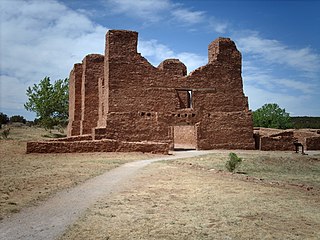
Quarai, also known historically as Quarai State Monument, is a prehistoric and historic unit of the Salinas Pueblo Missions National Monument located north of Mountainair, New Mexico. A National Historic Landmark District, it encompasses the archaeological remains of prehistoric Native American settlements, historic remains of a pueblo that was abandoned in the 1670s during the Spanish colonial period, the ruins of a 17th-century Spanish mission compound, and 19th-century Spanish ranching artifacts. The site was designated a National Historic Landmark in 1962, and was added to the Salinas Pueblo Missions National Monument in 1980.

Pueblo Grande Ruin and Irrigation Sites are pre-Columbian archaeological sites and ruins, located in Phoenix, Arizona. They include a prehistoric platform mound and irrigation canals. The City of Phoenix manages these resources as the Pueblo Grande Museum Archaeological Park.
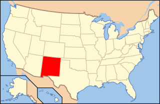
The following is an alphabetical list of articles related to the U.S. state of New Mexico.
The following outline is provided as an overview of and topical guide to the U.S. state of Arizona:

The Trail of the Ancients is a collection of National Scenic Byways located in the U.S. Four Corners states of Utah, Colorado, New Mexico, and Arizona. These byways comprise:
Bailey Ruin is an archaeological site located in Navajo County, Arizona, United States. The site, also known as "Stott Ranch Ruin" and "Pope Ranch Site," was added to the National Register of Historic Places on March 17, 2006 for its historical and archaeological significance.
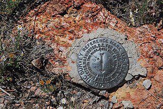
The Brow Monument is a monument listed in the National Register of Historic Places for Coconino County, Arizona, located in the Kaibab National Forest. The site contains one of the few remaining survey markers used by the expedition of John Wesley Powell in 1872 It is accessible via the Brow Monument Trail.

The Cocoraque Butte Archaeological District is located in Ironwood Forest National Monument, in Pima County, Arizona. Added to the National Register of Historic Places on October 10, 1975, it features ancient Hohokam ruins, hundreds of well-preserved petroglyphs, and the historic Cocoraque Ranch. The age of the petroglyphs range from 1150 to 2000 years old.

The Los Robles Archaeological District is located in Arizona's Ironwood Forest National Monument and was added to the National Register of Historic Places on May 11, 1989. The district is nearly 13,000 acres and contains over 100 historic and prehistoric archaeological sites, including the Los Robles Platform Mound Community and a trincheras.
| Topics | |
|---|---|
| Lists by state |
|
| Lists by insular areas | |
| Lists by associated state | |
| Other areas | |
| Related | |