| Saskatchewan Lake | |
|---|---|
 Saskatchewan Lake | |
| Location | Ontario |
| Coordinates | 45°07′55″N78°46′41″W / 45.132°N 78.778°W |
| Basin countries | Canada |
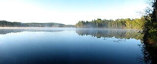
Saskatchewan Lake is a small lake in Haliburton County, Ontario, Canada.
| Saskatchewan Lake | |
|---|---|
| Saskatchewan Lake | |
| Location | Ontario |
| Coordinates | 45°07′55″N78°46′41″W / 45.132°N 78.778°W |
| Basin countries | Canada |
Saskatchewan Lake is a small lake in Haliburton County, Ontario, Canada.

Lake Ontario is one of the five Great Lakes of North America. It is bounded on the north, west, and southwest by the Canadian province of Ontario, and on the south and east by the U.S. state of New York. The Canada–United States border spans the centre of the lake.

Great Lakes Airlines was a regional airline in Canada. It was formed in 1958 in Sarnia, Ontario by John Blunt and by 1983 became Air Ontario Ltd. In June 1987 Air Ontario Ltd. merged with Austin Airways to form Air Ontario Inc. which in turn subsequently operated Air Canada Connector code sharing passenger flights on behalf of Air Canada with Convair 580 and de Havilland Canada DHC-8 Dash 8 series 100 and 300 turboprops. Air Ontario also operated Fokker F28 Fellowship jets at one point.

Unorganized Kenora District is an unorganized area in northwestern Ontario, Canada, in Kenora District. Constituting 98.39 percent of the district's land area, yet only 10.93 percent of its population, it is essentially the remainder of the district's territory after all incorporated cities, municipalities, townships, Indian reserves, and Indian settlements have been excluded. It is by far the largest municipal-equivalent level census division in Ontario, covering over 35 percent of the entire provincial land area, yet only about 0.05 percent of the population of Ontario.

Restoule Provincial Park is a provincial park in Parry Sound District in Central Ontario, Canada. It is located between Restoule Lake and Stormy Lake and extends along the banks of the Restoule River to its mouth at the French River in geographic Patterson Township and geographic Hardy Township. The park is located at the western terminus of Highway 534 northwest of Restoule, Ontario. The park offers three hiking trails and is home to coyotes, wolves, bears, otters, pine martens, moose and one of Ontario's largest white-tailed deer herds. It is also home to over 90 species of birds including the peregrine falcon and the heron. Camping areas include Bells Point, Putts Point and Kettle Point. Many hike the well-marked trail to the 100-foot (30 m) fire tower overlooking Stormy Lake. It is one of two provincial parks found in the Almaguin Highlands.

The Winisk River is a river in northern Ontario, Canada, that starts at Wunnummin Lake and flows east to Winisk Lake. From there it continues in a mostly northerly direction to Hudson Bay. The Winisk River is 475 kilometres (295 mi) long and has a drainage basin of 67,300 square kilometres (26,000 sq mi). The name is from Cree origin meaning "groundhog".

The Severn River is a river in northern Ontario. The northern Ontario river has its headwaters near the western border of the province. From the head of the Black Birch River, the Severn River is 982 km (610 mi) long, tying it with the Albany River for the title of longest river entirely in Ontario. Its drainage basin area is 102,800 km2 (39,700 sq mi), a small portion of which is in Manitoba. Its source is Deer Lake and flows northeasterly into Severn Lake, then by a second section to Hudson Bay where it ends at Fort Severn.

Bonnechere Provincial Park is an Ontario provincial park located on Round Lake in Renfrew County, Ontario, Canada.
Lake St. Peter Provincial Park is a recreation-class provincial park in the municipality of Hastings Highlands, Hastings County, Ontario, Canada. It is operated by the Ontario Parks branch of the Ontario Ministry of Natural Resources and Forestry.
Blue Lake Provincial Park is a park in Kenora District, Ontario, Canada, located 10 kilometres (6 mi) northwest of the community of Vermilion Bay. It can be accessed via Ontario Highway 647.

Halfway Lake Provincial Park is a provincial park astride Ontario Highway 144 in Sudbury District in northeastern Ontario, Canada. It is operated by Ontario Parks and is named for Halfway Lake, which is entirely within the park grounds. The nearest settlement on Highway 144 is Cartier, about 25 kilometres (16 mi) to the south. The park contains more than a dozen lakes, including Antrim Lake, Bailey Lake, Benny Lake, Bittern Lake, Burnt Ridge Lake, Halfway Lake, Lodge Lake, Moosemuck Lake, Otter Lake, Raven Lake, Three Island Lake, Trapper Lake, and Two Narrows Lake. There are a mix of 221 electrical and non-electrical sites in the two campgrounds, 10 interior canoe-access sites located on Antrim Lake, Bailey Lake, and Trapper Lake, plus an additional five interior hike-access sites located along the Hawk Ridge Trail.
Sedgman Lake Provincial Park is a provincial park operated by Ontario Parks located in the District of Thunder Bay, Ontario. Sedgman Lake was named May 5, 1960, in honour of World War II casualty Private Alfred Thomas Sedgman, who died while serving in the Canadian Army on February 26, 1945.
Cranberry Lake is a lake in the city of Kawartha Lakes, Ontario, Canada.
Mississagi River Provincial Park is a protected area on the Mississagi River in Algoma and Sudbury Districts, Ontario, Canada. It has an Ontario Parks designation of Waterway Class. The park encompasses the river and lakes on the river from Mississagi Lake to Bark Lake, and further downstream to a point just above Ricky Island Lake, as well as portions of the upper Spanish River system.
W.J.B. Greenwood Provincial Park is a non-operating recreational class park and protected area in the town of Latchford, Timiskaming District in Northeastern Ontario, Canada. It is on the southern shores of Bay Lake on the Montreal River, part of the Saint Lawrence River drainage basin, and is in the Great Lakes - St. Lawrence Forest / Boreal Forest transition zone biome. The park was established in 1985 and is named for Ben Greenwood, Ontario's first chief of the Division of Parks, 1954 to 1960.

The St. Joseph Channel is a strait in Algoma District, Northwestern Ontario, Canada and Chippewa County, Michigan, United States. It is in the Great Lakes Basin and connects the St. Marys River flowing through the Middle Neebish Channel between Neebish Island and Sugar Island at the northwest and Lake George/ East Neebish Channel between Sugar Island and the Ontario mainland at the north, with the North Channel between St. Joseph Island and the Ontario mainland at the east, and with the Munuscong Channel between Neebish Island and St. Joseph Island at the southwest. All of these waterbody elements are part of Lake Huron.
Lake George is a lake in Chippewa County, Michigan, United States, and Algoma District, Northwestern Ontario, Canada, that lies between Sugar Island in Michigan on the west and the Ontario mainland on the east.
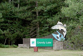
Grundy Lake Provincial Park is a natural environment park in Ontario, Canada, established in 1959, and part of the Ontario Parks system. The park is located near Britt, at the junction of Highway 69 and Highway 522.

The Centennial Lake Provincial Nature Reserve is a provincial park located in the municipality of Greater Madawaska, Renfrew County, in Eastern Ontario, Canada. The 530-hectare (1,300-acre) reserve was created in 1989 and is managed by Ontario Parks.
| | This Ontario location article is a stub. You can help Wikipedia by expanding it. |
| | This article related to a lake in Canada is a stub. You can help Wikipedia by expanding it. |