Related Research Articles

LaRue County is a county in the central region of the U.S. state of Kentucky, outside the Bluegrass Region and larger population centers. Its county seat is Hodgenville, which is best known as the birthplace of United States President Abraham Lincoln. The county was formed on March 4, 1843, from the southeast portion of Hardin County. It was named for John P. LaRue, an early settler. LaRue County is included in the Elizabethtown-Fort Knox, KY Metropolitan Statistical Area, which is also included in the Louisville/Jefferson County-Elizabethtown-Bardstown, KY-IN Combined Statistical Area. It is a prohibition or dry county.

Hardin County is a county located in the central part of the U.S. state of Kentucky. Its county seat is Elizabethtown. The county was formed in 1792. Hardin County is part of the Elizabethtown-Fort Knox, KY Metropolitan Statistical Area, as well as the Louisville/Jefferson County—Elizabethtown-Bardstown, KY-IN Combined Statistical Area. As of the 2020 census, the population was 110,702.

Elizabethtown is a village in and the county seat of Hardin County, Illinois, United States, along the Ohio River. The population was 299 at the 2010 census, down from 348 at the 2000 census. It is the least-populous county seat in the state.
Elizabethtown is a home rule-class city and the county seat of Hardin County, Kentucky, United States. The population was 28,531 at the 2010 census, and was estimated at 30,289 by the U.S. Census Bureau in 2019, making it the 11th-largest city in the state. It is included in the Elizabethtown–Fort Knox, Kentucky Metropolitan Statistical Area, which is included in the Louisville/Jefferson County–Elizabethtown–Madison, Kentucky-Indiana Combined Statistical Area. The Elizabethtown Metropolitan area had a 2019 estimated population of 153,057, making it the 5th largest metropolitan area in the state.
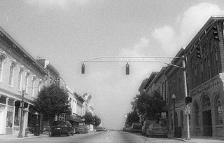
Shelbyville is a home rule-class city in and the county seat of Shelby County, Kentucky, United States. The population was 14,045 at the 2010 census.

Jesse Hilton Stuart was an American writer, school teacher, and school administrator who is known for his short stories, poetry, and novels as well as non-fiction autobiographical works set in central Appalachia. Born and raised in Greenup County, Kentucky, Stuart relied heavily on the rural locale of northeastern Kentucky for his writings. Stuart was named the poet laureate of Kentucky in 1954.

The Knobs Region or The Knobs is located in the US state of Kentucky. It is a narrow, arc-shaped region consisting of hundreds of isolated hills. The region wraps around the southern and eastern parts of the Bluegrass region in the north central to northeastern part of the state. The western end of the Knobs region begins near Louisville, Kentucky and continues southeastward through Bullitt, Hardin, Nelson, LaRue, Marion, Taylor, Boyle, Casey and Lincoln counties before turning northeast and running along the Pottsville Escarpment and the Appalachian Plateau. The Knob arc has a length of 230 miles (370 km).
Ballardsville is an unincorporated community in Oldham County, Kentucky, United States. It is a small unincorporated community that lies a few miles south of La Grange on KY 53.

Coxs Creek is an unincorporated community along U.S. Routes 31E/150 in Nelson County, Kentucky, United States, 4½ miles north of the county seat of Bardstown. It is named for Colonel Isaac Cox of Pennsylvania, who built a "fort" at the site in April 1775 before he fought in the American Revolutionary War, with the help of his brother James. The land had actually been his father's, but David moved back to Virginia before he developed it. More of a station, Cox's 1,000 acres (4.0 km2) was said to be the first pioneer station in Nelson County. Isaac Cox would later be the last white man to be killed by Indians during the time of the great Indian wars in what later became Kentucky.
The history of the Baptist movement in the United States state of Kentucky begins around 1775, when a few Baptist preachers visited from Virginia. Virginians John Taylor, Joseph Reading, and Lewis Lunsford all visited in 1779, but returned to Virginia. Baptists began to settle around 1781, the first Baptist congregation of 18 people being left by John Garrard. Rev. Lewis Craig led several hundred people of "The Travelling Church", including several preachers, to Gilbert's Creek from Spotsylvania County, Virginia, arriving the first week of December 1781. Cedar Fork Church was founded in 1782.

The First Baptist Church in Elizabethtown, Kentucky, originally known as Severn's Valley Baptist Church, is a historic church at 112 W. Poplar Street. It was built in 1855 and was a work of John Y. Hill, a tailor turned carpenter/builder. It was added to the National Register of Historic Places in 1974.
Saint John is an unincorporated community in Hardin County, Kentucky, United States. Saint John is located on Kentucky Route 1357, 5.6 miles (9.0 km) west of Elizabethtown.
Bardstown Junction is an unincorporated community in Bullitt County, Kentucky, in the United States.
English is an unincorporated community in Carroll County, in the U.S. state of Kentucky.
Albion is an unincorporated community in Johnson Township, Scott County, in the U.S. state of Indiana.

James Carme DuPlessis is a Republican member of the Kentucky House of Representatives as well as an engineer working for ChemTreat Inc. DuPlessis unseated longtime representative, Jimmie Lee, in the 2014 election and was re-elected in 2016.

Our Women and Children was a magazine published in Louisville, Kentucky by the American Baptist, the state Baptist newspaper. Founded in 1888 by William J. Simmons, president of State University, the magazine featured the work of African-American women journalists and covered both juvenile literature and articles focusing on uplifting the race. The magazine staff was made up of women who had an affiliation with State University. Of the hundreds of magazines begun in the United States between 1890 and 1950, very few gave editorial control or ownership to African American Women. Our Women and Children was one of them. It had a national reputation and became the leading black magazine in Kentucky before it folded in 1891 after Simmons' death.
Oak Grove is an unincorporated community in Trigg County, in the U.S. state of Kentucky.
Oak Hill is an unincorporated community in Pulaski County, in the U.S. state of Kentucky.
References
- ↑ Armitage, Thomas (1887). A history of the Baptists: traced by their vital principles and practices. University Press of Kentucky. p. 843. ISBN 978-0-8131-2498-8 . Retrieved October 30, 2009.
- ↑ Kleber, John E. (2001). The encyclopedia of Louisville. The University Press of Kentucky. p. 65. ISBN 978-0-8131-2100-0 . Retrieved October 30, 2009.