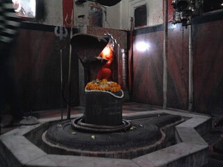
Khagaria is a city in Indian state of Bihar and the administrative headquarters of Khagaria district. Khagaria is a part of Munger division. It is located at 25.5°N 86.48°E and has an average elevation of 36 metres (118 feet). The Khagaria Junction railway station serves the city.It is situated about 25 km north of Munger.

Guna is a city and a municipality in Guna district in the Indian state of Madhya Pradesh. It is the administrative headquarters of Guna District and is located on the banks of Parbati river.

Gyanpur is a town and a nagar panchayat in Bhadohi district in the Indian state of Uttar Pradesh and the administrative headquarters of Bhadohi district.
Hamirpur is a city and a municipal board in Hamirpur district in the Indian state of Uttar Pradesh. It is the administrative headquarters of Hamirpur district.

Dankaur is a town and a nagar panchayat in Gautam Buddha Nagar District in the state of Uttar Pradesh, India PIN 203201.
Gulaothi is a town, near Bulandshahr city and municipal board in the Bulandshahr district that falls under the Meerut division of the Indian state of Uttar Pradesh.
Guriahati is a census town in the Cooch Behar I CD block in the Cooch Behar Sadar subdivision of the Cooch Behar district in the Indian state of West Bengal.
Haldibari is a city and a municipality in the Mekhliganj subdivision of the Cooch Behar district in the Indian state of West Bengal.
Khagrabari is a census town in the Cooch Behar II CD block in the Cooch Behar Sadar subdivision of the Cooch Behar district in the Indian state of West Bengal.

Khatima is a town and a municipal board in Udham Singh Nagar district in the Indian state of Uttarakhand.
Kiraoli is a town and a nagar panchayat in Agra district in the Indian state of Uttar Pradesh.

Mekhliganj is a city and a municipality in Cooch Behar district in the Indian state of West Bengal. It is the headquarters of the Mekhliganj subdivision.
Phulpur is a town area in Allahabad district in the Indian state of Uttar Pradesh. It is known for being the Lok Sabha seat from which Jawaharlal Nehru got elected to the Indian Parliament. Phulpur also hosts a Vidhan Sabha seat.
Pinahat is a town and a nagar panchayat in Agra district in the Indian state of Uttar Pradesh and situated on the Bank of Chambal River. It is about 55 km from Agra. The distance between Pinahat and Chambal is only 2 km.
Sahapur is a census town in Panchla CD Block of Howrah Sadar subdivision in Howrah district in the Indian state of West Bengal.
Fatehabad is a town in Agra district in the state of Uttar Pradesh, India. It is nearly 35 km south-east of Agra in the direction of Etawah. The historical name of the town is Samugarh.

Shahpur is a town and a notified area in Bhojpur district in the Indian state of Bihar.
Shahpur is a town and a nagar parishad in Sagar district in the Indian state of Madhya Pradesh. Mr.Abhishek Namdeo
Raya is a town and a nagar panchayat in the Mathura district of the Indian state of Uttar Pradesh.

Dewa Sharif or Dewa is a town and a nagar panchayat in Barabanki district in the state of Uttar Pradesh, India. It is famous for the shrine of Haji Waris Ali Shah. This town is also known by the name of Dewa Sharif in respect for the shrine. It is about 26 km north-east of the capital Lucknow.


