
Monroe County is a county located in the U.S. state of Illinois. According to the 2020 census, it had a population of 34,962. Its county seat and largest city is Waterloo.
Cairo is the southernmost city in Illinois and the county seat of Alexander County. A river city, Cairo has the lowest elevation of any location in Illinois and is the only Illinois city to be surrounded by levees. It is in the river-crossed area of Southern Illinois known as "Little Egypt", for which the city is named, after Egypt's capital on the Nile. The city is coterminous with Cairo Precinct.

Nauvoo is a small city in Hancock County, Illinois, United States, on the Mississippi River near Fort Madison, Iowa. The population of Nauvoo was 950 at the 2020 census. Nauvoo attracts visitors for its historic importance and its religious significance to members of several groups: The Church of Jesus Christ of Latter-day Saints; the Community of Christ, formerly the Reorganized Church of Jesus Christ of Latter Day Saints (RLDS); other groups stemming from the Latter Day Saint movement; and the Icarians. The city and its immediate surrounding area are listed on the National Register of Historic Places as the Nauvoo Historic District.

Sheridan is a village in LaSalle County, Illinois, United States. As of the 2020 census, the village's population was 2,431, up from 2,137 at the 2010 census. It is part of the Ottawa Micropolitan Statistical Area.

Harrisburg is a city in and the county seat of Saline County, Illinois, United States. It is located about 57 miles southwest of Evansville, Indiana, and 111 mi (179 km) southeast of St. Louis, Missouri. Its 2020 population was 8,219, and the surrounding Harrisburg Township had a population of 10,037, including the city residents. Harrisburg is included in the Illinois–Indiana–Kentucky tri-state area and is the principal city in the Harrisburg micropolitan statistical area with a combined population of 24,913.

Clay Township is a civil township of St. Clair County in the U.S. state of Michigan. The population was 8,446 at the 2020 census.

Titusville is an unincorporated community and census-designated place (CDP) located within Hopewell Township in Mercer County, in the U.S. state of New Jersey. The area includes a post office with its own ZIP Code (08560), several restaurants, gas stations, a firehouse, and a small cluster of homes. The Washington Crossing State Park, dedicated to George Washington's crossing of the Delaware River in 1776, is adjacent to the community.
Broderick is a former town in Yolo County, California, United States, now forming part of the City of West Sacramento. It is located just west of the Sacramento River in the eastern portion of the county. Broderick's ZIP Code is 95605 and is in area codes 916 and 279. It lies at an elevation of 23 feet.
Bird's Point is an unincorporated community in Mississippi County, Missouri, United States. It lies on an island or former island in the Mississippi River, near the confluence of the Ohio and Mississippi Rivers and is situated directly across from Cairo, Illinois. This is the point where the U.S. Route 60 bridge connects with Cairo.
Noyes is an unincorporated community in St. Vincent Township, Kittson County, Minnesota, United States. Located in the extreme northwestern corner of the state on the Canada–United States border, Noyes is the northern terminus of U.S. Highway 75 and site of a former road border crossing. U.S. Customs and Border Protection operates a customs inspection station for the Canadian Pacific and BNSF Railway lines that enter from Canada at Noyes. The community of Emerson, Manitoba, lies adjacent to Noyes on the Canadian side of the border, but the two communities are no longer directly linked by road.

Griggsville Landing, also known as Phillips Landing or Phillips Ferry, was located in Flint Township, just south of Valley City, Illinois. It is a former town site on the Illinois River in Pike County. The town was a steamboat stop which began sometime in the 1830s. There was a lime kiln there that was part of a commercial lime operation prior to post-Civil War industrial intensification in the lime industry. The town at Griggsville Landing was home to a boat yard, a grist mill and a hotel in addition to the Griggsville Landing Lime Kiln, built around 1850, which is still standing as of 2007. The town was eventually abandoned, rendering it a ghost town. Griggsville Landing is adjacent to the Ray Norbut State Fish and Wildlife Area.
The Village of Holly Bluff is a small unincorporated community in Yazoo County, Mississippi.

Carman Township is one of eleven townships in Henderson County, Illinois, USA. As of the 2010 census, its population was 309 and it contained 287 housing units.
Dahinda is an unincorporated community in Knox County, Illinois, United States. It is part of the Galesburg Micropolitan Statistical Area. Dahinda is in Persifer Township and lies approximately one mile north of U.S. Highway 150 and Interstate 74. Knox County Highway 15 runs from north to south through Dahinda. Once a bustling town, as time has gone on, the businesses in this community moved on, but the community still continues to exist.
The history of Nauvoo, Illinois, starts with the Sauk and Meskwaki tribes who frequented the area, on a bend of the Mississippi River in Hancock County, some 53 miles (85 km) north of today's Quincy. They called the area "Quashquema", in honor of the Native American chief who headed a Sauk and Fox settlement numbering nearly 500 lodges. Permanent settlement by non-natives was reportedly begun in 1824 by Captain James White. By 1830, the community was called "Venus", and it was the site of the first post office in the county. In 1834 the name Venus was changed to "Commerce" in anticipation that the town would prosper under the United States' westward expansion.
Meyer is an unincorporated community in Adams County, Illinois, United States. It has a population of approximately 10 full-time residents as of mid-2009, due to the flood of 2008. The community is part of the Quincy, IL–MO Micropolitan Statistical Area. It is the westernmost community in Illinois.
Niota is an unincorporated community in Appanoose Township, Hancock County, in the U.S. state of Illinois. The community is located on the bank of the Mississippi River and is at the eastern end of the Fort Madison Toll Bridge, which connects Niota to Fort Madison, Iowa. Niota is the western terminus of Illinois Route 9 and is also served by Illinois Route 96, which is part of the Great River Road.
Carman is an unincorporated village in Carman Township, Henderson County, Illinois, United States.

Spring Mill is an unincorporated community in Whitemarsh Township, Montgomery County, Pennsylvania, United States.

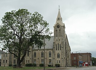
The Pulaski County Courthouse is a government building in Mound City, the county seat of Pulaski County, Illinois, United States. Built in 1912 and damaged by the Great Flood of 1937, it remains in use as the county's courthouse.


