Related Research Articles
Monroe Regional Airport is a public use airport in Ouachita Parish, Louisiana, United States. The airport is owned by the City of Monroe and is located within the city limits three nautical miles (6 km) east of its central business district.
Shreveport Regional Airport is a public use airport in Shreveport, Louisiana, United States. It is owned by the City of Shreveport and located four nautical miles (7 km) southwest of its central business district.

Columbus Municipal Airport is three miles north of Columbus, in Bartholomew County, Indiana, United States.
Natchitoches Regional Airport is a city-owned public-use airport located two nautical miles (4 km) south of the central business district of Natchitoches, a parish seat of Natchitoches Parish, Louisiana, United States.
Airlake Airport is a public use airport in Dakota County, Minnesota, United States. Owned by the Metropolitan Airports Commission, It is approximately 20 miles (32 km) south of both downtown Minneapolis and downtown St. Paul The airport is located near the Twin Cities suburbs of Lakeville and Farmington.
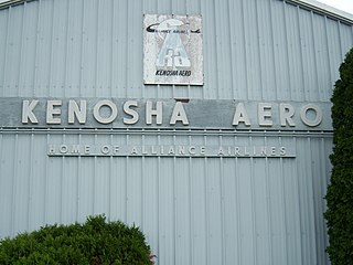
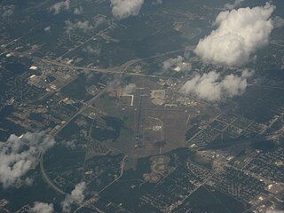
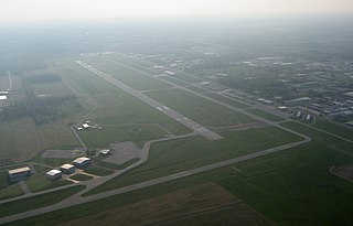
Kenosha Regional Airport is a city-owned public-use airport located four nautical miles (7 km) west of the central business district of Kenosha, a city in Kenosha County, Wisconsin, United States.

Zanesville Municipal Airport is a city-owned airport six miles east of downtown Zanesville, in Muskingum County, Ohio. The National Plan of Integrated Airport Systems for 2011–2015 called it a general aviation facility.
Ruston Regional Airport is a public use airport in Lincoln Parish, Louisiana, United States. It is owned by the City of Ruston and is located three nautical miles (6 km) east of its central business district.

Arlington Municipal Airport is five miles south of Arlington, in Tarrant County, Texas. The airport is at the intersection of Interstate 20 and South Collins Road; it is a reliever airport for Dallas/Fort Worth International Airport and Dallas Love Field.
Baker City Municipal Airport is three miles north of Baker City, in Baker County, Oregon, United States. The National Plan of Integrated Airport Systems for 2011–2015 categorized it as a general aviation facility.
Elkhart Municipal Airport is a city-owned public-use airport located three nautical miles (6 km) northwest of the central business district of Elkhart, a city in Elkhart County, Indiana, United States.

Marianna Municipal Airport is an airport in Marianna, Jackson County, Florida, 5 miles (8.0 km) northeast of Downtown Marianna. The Federal Aviation Administration (FAA)'s National Plan of Integrated Airport Systems for 2009–2013 categorized it as a general aviation airport. It was formerly Graham Air Base.
Deer Park Airport, formerly known as Deer Park Municipal Airport, is a city-owned public-use airport located three nautical miles (6 km) northeast of the central business district of Deer Park, a city in Spokane County, Washington, United States.
Hammond Northshore Regional Airport is a city-owned, public-use, joint civil-military, general aviation airport located three nautical miles (6 km) northeast of the central business district of Hammond, a city in Tangipahoa Parish, Louisiana, United States. The airport was previously an uncontrolled facility utilizing VHF-band UNICOM as a Common Traffic Advisory Frequency (CTAF). As a result of the relocation of Army National Guard flight operations from Lakefront Airport to Hammond, a new control tower was constructed at the airport. This tower, staffed by military air traffic controllers from the Air Operations Department of the Louisiana Army National Guard's Army Aviation Support Facility #1 at the airport, became operational on 15 December 2014.
Abbeville Chris Crusta Memorial Airport is a city-owned, public-use airport located three nautical miles east of the central business district of Abbeville, a city in Vermilion Parish, Louisiana, United States.
Vivian Airport is a town-owned public-use airport located two nautical miles southwest of the central business district of Vivian, a town in Caddo Parish, Louisiana, United States. The airport is 25 miles north of Shreveport, Louisiana and it is also known as Vivian Municipal Airport.
Dillon Airport is a county-owned airport five miles northeast of Dillon, in Beaverhead County, Montana.
Kickapoo Downtown Airport is a city-owned public use airport located three nautical miles (6 km) south of the central business district of Wichita Falls, a city in Wichita County, Texas, United States.
New Castle Municipal Airport is a small municipal airport located in Union Township, Lawrence County, Pennsylvania serving Lawrence County, Pennsylvania, part of the Pittsburgh metropolitan area. Union Township is an outskirt of New Castle, Pennsylvania hence the name. The airport is located four nautical miles northwest of the central business district of New Castle. The airport is a public-owned airport and is controlled by the Lawrence County Airport Authority.
Southland Field is a public-use airport located five nautical miles (9 km) south of the central business district of Sulphur, a city in Calcasieu Parish, Louisiana, United States. It is owned by the West Calcasieu Airport Managing Board and is also known as West Calcasieu Airport.
