
Old Mission is an unincorporated community in Grand Traverse County in the U.S. state of Michigan. It is located within Peninsula Township near the tip of Old Mission Peninsula along the shores of the East Arm of Grand Traverse Bay. As an unincorporated community, Old Mission has no legally defined boundaries or population statistics of its own.

Money is an unincorporated Mississippi Delta community near Greenwood in Leflore County, Mississippi, United States. It has fewer than 100 residents, down from 400 in the early 1950s when a cotton mill operated there. Money is located on a railroad line along the Tallahatchie River, a tributary of the Yazoo River in the eastern part of the Mississippi Delta. The community has ZIP code 38945 in the Greenwood, Mississippi micropolitan area.

Hermanville is a census-designated place and unincorporated community in Claiborne County, in southwest Mississippi, United States. Its ZIP code is 39086.

Lettsworth is an unincorporated community located in the extreme northern tip of Pointe Coupee Parish, Louisiana, United States. It lies on the east bank of the Atchafalaya River near its intersection with the Mississippi and Red rivers at the Old River Control Structure. As of 2005, the population is 202. The town's zip code is 70753.
Stringer is an unincorporated community in southwestern Jasper County, Mississippi, United States. It lies at the intersections of State Highways 15 and County Road 10, just north of Mississippi State Highway 533, between Bay Springs and Laurel. The population was 1,867 at the 2010 census.

Oilville is an unincorporated community in Goochland County, Virginia, United States. Oilville is located on U.S. Route 250 22 miles (35 km) west-northwest of Richmond. Oilville has a post office with ZIP code 23129.
Panther Burn is a census-designated place and unincorporated community located along U.S. Route 61 in northwestern Sharkey County, Mississippi, United States. It has a post office with the ZIP code of 38765.

Dublin, also known as Hopson Bayou, is a census-designated place and unincorporated community located along U.S. Route 49 in southeastern Coahoma County, Mississippi, United States. Dublin is located on the Mississippi Delta Railroad. Dublin has a ZIP code of 38739. A post office first began operation under the name Dublin in 1875.
Lamar is a census-designated place and unincorporated community in Benton County, Mississippi, United States. It is located along Mississippi Highway 7 in western Benton County. Lamar has a post office with the ZIP code 38642. The nearly abandoned Mississippi Central Railroad runs through Lamar, and is only used rarely for freight trafficking. Lamar shares its ZIP code with the nearby community of Slayden.
Coila is an unincorporated community located in Carroll County, Mississippi, United States. Coila is situated approximately 9 miles south of Carrollton on Highway 17. Coila is part of the Greenwood, Mississippi micropolitan area and its ZIP code is 38923.
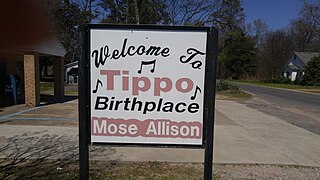
Tippo is an unincorporated community located in Tallahatchie County, Mississippi, United States, located approximately 10 miles (16 km) from Swan Lake; 11 miles (18 km) northeast of Glendora; and approximately 14 miles (23 km) from Charleston. Tippo is located at the intersection of Tippo and Sharkey roads.
Stovall, also known as Prarieville, is an unincorporated community in Coahoma County, Mississippi, United States, along Mississippi Highway 1, 7 miles (11 km) north of Sherard and approximately 6 miles (9.7 km) south of Friars Point.
Oil City is an unincorporated community located in Yazoo County, Mississippi. Oil City is approximately 2 miles (3.2 km) west of Anding, 4 miles (6.4 km) south of Tinsley and approximately 8 miles (13 km) northwest of Bentonia.

Buckatunna is a census-designated place (CDP) and unincorporated community located in Wayne County, Mississippi, United States. Buckatunna is located in the southeast corner of Wayne County, just west of the Alabama state line. Buckatunna has a post office with the zip code 39322.
Carson is an unincorporated community in Jefferson Davis County, Mississippi, United States. Carson is located on Mississippi Highway 42, 6 miles (9.7 km) southeast of Prentiss. Carson has a post office with ZIP code 39427.
Ludlow is an unincorporated community in Scott County, Mississippi, United States. Ludlow is located on Mississippi Highway 483, 7 miles (11 km) west of Lena. Ludlow has a post office with ZIP code 39098.
Bethlehem is a census-designated place and unincorporated community in Marshall County, Mississippi, United States. Its ZIP code is 38659.
Hutchins Landing is a ghost town in Adams County, Mississippi, United States.
Possum Corner is an unincorporated community in Wilkinson County, Mississippi, United States.
Cannonsburg is an unincorporated community in Jefferson County, Mississippi, United States.


