
The South Branch Potomac River has its headwaters in northwestern Highland County, Virginia near Hightown along the eastern edge of the Allegheny Front. After a river distance of 139 miles (224 km), the mouth of the South Branch lies east of Green Spring in Hampshire County, West Virginia where it meets the North Branch Potomac River to form the Potomac.

Blue Mountain, Blue Mountain Ridge, or the Blue Mountains of Pennsylvania, is a ridge of the Appalachian Mountains in eastern Pennsylvania. Forming the southern and eastern edge of the Ridge-and-Valley Appalachians physiographic province in Pennsylvania, Blue Mountain extends 150 miles (240 km) from the Delaware Water Gap on the New Jersey border in the east to Big Gap in Franklin County in south-central Pennsylvania at its southwestern end.

West Virginia Route 99 is an east–west state highway in southern West Virginia. The western terminus of the route is at West Virginia Route 85 northeast of Kopperston in the rural southeast corner of Boone County. The eastern terminus is at West Virginia Route 3 in Glen Daniel.

Blue Knob State Park is a 6,128-acre (2,480 ha) Pennsylvania state park in Kimmel, Lincoln, and Pavia townships in Bedford County, Pennsylvania, in the United States. The average annual snowfall at the park is about 12 feet (370 cm). The park is named for Blue Knob, the second highest mountain in Pennsylvania at 3,146 feet (959 m). It is the location of Blue Knob All Seasons Resort, the ski slope in Pennsylvania with the highest elevation. Blue Knob State Park is just off Interstate 99 on Pennsylvania Route 869 west of Pavia.
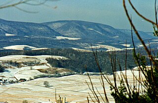
Cooper Mountain runs southwest northeast through Hampshire County in West Virginia's Eastern Panhandle, rising to its greatest elevation of 2,028 feet (618 m) above sea-level at Bens Knob. The mountain's other knob, Butchers Knob, has an elevation of 1,783 feet (543 m). Cooper Mountain is flanked to its west by North River Mountain and to its east by Parks Valley and Dillons Run. The Northwestern Turnpike crosses Cooper Mountain at Loom between Hanging Rock and Capon Bridge. Tourists and travelers on U.S. Route 50 pull off at the Cooper Mountain overlook for the views over Parks Valley, Capon Bridge, and the ridges of Virginia.
The South Pennsylvania Railroad is the name given to two proposed, but never completed, Pennsylvania railroads in the nineteenth century. Parts of the right of way for the second South Pennsylvania Railroad were reused for the Pennsylvania Turnpike in 1940.

Reddish Knob of Shenandoah Mountain is one of the highest points in Virginia, rising 4,397 feet (1,340 m). A narrow, paved road reaches the summit from Harrisonburg, Virginia.

Allegheny Mountain is a major mountain ridge in the southern range of the Allegheny Mountains, part of the Appalachian Mountains. It forms the Eastern Continental Divide along part of its course and also serves as part of the Virginia–West Virginia state line.

North Fork Mountain is a quartzite-capped mountain ridge in the Ridge and Valley physiographic province of the Allegheny Mountains, also known as the High Alleghenies or Potomac Highlands, of eastern West Virginia. Kile Knob, at 4,588 feet, is the mountain's highest point, and Panther Knob and Pike Knob are nearly as high.

Waterrock Knob is a mountain peak in the U.S. state of North Carolina. It is the highest peak in the Plott Balsams and is the 16th-highest mountain in the Eastern United States.

Chimney Tops is a mountain in the central Great Smoky Mountains in Tennessee. It is 4,724 feet (1,440 m) above sea level. Chimney Tops is a double-capstone knob on the eastern slope of the Sugarland Mountain massif, which stretches north-south across the north-central section of the Smokies. Mount Le Conte resides east of Chimney Tops and Mt. Mingus southeast of Chimney Tops. Thus, while the view from the summit is 360 degrees, Chimney Tops is practically "walled in" on three sides.

The Silurian Tuscarora Formation — also known as Tuscarora Sandstone or Tuscarora Quartzite — is a mapped bedrock unit in Pennsylvania, Maryland, West Virginia, and Virginia, USA.
Pine Knob is a peak in the Allegheny Mountains of Pennsylvania. It is a satellite peak of its larger neighbor Blue Knob.

New York State Route 99 (NY 99) was a state highway in Franklin County. The western terminus of the route was at an intersection with NY 30 in Duane. Its eastern terminus was at a junction with NY 3 near the Franklin community of Merrillsville. The narrow, winding route passed through isolated and heavily wooded areas of Adirondack Park. NY 99 was known as the Port Kent–Hopkinton Turnpike and maintained by Franklin County as a county highway. The state highway had been co-designated, and is signed today solely as County Route 26 (CR 26).
Burnt Cabins is a historic unincorporated community in Dublin Township, Fulton County, Pennsylvania, United States, at the foot of Tuscarora Mountain. It is approximately three miles west of the Tuscarora Mountain Tunnel on I-76 and the turnpike runs within 100 yards of the village. U.S. Route 522 also runs through the village.
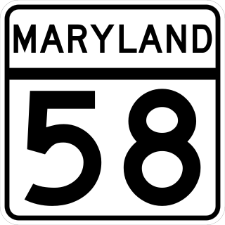
Maryland Route 58 is a state highway in the U.S. state of Maryland. Known for most of its length as Cearfoss Pike, the state highway runs 3.53 miles (5.68 km) from MD 63 in Cearfoss east to Key Circle in Hagerstown. MD 58 was constructed in the late 1920s along what was originally a turnpike called the Hagerstown and Cross Roads Turnpike.

Allegheny Mountain is a stratigraphic ridge that extends northeast to southwest from south of Blue Knob to a saddle point at the Savage Mountain anticline. It merges with Negro Mountain just north of the Cambria County line where the Berlin-Salisbury basin expires.

Pisgah Mountain or Pisgah Ridge is a ridgeline running 12.5 miles (20.1 km) from Tamaqua to Jim Thorpe, Pennsylvania. It is oriented north-northeast to south-southwest, and its north-side valley is followed by U.S. Route 209 from river gap to river gap. The ridge is a succession of peaks exceeding 1,440 feet (438.9 m) rising 300 to 540 feet above the boroughs of Lansford, Coaldale, and Tamaqua in the Panther Creek valley. The highest point on Pisgah Mountain is at 1,611 feet (491 m) in the borough of Summit Hill, which sits atop the ridge. Near Summit Hill was the "Sharpe Mountain" (peak) where in 1791 Phillip Ginter is documented as having discovered anthracite, leading to the formation of the Lehigh Coal Mine Company. In 1818 the Lehigh Coal Company took over the mines, and the mining camp gradually became a settlement and grew into Summit Hill.

Nescopeck Mountain is a ridge in Columbia County and Luzerne County, in Pennsylvania, in the United States. Its elevation is 1,594 feet (486 m) above sea level. The ridge is a forested ridge, with at least two types of forest and two systems of vernal pools. It is a very long and unbroken ridge with two water gaps: one carved by Catawissa Creek and one carved by Nescopeck Creek. This later gap was exploited as a transportation corridor with the construction of the Lausanne–Nescopeck Turnpike between the respective frontier communities at Lausanne Landing and Nescopeck in 1805 connecting the newly developing Wyoming Valley with Philadelphia and the Delaware River valley; cutting off over 100 miles between Philadelphia and Wilkes-Barre. Today's Route PA 93 derives from this historic pack mule road.

Pilot Knob is a 12,245-foot-elevation (3,732 meter) mountain summit located in Fresno County in the Sierra Nevada mountain range in northern California, United States. It is situated at the intersection of Piute Canyon and French Canyon, in the John Muir Wilderness, on land managed by Sierra National Forest. It is set 2.5 miles (4.0 km) south of Merriam Peak and three miles north of the Matthes Glaciers. Pilot Knob is the 360th-highest peak in California, and topographic relief is significant as the west aspect rises 2,800 feet above Hutchinson Meadow in approximately one mile. This mountain was likely named by the USGS during the 1907–09 survey for the Mt. Goddard Quadrangle, and the toponym has been officially adopted by the U.S. Board on Geographic Names.

