
Buckeye is a city in Maricopa County, Arizona, United States. It is Arizona's largest city by area, and it is the westernmost suburb in the Phoenix Metropolitan Area. As of the 2020 census, the population was 91,502, up from 50,876 in 2010, and 6,537 in 2000. It was the fastest-growing city in the United States for 2017, 2018, and 2021.

The Sonoran Desert is a desert in North America and ecoregion that covers the northwestern Mexican states of Sonora, Baja California, and Baja California Sur, as well as part of the southwestern United States. It is the hottest desert in both Mexico and the United States. It has an area of 260,000 square kilometers (100,000 sq mi).

Picacho Peak State Park is a state park surrounding Picacho Peak in Picacho, Arizona. The park is located between Casa Grande and Tucson near Interstate 10 in Pinal County. Its centerpiece spire is visible from downtown Tucson, a distance of 45 miles (72 km). The summit rises to 3,374 feet (1,028 m) above mean sea level. Though appearing to be the remnant of a volcanic neck, it is now believed to be a tilted and eroded piece of rock overlain by a lava flow.

South Mountain Park in Phoenix, Arizona is the largest municipal park in the United States, and one of the largest urban parks in North America and in the world. It has been designated as a Phoenix Point of Pride.

The South Mountains, known locally as simply South Mountain, is a mountain range in central Arizona in south Phoenix, Arizona. It is on public land managed by the city of Phoenix as South Mountain Park.

Camelback Mountain is a mountain in Phoenix, Arizona, United States. The English name is derived from its shape, which resembles the hump and head of a kneeling camel. The mountain, a prominent landmark of the Phoenix metropolitan area, is located in the Camelback Mountain Echo Canyon Recreation Area between the Arcadia neighborhood of Phoenix and the town of Paradise Valley. It is a popular recreation destination for hiking and rock climbing.

The North Shore Mountains are a mountain range overlooking Vancouver in British Columbia, Canada. Their southernmost peaks are visible from most areas in Vancouver and form a distinctive backdrop for the city.

The White Tank Mountain Regional Park is a large regional park located in west-central Maricopa County, Arizona. Encompassing 29,271 acres of desert and mountain landscape, it is the largest regional park in the county. The bulk of the White Tank Mountains range is located within the park's boundaries.

Piestewa Peak, at 2,610 feet (796 m) is the second highest point in the Phoenix Mountains, after Camelback Mountain, and the third highest in the city of Phoenix, Arizona. It is located in the Piestewa Peak Recreation Area within the Phoenix Mountain Preserve, near Piestewa Freeway. Piestewa Peak is named in honor of Army Spc. Lori Ann Piestewa, the first known Native American woman to die in combat in the U.S. military, and the first female soldier to be killed in action in the 2003 Iraq War.

Four Peaks is a prominent landmark on the eastern skyline of Phoenix. Part of the Mazatzal Mountains, it is located in the Four Peaks Wilderness in the Tonto National Forest, 40 miles (64 km) east-northeast of Phoenix. In winter, Four Peaks offers much of the Phoenix metro area a view of snow-covered peaks. Four Peaks is the site of an amethyst mine that produces top-grade amethyst.

Pinnacle Peak is a granite summit located in Scottsdale, Arizona. The peak rises to an elevation of 3,169 feet (966 m). It is located within the 150-acre (61 ha) Pinnacle Peak Park, operated by the City of Scottsdale Park District. Part of the Sonoran Desert, the park is home to a variety of native desert flora and fauna. Hikers utilize a 1.75 mile trail to explore the area, though rock climbing skills are needed to reach the summit.
McDowell Peak is located in the McDowell Mountains, to the northeast of Phoenix, Arizona. Its height is 4,036 feet (1,230 m). McDowell Peak is located approximately half a mile north of the easily recognizable Thompson Peak, and shares a ridge with Drinkwater Peak. It is bordered on the south by Bell Pass, and on the north by Windgate Pass.

Arizona is a landlocked state situated in the southwestern region of the United States of America. It has a vast and diverse geography famous for its deep canyons, high- and low-elevation deserts, numerous natural rock formations, and volcanic mountain ranges. Arizona shares land borders with Utah to the north, the Mexican state of Sonora to the south, New Mexico to the east, and Nevada to the northwest, as well as water borders with California and the Mexican state of Baja California to the southwest along the Colorado River. Arizona is also one of the Four Corners states and is diagonally adjacent to Colorado.
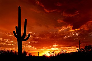
Saguaro National Park is a United States national park in Pima County, southeastern Arizona. The 92,000-acre (37,000 ha) park consists of two separate areas—the Tucson Mountain District (TMD), about 10 miles (16 km) west of Tucson, and the Rincon Mountain District (RMD), about 10 miles (16 km) east of the city. Both districts preserve Sonoran Desert landscapes, fauna, and flora, including the giant saguaro cactus.
The Maricopa Trail is a 315 miles (507 km) trail located within Maricopa County connecting the major regional and municipal parks in and around the Phoenix metropolitan area. A loop trail encircling much of the urbanized area, the trail also consists of four spurs that will connect the loop with outlying mountain parks in the region.
The Black Hills of Greenlee County are a 20 mi (32 km) long mountain range of the extreme northeast Sonoran Desert bordering the south of the White Mountains of eastern Arizona's transition zone.
The Phoenix Mountains Preserve is a group of parks located among the Phoenix Mountains in Phoenix, Arizona, United States. The Phoenix Mountains Park and Recreation Area, the first of these parks to be preserved, has been designated as a Phoenix Point of Pride.

The Oregon Skyline Trail is a long-distance trail in the Cascade Mountains of Oregon. The trail extends 428 miles (689 km) from Cascade Locks on the Columbia River south to Siskiyou Summit near the Oregon-California border. The century-old trail is a foot and equestrian path that passes through nine wilderness areas, Crater Lake National Park, and Cascade-Siskiyou National Monument. Historically known as the Oregon Skyline Trail or Skyline Trail, the entire length of the trail was incorporated into the Pacific Crest National Scenic Trail in 1968.

Silly Mountain, also known as "Roadside Benchmark", is a mountain in Arizona, United States, located near the city of Apache Junction. It is part of the Superstition Mountain range. The elevation of the mountain is 2,139 feet (652 m), and the prominence is 358 feet (109 m).


