Related Research Articles

The City and Borough of Juneau, more commonly known simply as Juneau, is the capital city of the U.S. state of Alaska, located in the Gastineau Channel and the Alaskan panhandle. Juneau was named the capital of Alaska in 1906, when the government of what was then the District of Alaska was moved from Sitka as dictated by the U.S. Congress in 1900. On July 1, 1970, the City of Juneau merged with the City of Douglas and the surrounding Greater Juneau Borough to form the current consolidated city-borough, which ranks as the second-largest municipality in the United States by area and is larger than both Rhode Island and Delaware.

Kodiak Island Borough is a borough in the U.S. state of Alaska. At the 2020 census, the population was 13,101, down from 13,592 in 2010. The borough seat is Kodiak.

Hoonah–Angoon Census Area is a census area located in the U.S. state of Alaska. As of the 2020 census, the population was 2,365, up from 2,150 in 2010. It is part of the unorganized borough and therefore has no borough seat. Its largest community is the city of Hoonah.

Petersburg Borough is a borough in the U.S. state of Alaska. According to the 2020 census, the population was 3,398. The borough seat is Petersburg.
Manokotak is a city in Dillingham Census Area, Alaska, United States. At the 2010 census the population was 442, up from 399 in 2000.

Excursion Inlet is a census-designated place (CDP) in Haines Borough in the U.S. state of Alaska. The population was 40 at the 2020 census, up from 12 in 2010.
Nondalton is a town on the west shore of Six Mile Lake in the Lake and Peninsula Borough, Alaska, United States. At the 2020 census, the population was 133, down from 164 in 2010.
Gustavus is a second-class city in Hoonah-Angoon Census Area in the U.S. state of Alaska. The 2020 census population was 655, which represents a 48% increase over the 2010 census of 442 and is one of the fastest growing communities in Alaska.

Nikolai is a city in Yukon-Koyukuk Census Area, Alaska, United States. The population was 94 as of the 2010 census, down from 100 in 2000.

The Juneau Empire is a newspaper in Juneau, Alaska, United States. It publishes Wednesdays and Saturdays.

Thane is a neighborhood in the City and Borough of Juneau in the U.S. state of Alaska. Located along Gastineau Channel, it begins one mile (1.6 km) south of downtown Juneau and consists of approximately five dozen houses spread over five miles (8 km). All the houses are located on Thane Road, which comes to a dead end about six miles (10 km) from downtown; there are no side streets. It was named for Bartlett L. Thane, Manager and Director of the Alaska-Gastineau Mining Company.

Alaska Electric Light & Power, also known as AEL&P, is the power utility for Juneau, the capital city of Alaska. AEL&P gets their electricity primarily through the Snettisham hydroelectric power plant, located in an uninhabited region 30 miles (48 km) Southeast of downtown Juneau, accessible only by boat and aircraft. The General Manager for the company is Connie Hulbert.

The Treadwell gold mine was on the south side of Douglas Island, .5-mile (0.80 km) east of downtown Douglas and southeast of downtown Juneau, owned and operated by John Treadwell. Composed of four sub-sites, Treadwell was in its time the largest hard rock gold mine in the world, employing over 2,000 people. Between 1881 and 1922, over 3 million troy ounces of gold were extracted. Not much remains today except for a few crumbling buildings and a "glory hole". Although John Treadwell had twelve years of experience in both placer and lode mines, he was a carpenter and builder by trade who had come to Alaska prior to the Klondike Gold Rush.
The Whiting River is a stream, about 50 miles (80 km) long, in the U.S. state of Alaska and the Canadian province of British Columbia. It enters the waters of Stephens Passage at the Borough of Juneau in the Alaska Panhandle between the mouths of the Taku and Stikine Rivers. The main tributary of the Whiting is the South Whiting. The river's basin is at the northern end of the Stikine Icecap The river crosses the international boundary at 58°11′00″N133°13′00″W. Its origin is in the Chechidla Range, and its terminus is at Gilbert Bay, which empties into Stephens Passage.
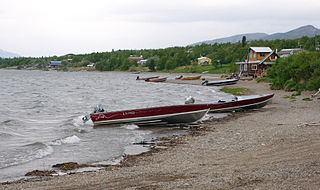
Snettisham is a locale and former populated place in the City and Borough of Juneau, Alaska, United States. Based on the mainland coast of Stephens Passage, it is 31 miles (50 km) southeast of the city of Juneau. The area was named by George Vancouver in 1794; the bay on which Snettisham was located was named for the village of Snettisham in Norfolk, England. It was established as a gold- and silver-mining camp around 1895, its operations being linked to those in the immediate Juneau area, and it remained a small harbor village until 1926. The United States Department of the Treasury designated Snettisham as one of several of Alaska's "special" landing places for vessels carrying "coal, salt, railroad iron, and other like items in bulk". The designation was meant to encourage the construction of facilities to accommodate these shipments, thus stimulating creation and growth of local businesses.

The Salmon Creek Dam is a concrete arch dam on the Salmon Creek, 3 miles (5 km) northwest of Juneau, Alaska. Built in 1914, it is the world's first constant-angle arch variable radius dam. Since it was built, over 100 such dams have been constructed all over the world. The dam was designated as a National Historic Civil Engineering Landmark by the American Society of Civil Engineers in 2022.

Kowee Creek is a river on Douglas Island in the City and Borough of Juneau, Alaska, United States. Its origin is southeast of Mount Troy and it flows north-northeast to Gastineau Channel near West Juneau; it is 0.5 miles (0.80 km) southwest of the city of Juneau. Kowee Creek is nearly 10 miles (16 km) long. It has a drainage basin of about 50 square miles (130 km2) and two transverse tributaries.
The Alaska-Gastineau Mining Co. had its offices in 25 Broad St., New York City, New York. It was the operating company for the Alaska Gold Mines Co. in Alaska. It worked the Alaska-Gastineau Mine/Perseverance Mine in the Silver Bow Basin, approximately 4 miles (6.4 km) from Juneau and processed its ore at an old remodeled mill and crushing plant at Sheep Creek. The property of the Alaska Juneau Gold Mining Co. adjoined the Alaska Gastineau on the west.
Sheep Creek is located 4 miles (6.4 km) southeast of Juneau, in the U.S. state of Alaska. The Juneau community of Thane was originally called Sheep Creek. Draining an area of about 5 square miles (13 km2), it empties into Gastineau Channel. The valley formed by the river has a flat, gravel, trekking trail of 3.5 miles (5.6 km), south of Mount Roberts. The Snettisham hydroelectric dam substation is situated on a trail spur. Sheep Creek Hatchery is located at the outflow.
The Speel River is a river in the southeastern portion of the City and Borough of Juneau, Alaska. It begins at Speel Glacier and flows for 18 kilometers (11 mi) before entering Port Snettisham. It has a drainage area of 226 miles (363.71 km), typically steep and wooded terrain.
References
- 1 2 McAllister, Kirk (17 April 1987). "For Sale: One hydroelectric project". Juneau Empire. Juneau, United States.
- 1 2 "Snettisham Hydroelectric Facility" (PDF). Alaska Industrial Development and Export Authority. December 2017. Retrieved January 29, 2018.
- ↑ "Snettisham Power Plant, Alaska 1991-2020 Monthly Normals" . Retrieved May 7, 2024.
- ↑ "xmACIS". National Oceanic and Atmospheric Administration. Retrieved May 7, 2024.
| International | |
|---|---|
| National | |
58°10′00″N133°44′00″W / 58.16667°N 133.73333°W
| | This article about a location in the City and Borough of Juneau, Alaska is a stub. You can help Wikipedia by expanding it. |