Snow Shoe, Pennsylvania

Last updated
Snow Shoe, Pennsylvania
Former Snow Shoe PA Presbyterian.jpg
Former Presbyterian church
Centre County Pennsylvania Incorporated and Unincorporated areas Snow Shoe Highlighted.svg
Location of Snow Shoe in Centre County, Pennsylvania.
USA Pennsylvania location map.svg
Red pog.svg
Snow Shoe
Usa edcp location map.svg
Red pog.svg
Snow Shoe
Coordinates: 41°01′40″N77°56′57″W / 41.02778°N 77.94917°W / 41.02778; -77.94917
Country United States
State Pennsylvania
County Centre
Settled1850
Incorporated (borough)1907
Area
[1]
  Total0.59 sq mi (1.53 km2)
  Land0.59 sq mi (1.53 km2)
  Water0.00 sq mi (0.00 km2)
Elevation
1,601 ft (488 m)
Population
 (2010)
  Total765
  Estimate 
(2019) [2]
765
  Density1,298.81/sq mi (501.50/km2)
Time zone Eastern (EST)
  Summer (DST)EDT
Zip code
16874
Area code 814
FIPS code 42-71600

Snow Shoe is a borough in Centre County, Pennsylvania, United States. It is part of the State College, Pennsylvania Metropolitan Statistical Area. The population was 765 at the 2010 census.

Contents

According to tradition, Snow Shoe was so named when a pair of snowshoes were found at an Indian village near the present town site. [3]

Geography

Snow Shoe is located at 41°1′40″N77°56′57″W / 41.02778°N 77.94917°W / 41.02778; -77.94917 (41.027821, -77.949099). [4]

According to the United States Census Bureau, the borough has a total area of 0.6 square miles (1.6 km2), all land.

Demographics

Historical population
CensusPop.Note
1880 400
1910 643
1920 6501.1%
1930 520−20.0%
1940 57811.2%
1950 67015.9%
1960 7146.6%
1990 800
2000 771−3.6%
2010 765−0.8%
2020 670−12.4%
Sources: [5] [6] [7]

At the 2010 census there were 765 people, 290 households, and 216 families residing in the borough. The population density was 1,286.9 inhabitants per square mile (496.9/km2). There were 333 housing units at an average density of 560.2 per square mile (216.3/km2). The racial makeup of the borough was 99.6% White, 0.1% Asian, and 0.3% of two or more races. Hispanic or Latino of any race were 0.1%. [6]

There were 290 households, 35.5% had children under the age of 18 living with them, 60.0% were married couples living together, 4.1% had a male householder with no wife present, 10.4% had a female householder with no husband present, and 25.5% were non-families. 22.1% of households were made up of individuals, and 11.8% were one person aged 65 or older. The average household size was 2.64 and the average family size was 3.05.

In the borough the population was spread out, with 24.6% under the age of 18, 8.4% from 18 to 24, 23.9% from 25 to 44, 27.8% from 45 to 64, and 15.3% 65 or older. The median age was 40 years. For every 100 females there were 98.2 males. For every 100 females age 18 and over, there were 101.0 males.

The median household income was $48,789 and the median family income was $52,847. The per capita income for the borough was $21,225. About 2.1% of families and 2.6% of the population were below the poverty line, including 7.0% of those age 65 or over.

Related Research Articles

<span class="mw-page-title-main">New Albany, Pennsylvania</span> Borough in Pennsylvania, United States

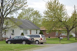
New Albany is a borough in Bradford County, Pennsylvania, United States. It is part of Northeastern Pennsylvania. The population was 254 at the 2020 census.

<span class="mw-page-title-main">West Liberty, Pennsylvania</span> Borough in Pennsylvania, United States

West Liberty is a borough in Butler County, Pennsylvania, United States. The population was 343 at the 2010 census.

<span class="mw-page-title-main">Burnside Township, Centre County, Pennsylvania</span> Township in Pennsylvania, United States

Burnside Township is a township in Centre County, Pennsylvania, United States. It is part of the State College, Pennsylvania, Metropolitan Statistical Area. It is located approximately at 41°08′03″N77°09′58″W.

<span class="mw-page-title-main">Clarence, Pennsylvania</span> Census-designated place in Pennsylvania, United States

Clarence is a census-designated place (CDP) in Centre County, Pennsylvania, United States. It is part of the State College, Pennsylvania Metropolitan Statistical Area. The population was 626 at the 2010 census.

<span class="mw-page-title-main">Howard, Pennsylvania</span> Borough in Pennsylvania, United States

Howard is a borough in Centre County, Pennsylvania, United States. It is part of the State College, Pennsylvania Metropolitan Statistical Area. The population was 720 at the 2010 census.

<span class="mw-page-title-main">Snow Shoe Township, Pennsylvania</span> Township in Pennsylvania, United States

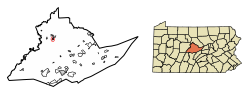
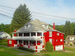
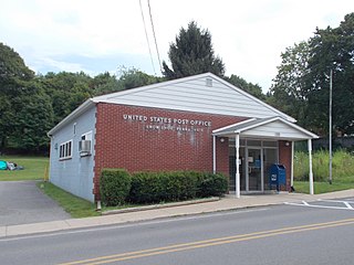
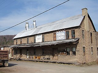
Snow Shoe Township is a township in Centre County, Pennsylvania, United States. It is part of the State College, Pennsylvania Metropolitan Statistical Area. The population was 1,638 at the 2020 census.

<span class="mw-page-title-main">Union Township, Centre County, Pennsylvania</span> Township in Pennsylvania, United States

Union Township is a township that is located in Centre County, Pennsylvania, United States. It is part of the State College, Pennsylvania Metropolitan Statistical Area.

<span class="mw-page-title-main">Avis, Pennsylvania</span> Borough in Pennsylvania, United States

Avis is a borough in Clinton County, Pennsylvania, United States. The population was 1,484 at the 2010 census.

<span class="mw-page-title-main">Beech Creek, Pennsylvania</span> Borough in Pennsylvania, United States

Beech Creek is a borough in Clinton County, Pennsylvania, United States. The population was 701 at the 2010 census. It is the setting for Fun Home, a 2006 graphic memoir by Alison Bechdel, who grew up there. Brittani Kline, winner of America's Next Top Model, Cycle 16, was born there.

<span class="mw-page-title-main">Mill Hall, Pennsylvania</span> Borough in Pennsylvania, United States

Mill Hall is a borough in Clinton County, Pennsylvania, United States. The population was 1,613 at the 2010 census.

<span class="mw-page-title-main">South Renovo, Pennsylvania</span> Borough in Pennsylvania, United States

South Renovo is a borough in Clinton County, Pennsylvania, United States, located on the West Branch Susquehanna River, directly across from Renovo. The population was 439 at the 2010 census, down from 557 in 2000.

<span class="mw-page-title-main">Blooming Valley, Pennsylvania</span> Borough in Pennsylvania, United States

Blooming Valley is a borough in Crawford County, Pennsylvania, United States. The population was 342 at the 2020 census, up from 337 at the 2010 census.

<span class="mw-page-title-main">Cassville, Pennsylvania</span> Borough in Pennsylvania, United States

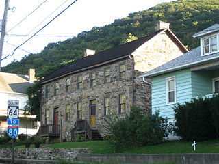
Cassville is a borough in Huntingdon County, Pennsylvania, United States. As of the 2020 census, the borough population was 138.

<span class="mw-page-title-main">Mapleton, Pennsylvania</span> Borough in Pennsylvania, United States

Mapleton is a borough in Huntingdon County, Pennsylvania, United States. The population was 441 at the 2010 census. It is located on the Juniata River, which is a tributary of the Susquehanna River.

<span class="mw-page-title-main">Lawrenceville, Pennsylvania</span> Borough in Pennsylvania, United States

Lawrenceville is a borough in Tioga County, Pennsylvania. The population was 690 at the 2020 census.

<span class="mw-page-title-main">Liberty, Tioga County, Pennsylvania</span> Borough in Pennsylvania, United States

Liberty is a small borough in Tioga County, Pennsylvania, United States. The population was 232 at the time of the 2020 census.

<span class="mw-page-title-main">Mansfield, Pennsylvania</span> Borough in Pennsylvania, United States

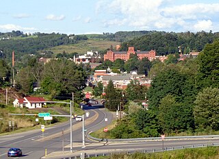
Mansfield is a borough located in east-central Tioga County, Pennsylvania, United States, in the Tioga River valley. It is situated at the intersection of U.S. Route 6 and U.S. Business Route 15, about 36 miles (58 km) southwest of Elmira, New York.

<span class="mw-page-title-main">Tioga, Pennsylvania</span> Borough in Pennsylvania, United States

Tioga is a borough in Tioga County, Pennsylvania, United States. The population was 611 at the 2010 census. It is located north of Tioga and Hammond Lakes along the Tioga River.

<span class="mw-page-title-main">Westfield, Pennsylvania</span> Borough in Pennsylvania, United States

Westfield is a borough in Tioga County, Pennsylvania, United States. The population was 1,113 at the time of the 2020 census.

<span class="mw-page-title-main">Cooperstown, Pennsylvania</span> Borough in Pennsylvania, United States

Cooperstown is a borough in Venango County, Pennsylvania, United States. The population was 460 at the 2010 census.

References

  1. "2019 U.S. Gazetteer Files". United States Census Bureau. Retrieved July 28, 2020.
  2. "Population and Housing Unit Estimates". United States Census Bureau. May 24, 2020. Retrieved May 27, 2020.
  3. Espenshade, Abraham Howry (1925). Pennsylvania Place Names. Evangelical Press. p. 295. ISBN   978-0-8063-0416-8.
  4. "US Gazetteer files: 2010, 2000, and 1990". United States Census Bureau. 2011-02-12. Retrieved 2011-04-23.
  5. "Census of Population and Housing". U.S. Census Bureau. Retrieved 11 December 2013.
  6. 1 2 "U.S. Census website". United States Census Bureau . Retrieved 2008-01-31.
  7. "Incorporated Places and Minor Civil Divisions Datasets: Subcounty Resident Population Estimates: April 1, 2010 to July 1, 2012". Population Estimates. U.S. Census Bureau. Archived from the original on 11 June 2013. Retrieved 11 December 2013.