
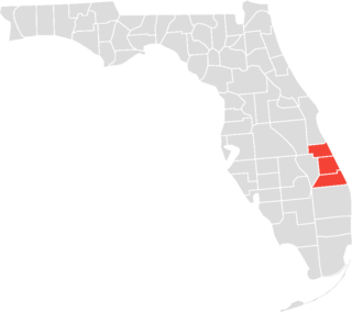
Homestead is a city within Miami-Dade County in the U.S. state of Florida, between Biscayne National Park to the east and Everglades National Park to the west. Homestead is primarily a Miami suburb and a major agricultural area. It is a principal city of the Miami metropolitan area of South Florida, which was home to an estimated 6,012,331 people at the 2015 census. It is located approximately 26 miles (42 km) southwest of Miami, and 25 miles (40 km) northwest of Key Largo. The population was 80,737 as of the 2020 census.

The East Coast Greenway is a 3,000-mile (4,800 km) pedestrian and bicycle route between Maine and Florida along the East Coast of the United States. The nonprofit East Coast Greenway Alliance was created in 1991 with the goal to use the entire route with off-road, shared-use paths; as of 2021, over 1,000 mi (1,600 km) of the route (35%) meets these criteria. In 2020, the Greenway received over 50 million visits.

Miami-Dade Transit (MDT) is the primary public transit authority of Miami, Florida and the greater Miami-Dade County area. It is the largest transit system in Florida and the 15th-largest transit system in the United States. As of 2023, the system has 80,168,700 rides per year, or about 277,400 per weekday in the fourth quarter of 2023. MDT operates the Metrobus with their paratransit STS systems run by LSF. MDT also operates two rail transit systems: Metrorail and Metromover.
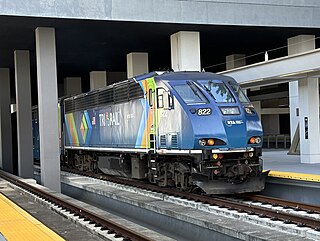
Tri-Rail is a commuter rail service linking Miami, Fort Lauderdale and West Palm Beach in Florida, United States. The Tri prefix in the name refers to the three counties served by the railroad: Palm Beach, Broward, and Miami-Dade. Tri-Rail is managed by the South Florida Regional Transportation Authority (SFRTA) along CSX Transportation's former Miami Subdivision; the line is now wholly owned by the Florida DOT. The 80.0-mile-long (128.7 km) system has 19 stations along the Southeast Florida coast, and connects directly to Amtrak at numerous stations, to Metrorail at the Metrorail Transfer station, Miami Airport station, and MiamiCentral, and to Brightline at MiamiCentral.
The Tamiami Trail is the southernmost 284 miles (457 km) of U.S. Highway 41 (US 41) from State Road 60 (SR 60) in Tampa to US 1 in Miami. A portion of the road also has the hidden designation of State Road 90 (SR 90).

The Florida East Coast Railway is a Class II railroad operating in the U.S. state of Florida, currently owned by Grupo México.
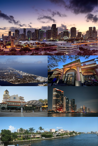
The Miami metropolitan area, also known as South Florida, SoFlo, SoFla, the Gold Coast, the Tri-County Area, or Greater Miami, and officially the Miami–Fort Lauderdale–West Palm Beach Metropolitan Statistical Area, is a coastal metropolitan area in southeastern Florida. It is the ninth-largest metropolitan statistical area (MSA) in the United States, the fifth-largest metropolitan area in the Southern United States, and the largest metropolitan area in Florida. With a population of 6.18 million, its population exceeds 31 of the nation's 50 states as of 2023. It comprises the three most populated counties in the state, Miami-Dade County, Broward County, and Palm Beach County, which rank as the first, second, and third-most populous counties in the state, respectively. Miami-Dade County, with 2,701,767 people in 2020, is the seventh-most populous county in the United States.

State Road 9336, also known in parts as the Ingraham Highway, Tower Road and West Palm Drive, is an 8.75-mile-long (14.08 km) two- to four-lane road in Miami-Dade County, in the U.S. state of Florida. The route is the only signed four-digit state road in Florida. The route connects US 1, and the Homestead Extension of Florida's Turnpike by proxy, in Florida City with the Everglades National Park, acting as the park's primary mode of entry. The road continues on from its western terminus at the national park's entrance as Main Park Road for another 39.3 miles (63.2 km), providing access to many of the park's facilities and the ghost town of Flamingo, in Monroe County, at its western end.
The Treasure Coast is a region in the southeast of the U.S. state of Florida. It borders the Atlantic Ocean and comprises Indian River, Martin, and St. Lucie counties. The region, whose name refers to the Spanish Treasure Fleet that was lost in a 1715 hurricane, evidently emerged from residents' desire to distinguish themselves from the Gold Coast to the south.
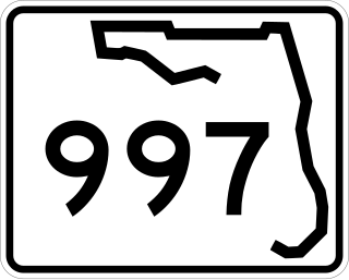
State Road 997, also known as Krome Avenue and West 177th Avenue is a 36.7-mile-long (59.1 km) north–south state highway in western Miami-Dade County, Florida. It runs from State Road 998 in Homestead north across U.S. Route 41 to U.S. Route 27 near Countyline Dragway, just south of the Broward County line. Its main use is as a bypass around the western side of Miami, linking the routes that run southwest, west and northwest from that city. The road passes through newer suburbs in the southern third of its length, while the northern two thirds of the highway traverse the eastern edge of the Everglades.

Downtown Miami is the urban city center of Miami, Florida, United States. The city's greater downtown region consists of the Central Business District, Brickell, the Historic District, Government Center, the Arts & Entertainment District, and Park West. It is divided by the Miami River and is bordered by Midtown Miami's Edgewater, and Wynwood sections to its north, Biscayne Bay to its east, the Health District and Overtown to its west, and Coconut Grove to its south.

Metrorail is a rapid transit system in Miami and Miami-Dade County in the U.S. state of Florida. Metrorail is operated by Miami-Dade Transit (MDT), a departmental agency of Miami-Dade County. Opened in 1984, it is Florida's only rapid transit metro system, and is currently composed of two lines of 23 stations on 24.4 miles (39.3 km) of standard gauge track. Metrorail serves the urban core of Miami, connecting Miami International Airport, the Health District, Downtown Miami, and Brickell with the northern developed neighborhoods of Hialeah and Medley to the northwest, and to suburban The Roads, Coconut Grove, Coral Gables, and South Miami, ending at urban Dadeland in Kendall. Metrorail connects to the Metromover in Downtown, which provides metro service to the entirety of Downtown and Brickell. Additionally, it connects to South Florida's commuter rail system at Tri-Rail station, as well as Metrobus routes at all stations. In 2023, the system had 13,439,300 rides, and about 48,300 per day in the fourth quarter of 2023.

A linear park is a type of park that is significantly longer than it is wide. These linear parks are strips of public land running along canals, rivers, streams, defensive walls, electrical lines, or highways and shorelines. Examples of linear parks include everything from wildlife corridors to riverways to trails, capturing the broadest sense of the word. Other examples include rail trails, which are disused railroad beds converted for recreational use by removing existing structures. Commonly, these linear parks result from the public and private sectors acting on the dense urban need for open green space. Linear parks stretch through urban areas, coming through as a solution for the lack of space and need for urban greenery. They also effectively connect different neighborhoods in dense urban areas as a result, and create places that are ideal for activities such as jogging or walking. Linear parks may also be categorized as greenways. In Australia, a linear park along the coast is known as a foreshoreway. When being designed, linear parks appear unique as they are planned around the public's opinion of how the space will affect them.
The Miami metropolitan area composed of the three counties of Miami-Dade, Broward, and Palm Beach, also known collectively as South Florida, is home to a wide variety of public and private transportation systems.

The Nature Coast State Trail (NCST) is a 31.7-mile long segment of Florida's Statewide System of Greenways and Trails System built along abandoned railroad tracks, and designated by the U.S. Department of the Interior as a National Recreation Trail. It has two primary sections following unused rail lines that were originally built by the Atlantic Coast Line Railroad. It includes historic sites such as a 1902 train trestle bridge over the Suwannee River near Old Town and train stations in Trenton, Cross City, and Chiefland. At Wilcox Junction abandoned rail tracks cross and connect with several communities. The trail is available to hikers, cyclists, and horse riders.

The Seaboard–All Florida Railway was a subsidiary of the Seaboard Air Line Railroad that oversaw two major extensions of the system in the early 1920s to southern Florida on each coast during the land boom. One line extended the Seaboard's tracks on the east coast from West Palm Beach down to Fort Lauderdale and Miami, while the other extension on the west coast extended the tracks from Fort Ogden south to Fort Myers and Naples, with branches from Fort Myers to LaBelle and Punta Rassa. These two extensions were heavily championed by Seaboard president S. Davies Warfield, and were constructed by Foley Brothers railroad contractors. Both extensions also allowed the Seaboard to better compete with the Florida East Coast Railway and the Atlantic Coast Line Railroad, who already served the lower east and west coasts of Florida respectively.

The Underline is a 10-mile linear park being developed in Miami-Dade County, Florida. When complete, it will run underneath the county's elevated Metrorail system from the Miami River near Brickell to the Metrorail's southern terminus at Dadeland South. The project is essentially upgrading a pre-existing bike path, known as the M-Path, into a full linear park. As of 2024, the first phase of The Underline was completed in the Brickell area on February 26, 2021. The second phase, which runs from Brickell to just south of Vizcaya station, was completed on April 24, 2024. The third and final phase will be completed in 2026.
The Ludlam Trail is a proposed 5.6-mile (9 km) shared-use linear park rail trail in Miami-Dade County, Florida, that will follow the former Florida East Coast Railway Little River Branch between NW 7th Street and SW 80th Street. The trail is planned to provide safe and direct pathways for walking, running, and cycling, as well as connect schools, parks, transit stops, residences, workplaces, and shopping areas. The trail is envisioned as part of the "Miami Loop", a network of bikeways that also includes the Perimeter Trail, the Miami River Greenway, and The Underline. A groundbreaking ceremony was held October 26, 2021. Construction is anticipated to start fall of 2026.