South Dakota Highway 100

Last updated

SD 100.svg

Highway 100

South Dakota Highway 100
SR 100 corridor highlighted in red
Route information
Maintained by City of Sioux Falls
Major junctions
South endI-29.svg I-29 south of Sioux Falls
Major intersectionsSD 11.svg SD 11 in Sioux Falls
SD 11.svgSD 42.svg SD 11  / SD 42 in Sioux Falls
North endI-90.svg I-90 north of Sioux Falls
Location
Country United States
State South Dakota
Counties Lincoln, Minnehaha
Highway system
  • South Dakota State Trunk Highway System
I-90.svg I-90 SD 101.svg SD 101

South Dakota Highway 100 (SD 100) is the designation of a future state highway that will be built south and east of Interstate 229 (I-229) as a second southeastern bypass of Sioux Falls. The highway will run from exit 73 on I-29 east and north to exit 402 on I-90. This highway is currently named Veterans Parkway on its route from Interstate 90 to 57th Street in Sioux Falls.

Contents

Route description

SD 100 is expected to facilitate commercial and residential growth in the eastern section of the city of Sioux Falls. It will also serve as a second eastern bypass of the city, running roughly parallel to I-229 and about 2.5 miles (4.0 km) outside of it.

As proposed, SD 100 will begin at the single-point urban interchange (SPUI) at exit 73 along I-29. It will run in a general northeasterly direction just outside of the southern extremities of Sioux Falls and enter the Sioux Falls city limits just west of its intersection with SD 115 (Minnesota Avenue). [1] The route is to continue to the northeast past this intersection until it reaches what is now 69th Street; at that point, the route will curve to the east and follow that alignment. It will continue to follow 69th Street until east of an intersection with Sycamore Avenue, at which point it is to bend to the northeast. [2] While heading northeast, the road will meet SD 11, and the two routes will together curve due north along Powder House Road. The road will meet 57th Street at a SPUI that is yet to be constructed and cross from Lincoln County into Minnehaha County.

After intersecting 57th Street, SD 100 and SD 11 will continue north to an intersection with SD 42 (Arrowhead Parkway). At this intersection, SD 11 will leave SD 100 and turn east along SD 42. [3] SD 100 is to continue north of this intersection along Powder House Road until just south of Madison Street, where it will curve slightly to the northeast. The highway will continue northeast until intersecting a proposed extension of Benson Road at another SPUI. Here, the road will curve northwest to intersect Rice Street, then back to the north before crossing the Big Sioux River and intersecting 60th Street North. Just north of 60th Street North, SD 100 will end at what was previously a diamond interchange, but was upgraded to a SPUI, at exit 402 on I-90. [4]

History

Planning for a new southeastern bypass of Sioux Falls began in the 1990s, when community members collaborated with officials from the City of Sioux Falls and South Dakota Department of Transportation. Construction of the first segment of Highway 100, extending from just south of South Dakota Highway 42/Arrowhead Parkway southward to 26th Street. The rest of the eastern half of Highway 100, extending from 57th Street northward to Interstate 90, was constructed in phases over ten years. The last segment of this stretch, extending from Rice Street across the Big Sioux River to Interstate 90, opened to traffic in December 2020. [5]

Major intersections

CountyLocationmikmDestinationsNotes
Lincoln 0.000.00I-29.svg I-29  Beresford Future southern terminus; exit 73 on I-29; single-point urban interchange (SPUI); road to continue west as CR 106 (271st Street)
Sioux Falls SD 115.svg SD 115 (Minnesota Avenue)
Minnehaha South plate South Dakota.svg
SD 11.svg
SD 11 south (Powder House Road)
Future southern end of SD 11 concurrency
North plate South Dakota.svg
SD 11.svg
SD 42.svg SD 11 north / SD 42 (Arrowhead Parkway)
Temporary southern terminus; future northern end of SD 11 concurrency
Rice StreetTemporary northern terminus, from 2018 to December 2020.
I-90.svg I-90 Northern terminus; exit 402 on I-90; single-point urban interchange; road to continue as 478th Avenue
1.000 mi = 1.609 km; 1.000 km = 0.621 mi

See also

Related Research Articles

<span class="mw-page-title-main">Interstate 229 (South Dakota)</span> Auxiliary Interstate Highway in Sioux Falls, South Dakota, US

Interstate 229 (I-229) is an auxiliary Interstate Highway located entirely within Sioux Falls, South Dakota, United States. It runs for approximately 11 miles (18 km) around the southern and eastern sides of the city, providing a bypass route and connecting I-29 and I-90. The freeway is generally four-to-six lanes wide and follows the Big Sioux River through parts of the city. I-229 also has a business route that provides access to downtown Sioux Falls from the freeway.

<span class="mw-page-title-main">South Dakota Highway 44</span> State highway in South Dakota, United States

South Dakota Highway 44 (SD 44) is a state highway in southern South Dakota that runs from U.S. Route 385 (US 385) west of Rapid City to Interstate 29 (I-29) south of Sioux Falls. It is just more than 379 miles (610 km) long.

<span class="mw-page-title-main">South Dakota Highway 115</span>

South Dakota Highway 115 is a 40-mile (64 km) state highway in Lincoln and Minnehaha countess in South Dakota, United States, that was created from the routing of US 77, "Old 77", when its alignment was moved west to become Interstate 29 around 1980 and SD 15's route from US 18 to Sioux Falls. SD 115 routes from its intersection with US 18 about 13 miles (21 km) south of Sioux Falls to Interstate 29 three miles west of Dell Rapids. It is about 40.5 miles (65.2 km) in length.

<span class="mw-page-title-main">South Dakota Highway 13</span>

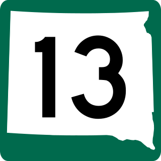
South Dakota Highway 13 (SD 13) is a 23.835-mile-long (38.359 km) state highway in Moody and Brookings counties in the U.S. state of South Dakota. It connects Flandreau with Elkton. SD 13 was originally part of SD 11's path.

<span class="mw-page-title-main">South Dakota Highway 22</span>

South Dakota Highway 22 (SD 22) is a 48.546-mile-long (78.127 km) state highway in Hamlin and Deuel counties in South Dakota, United States. It connects Hazel and Clear Lake.

<span class="mw-page-title-main">South Dakota Highway 25</span>

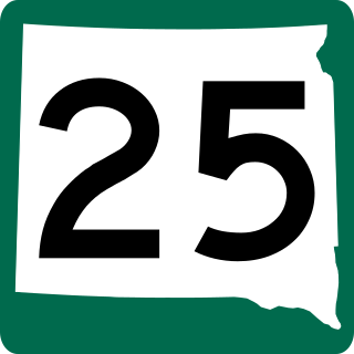
South Dakota Highway 25 (SD 25) is a 194.524-mile-long (313.056 km) state highway in the eastern part of the U.S. state of South Dakota. It connects Scotland, Howard, De Smet, and Webster.

<span class="mw-page-title-main">South Dakota Highway 15</span>

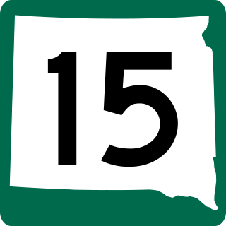
South Dakota Highway 15 (SD 15) is a 67.562-mile-long (108.730 km) state highway in the northeastern South Dakota, United States. It connects Clear Lake, Milbank, and Wilmot.

<span class="mw-page-title-main">South Dakota Highway 28</span>

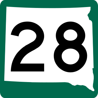
South Dakota Highway 28 (SD 28) is a 105.937-mile (170.489 km) state highway in the east-central South Dakota, United States, that connects Hitchcock, Estelline, and Toronto.

<span class="mw-page-title-main">South Dakota Highway 32</span>

South Dakota Highway 32 (SD 32) is a 8.643-mile-long (13.910 km) state highway in Moody County, South Dakota, United States, connects Interstate 29 (I-29) with Flandreau.

<span class="mw-page-title-main">South Dakota Highway 20</span>

South Dakota Highway 20 (SD 20) is a 385.079-mile (619.725 km) state highway in northern South Dakota, United States, that connects the Montana state line, west-southwest of Camp Crook, with the Minnesota state line, east-southeast of Revillo, via Buffalo, Bison, Timber Lake, Mobridge, Selby, and Watertown. From Mobridge to the Walworth–Potter county line, this highway is part of the Lewis and Clark Trail. From about Timber Lake to just west of Mobridge, this highway is part of the Native American Scenic Byway. From the Montana state line to Camp Crook, the highway is a dirt road.

<span class="mw-page-title-main">South Dakota Highway 11</span> State highway in South Dakota, United States

South Dakota Highway 11 (SD 11) is a 77.724-mile (125.085 km) state highway in eastern South Dakota, United States. It connects the northern part of the Sioux City metropolitan area with the Sioux Falls metropolitan area.

<span class="mw-page-title-main">South Dakota Highway 42</span>

South Dakota Highway 42 (SD 42) is a segmented state highway in southeastern South Dakota, United States. The first segment is a six-mile-long (9.7 km) highway in Aurora County. The second and longest is 60 miles (97 km) long and connects Ethan and Sioux Falls. The final segment connects Sioux Falls to Iowa Highway 9 southeast of Rowena.

<span class="mw-page-title-main">Interstate 29 in South Dakota</span>

Interstate 29 (I-29) is a north–south Interstate Highway in the midwestern United States. In the state of South Dakota, I-29 traverses on the eastern side of the state from the Iowa border near Sioux City to the North Dakota border near New Effington. On its route, I-29 passes through western portions of Sioux Falls, the state's largest city. It travels 252.5 miles (406.4 km) in the state, the longest stretch of any of the four states through which it passes. I-229, the highway's lone auxiliary route in South Dakota, serves as a bypass around southern and eastern Sioux Falls.

<span class="mw-page-title-main">South Dakota Highway 38</span>

South Dakota Highway 38 is a 63.393-mile (102.021 km) state highway in southeastern South Dakota, United States, that runs from Mitchell to Sioux Falls.

<span class="mw-page-title-main">Business routes of Interstate 90</span>

Interstate 90 Business may refer to several business routes of the Interstate Highway System that connects Interstate 90 with the central business district of various cities bypassed by I-90. Each business route can be either a business loop or a business spur, depending on whether both ends connect to I-90. The business route in each community is considered a unique route. In many cases, these routes are a former section of a U.S. Route.

<span class="mw-page-title-main">Special routes of U.S. Route 20</span>

Several special routes of U.S. Route 20 exist. In order from west to east they are as follows.

<span class="mw-page-title-main">Business routes of Interstate 29</span>

At least five business routes of Interstate 29 (I-29) are known to exist. These business routes provide access from I-29 to adjacent communities.

<span class="mw-page-title-main">South Dakota Highway 1804</span> State Highway in South Dakota

South Dakota Highway 1804 (SD 1804) is a 126.745-mile-long (203.976 km) state highway in the U.S. state of South Dakota.

<span class="mw-page-title-main">South Dakota Highway 63</span>

South Dakota Highway 63 (SD 63) is a 167.455-mile (269.493 km) state highway in central South Dakota, United States, that connects U.S. Route 18 (US 18) south-southeast of Parmelee with the North Dakota state line north of McLaughlin.

<span class="mw-page-title-main">U.S. Route 16 in South Dakota</span>

U.S. Highway 16 (US 16) is a 69-mile-long (111 km) east–west U.S. Highway in the western part of the U.S. state of South Dakota. It travels between Yellowstone National Park in Wyoming and Rapid City. In South Dakota, the highway extends from the Wyoming state line near Newcastle, Wyoming to Interstate 90 (I-90) in Rapid City.

References

  1. Segment 0 - I-29 to SD115 (Minnesota Ave.) (PDF) (Map) (Revised ed.). Cartography by Brenda Miller. South Dakota Department of Transportation (published November 22, 2011). April 1, 2009. Retrieved March 4, 2015.
  2. Segment 1 - SD115 (Minnesota Ave.) to Sycamore Ave (PDF) (Map) (Revised ed.). Cartography by Brenda Miller. South Dakota Department of Transportation (published November 22, 2011). April 1, 2009. Retrieved March 4, 2015.
  3. Segment B(2) - Sycamore Ave. to SD42 (10th Street) (PDF) (Map) (Revised ed.). Cartography by Brenda Miller. South Dakota Department of Transportation (published November 22, 2011). April 1, 2009. Retrieved March 4, 2015.
  4. Segment C(3) - Madison Street to Interstate 90 (PDF) (Map) (Revised ed.). Cartography by Brenda Miller. South Dakota Department of Transportation (published November 22, 2011). April 1, 2009. Retrieved March 4, 2015.
  5. "NEW SECTION OF VETERAN'S PARKWAY OPENING". dot.sd.gov. December 14, 2020. Retrieved August 20, 2021.


Route map:

Template:Attached KML/South Dakota Highway 100
KML is not from Wikidata