South Dakota Highway 1806

Last updated

SD 1806.svg

Highway 1806

South Dakota Highway 1806
SD 1806 highlighted in red
Route information
Maintained by SDDOT
Existed1975 [1] –present
Southern Gregory County segment
South endUS 18.svg US 18 near Bonesteel
North endMule Head Road
Northern Gregory County segment
South endOld 1806 Road south / Lakeview Drive
North endSD 44.svg SD 44 west of Platte
Lyman–Stanley Counties segment
Length122.603 mi (197.310 km)
South endSD 273.svg SD 273 north of Kennebec
Major intersectionsUS 14.svgUS 83.svgSD 34.svg US 14  / US 83  / SD 34 in Fort Pierre
North endMinneconjou Road near Mission Ridge
Corson County segment
South end280 Avenue southwest of Mobridge
Major intersectionsUS 12.svgSD 20.svg US 12  / SD 20 northeast of Mobridge
North endBIA Rd. 3 to ND-1806 (2015).svg ND 1806 in Kenel
Location
Country United States
State South Dakota
Counties Gregory, Lyman, Stanley, Corson
Highway system
  • South Dakota State Trunk Highway System
SD 1804.svg SD 1804 SD 8.svg SD 8

South Dakota Highway 1806 (SD 1806) is a state highway in the U.S. state of South Dakota. It exists in four distinct sections. Its longest section begins at SD 273 and runs along the Missouri River nearly its whole length, serving Pierre. SD 1806 along with SD 1804 are numbered from the years of the Lewis and Clark Expedition. [2]

Contents

Route description

Gregory County

Southern segment

Northern segment

Lyman and Stanley Counties

SD 1806 begins at the northern terminus of SD 273 in Lyman County and begins heading northwest. The route remains a two lane road and follows the Missouri River, heading towards Pierre. As it nears Pierre, the route becomes concurrent with US 83 and enters Fort Pierre. At the north end of Fort Pierre, US 83 becomes concurrent with US 14 heading east while SD 1806 splits from US 83 and becomes concurrent with US 14 and SD 34 for nearly a mile, heading west from the Deadwood Street and Yellowstone Street intersection. After one mile of concurrency, SD 1806 splits from US 14/SD 34 and heads north, passing by the Fort Pierre Chouteau National Historic Landmark and remaining parallel with the Missouri River. It then passes by Lake Oahe, intersecting the west end of SD 204 which passes over the Oahe Dam. SD 1806 continues west and remains parallel with the Missouri River until reaching Sansarc Road. The route continues northwest and ends at an intersection with Minneconjou Road south of Mission Ridge.

Corson County

History

A portion of SD 1806 near Lake Oahe was numbered as SD 514. It was later redesignated into parts of SD 1804, SD 204, and part of today's portion of SD 1806.

Major intersections

CountyLocationmi [3] [4] kmDestinationsNotes
Gregory 15.6825.23US 18.svg US 18 Southern terminus; road continues unpaved as 361 Avenue
23.8638.40Old 1806 Road northTo SD 1806 (Northern Gregory County segment)
25.7541.44Mule Head RoadContinuation beyond northern terminus of southern segment
Gap in route
37.8860.96Old 1806 Road south / Lakeview DriveSouthern terminus of northern segment; road continues east as Lakeview Dr.; Old 1806 Rd. provides access to SD 1806 (Southern Gregory County segment)
48.5578.13SD 44.svg SD 44 Northern terminus
Gap in route
Lyman Lower Brule Indian Reservation 138.45222.81South plate South Dakota.svg
SD 273.svg
Lewis and Clark Trail.svg SD 273 south / Lewis and Clark Trail
Southern terminus; northern terminus of SD 273; road continues east as Medicine Bull Memorial Highway (Iron Nation Road)
Stanley Fort Pierre 180.05
116.94
289.76
188.20
South plate.svg
US 83.svg
US 83 south
Southern end of US 83 concurrency; mileposts change to reflect US 83 mileage
138.73
227.73
223.26
366.50
US 14.svgEast plate South Dakota.svg
SD 34.svg
North plate.svg
US 83.svg
Lewis and Clark Trail.svg US 14  / SD 34 east / US 83 north / Lewis and Clark Trail  Pierre
Northern end of US 83 concurrency; southern end of US 14/SD 34 concurrency; mileposts change to reflect US 14 mileage
226.86
186.46
365.10
300.08
US 14.svgWest plate South Dakota.svg
SD 34.svg
US 14  / SD 34 west Philip
Northern end of US 14/SD 34 concurrency; mileposts change to reflect SD 1806 mileage
191.60308.35East plate South Dakota.svg
SD 204.svg
To plate South Dakota.svg
SD 1804.svg
SD 204 east to SD 1804
Western terminus of SD 204
221.05355.75Minneconjou RoadContinuation beyond northern terminus
Gap in route
Corson 359.75578.96280 AvenueContinuation beyond southern terminus
363.43584.88US 12.svgWest plate South Dakota.svg
SD 20.svg
Lewis and Clark Trail.svg US 12  / SD 20 west / Lewis and Clark Trail
Southern end of US 12/SD 20 concurrency
364.61586.78US 12.svgEast plate South Dakota.svg
SD 20.svg
US 12  / SD 20 east Mobridge
Northern end of US 12/SD 20 concurrency
370.13595.67 SD 1806 Spur north Wakpala Southern terminus of unsigned SD 1806 Spur
Kenel 386.83622.54Lewis and Clark Trail.svg BIA Rd. 3 / Lewis and Clark Trail Continuation beyond northern terminus; to ND 1806
1.000 mi = 1.609 km; 1.000 km = 0.621 mi

Wakpala spur

Spur plate South Dakota.svg

SD 1806.svg

Highway 1806 Spur

Location Wakpala
Length1.8 mi (2.9 km)

South Dakota Highway 1806 Spur (SD 1806P) is a 1.8-mile (2.9 km) long spur route of SD 1806. Although unsigned, it provides access to the town of Wakpala, South Dakota, located in the Standing Rock Indian Reservation.

See also

Related Research Articles

<span class="mw-page-title-main">Interstate 29</span> Interstate Highway from Kansas City north to Canada

Interstate 29 (I-29) is an Interstate Highway in the Midwestern United States. I-29 runs from Kansas City, Missouri, at a junction with I-35 and I-70, to the Canada–US border near Pembina, North Dakota, where it connects with Manitoba Provincial Trunk Highway 75 (PTH 75), which continues on to Winnipeg. The road follows the course of three major rivers, all of which form the borders of US states. The southern portion of I-29 closely parallels the Missouri River from Kansas City northward to Sioux City, Iowa, where it crosses and then parallels the Big Sioux River. For the northern third of the highway, it closely follows the Red River of the North. The major cities that I-29 connects to includes Council Bluffs, Iowa; Sioux Falls, South Dakota; and Fargo, North Dakota.

<span class="mw-page-title-main">U.S. Route 69</span> Highway in the United States

U.S. Route 69 (US 69) is a major north–south United States highway. When it was first created, it was only 150 miles (241 km) long, but it has since been expanded into a Minnesota to Texas cross-country route. The highway's southern terminus is in Port Arthur, Texas at an intersection with State Highway 87. Its northern terminus is in Albert Lea, Minnesota at Minnesota State Highway 13.

<span class="mw-page-title-main">U.S. Route 83</span> Highway in the United States

U.S. Route 83 (US 83) is a major north–south United States Numbered Highway that extends 1,885 miles (3,034 km) in the central United States. Only four other north–south routes are longer: US 1, US 41, US 59, and US 87, while US 83 follows a straighter north-south path than all of these. Nearly half of its mileage is in the state of Texas. The highway's northern terminus is north of Westhope, North Dakota, at the Canadian border, where it continues as Manitoba Highway 83 (PTH 83). The southern terminus is at the Veterans International Bridge in Brownsville, Texas. Together, US 83 and PTH 83 form a continuously numbered north-south highway with a combined distance of 3,450 kilometres (2,140 mi).

<span class="mw-page-title-main">U.S. Route 16</span> U.S. Highway in Wyoming and South Dakota

U.S. Highway 16 (US 16) is an east–west United States Numbered Highway between Rapid City, South Dakota, and Yellowstone National Park in Wyoming. The highway's eastern terminus is at a junction with Interstate 90 (I-90)/US 14, concurrent with I-190, in Rapid City. The western terminus is the east entrance to Yellowstone National Park, concurrent with US 14 and US 20. US 16 used to extend all the way to Michigan but has been truncated in favor of I-90 and I-96.

<span class="mw-page-title-main">South Dakota Highway 10</span>

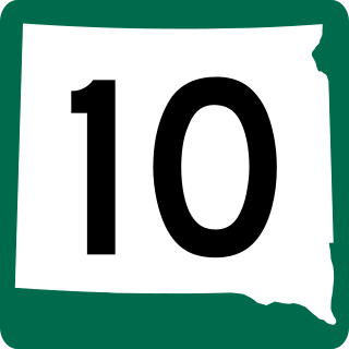
South Dakota Highway 10 (SD 10) is a 175.945-mile (283.156 km) state highway in the north-central and northeastern portions of South Dakota, United States. It connects SD 1804 in Pollock with the Minnesota state line southeast of Sisseton.

<span class="mw-page-title-main">North Dakota Highway 23</span>

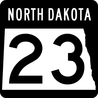
North Dakota Highway 23 is a 122.581-mile-long (197.275 km) east–west highway in northwestern North Dakota. ND 23's eastern terminus is at ND 41 near Velva, and its western terminus at U.S. Route 85 in Watford City.

<span class="mw-page-title-main">South Dakota Highway 44</span> State highway in South Dakota, United States

South Dakota Highway 44 (SD 44) is a state highway in southern South Dakota that runs from U.S. Route 385 (US 385) west of Rapid City to Interstate 29 (I-29) south of Sioux Falls. It is just more than 379 miles (610 km) long.

<span class="mw-page-title-main">South Dakota Highway 22</span>

South Dakota Highway 22 (SD 22) is a 48.546-mile-long (78.127 km) state highway in Hamlin and Deuel counties in South Dakota, United States. It connects Hazel and Clear Lake.

<span class="mw-page-title-main">South Dakota Highway 15</span>

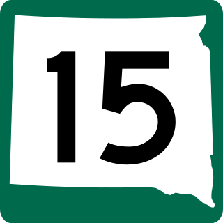
South Dakota Highway 15 (SD 15) is a 67.562-mile-long (108.730 km) state highway in the northeastern South Dakota, United States. It connects Clear Lake, Milbank, and Wilmot.

<span class="mw-page-title-main">South Dakota Highway 19</span> State highway in South Dakota, United States

South Dakota Highway 19 (SD 19) is a 86.974-mile (139.971 km) state highway in southeastern South Dakota, United States. It connects the Nebraska state line, south of Vermillion, with the southeastern part of the Madison area, via Viborg, Hurley, Parker, and Humboldt. SD 19 formerly entered Centerville, but was shifted to the south. Its former path was redesignated as SD 19A. Its former southern terminus was at Vermillion, but was extended when a new bridge from Nebraska opened.

<span class="mw-page-title-main">South Dakota Highway 20</span>

South Dakota Highway 20 (SD 20) is a 385.079-mile (619.725 km) state highway in northern South Dakota, United States, that connects the Montana state line, west-southwest of Camp Crook, with the Minnesota state line, east-southeast of Revillo, via Buffalo, Bison, Timber Lake, Mobridge, Selby, and Watertown. From Mobridge to the Walworth–Potter county line, this highway is part of the Lewis and Clark Trail. From about Timber Lake to just west of Mobridge, this highway is part of the Native American Scenic Byway. From the Montana state line to Camp Crook, the highway is a dirt road.

<span class="mw-page-title-main">South Dakota Highway 11</span> State highway in South Dakota, United States

South Dakota Highway 11 (SD 11) is a 77.724-mile (125.085 km) state highway in eastern South Dakota, United States. It connects the northern part of the Sioux City metropolitan area with the Sioux Falls metropolitan area.

<span class="mw-page-title-main">Interstate 90 in South Dakota</span> Section of Interstate Highway in South Dakota, United States

Interstate 90 (I-90) in the US state of South Dakota traverses east–west through the southern half of the state.

North Dakota Highway 1804 is a state highway in the U.S. state of North Dakota. ND 1804 and ND 1806 were named to reflect the years of Lewis and Clark's travels through the area, and together constitute the portion of the Lewis and Clark Trail that runs through North Dakota along the northeast and southwest sides of Lake Sakakawea and the Missouri River, respectively.

<span class="mw-page-title-main">South Dakota Highway 1804</span> State Highway in South Dakota

South Dakota Highway 1804 (SD 1804) is a 126.745-mile-long (203.976 km) state highway in the U.S. state of South Dakota.

<span class="mw-page-title-main">South Dakota Highway 63</span>

South Dakota Highway 63 (SD 63) is a 167.455-mile (269.493 km) state highway in central South Dakota, United States, that connects U.S. Route 18 (US 18) south-southeast of Parmelee with the North Dakota state line north of McLaughlin.

<span class="mw-page-title-main">North Dakota Highway 24</span>

North Dakota Highway 24 (ND 24) is a minor north–south highway contained entirely within Sioux County, North Dakota. It runs from one junction with ND 6 east of Selfridge near the South Dakota border to another junction on ND 6 west of Solen.

<span class="mw-page-title-main">U.S. Route 16 in South Dakota</span>

U.S. Highway 16 (US 16) is a 69-mile-long (111 km) east–west United States Numbered Highway in the western part of the U.S. state of South Dakota. It travels between Yellowstone National Park in Wyoming and Rapid City. In South Dakota, the highway extends from the Wyoming state line near Newcastle, Wyoming, to Interstate 90 (I-90) in Rapid City.

<span class="mw-page-title-main">South Dakota Highway 204</span> State Highway in South Dakota

South Dakota Highway 204 is a short 2.131-mile-long (3.430 km) east-west state highway in central South Dakota. It serves as a crossing of the Missouri River, running directly overtop of the Oahe Dam.

<span class="mw-page-title-main">South Dakota Highway 273</span> State highway in the U.S. state of South Dakota

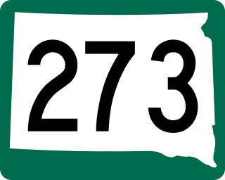
South Dakota Highway 273 is a 12.7-mile-long (20.4 km) north-south state highway in Lyman County, South Dakota. It serves as a connection to SD 1806, linking it with the town of Kennebec and Interstate 90 (I-90).

References

  1. "Highway Division Makes Road Numbering Changes". The Sioux Falls Argus-Leader. March 20, 1975. p. 2. Retrieved November 15, 2021 via Newspapers.com. Open Access logo PLoS transparent.svg
  2. Hunhoff, Bernie (June 14, 2016). "A River Road Called 1806". South Dakota Magazine. Retrieved November 15, 2021.
Template:Attached KML/South Dakota Highway 1806
KML is not from Wikidata