South Thomaston, Maine

Last updated

South Thomaston, Maine
Knox County Maine incorporated and unincorporated areas South Thomaston highlighted.svg
Location in Knox County and the state of Maine.
Coordinates: 44°2′0″N69°7′56″W / 44.03333°N 69.13222°W / 44.03333; -69.13222
Country United States
State Maine
County Knox
Incorporated1848
VillagesSouth Thomaston
Pleasant Beach
Spruce Head
Waterman Beach
Area
[1]
  Total17.97 sq mi (46.54 km2)
  Land11.44 sq mi (29.63 km2)
  Water6.53 sq mi (16.91 km2)
Elevation
49 ft (15 m)
Population
 (2020)
  Total1,511
  Density132/sq mi (51.0/km2)
Time zone UTC-5 (Eastern (EST))
  Summer (DST) UTC-4 (EDT)
ZIP code
04858
Area code 207
FIPS code 23-72585
GNIS feature ID0582739

South Thomaston is a town in Knox County, Maine, United States. The population was 1,511 at the 2020 census. [2] A fishing and resort area, the town includes the village of Spruce Head.

Contents

History

Abenaki Indians called it Wessaweskeag, meaning "tidal creek" or "salt creek," a reference to what is now known as the Weskeag River. Thomas Lefebvre from Quebec, Canada owned a huge tract of land at the Weskeag River, where his stay began in 1704. He built a large gristmill, with a house on the shoreline. Although he would eventually return to Quebec, the area retained his name—Thomas' Town. But the adjacent St. George River was the uneasy dividing line between land controlled by New England and New France. Permanent settlement would be delayed by the French and Indian Wars, which ended with the 1763 Treaty of Paris. [3]

In 1767, Wessaweskeag was settled by Elisha Snow, who built a sawmill operated by tidal power. In 1773, Joseph Coombs arrived and built another sawmill nearby, and together they built a gristmill. The village of South Thomaston grew around the mills, which would include three granite polishing machines to process stone cut from the town's numerous quarries. On July 28, 1848, South Thomaston was set off from Thomaston and incorporated as a separate town. [4] Owl's Head would be set off from South Thomaston on July 9, 1921. Joseph Baum and Flora Baum owned and operated the Baum's Market, now known as the Keag Store. Flora Baum was the Postmistress, appointed by President Woodrow Wilson. The Baum's had four children: Alice, Dorothy, Joan and Joseph Baum, Jr. (Bud). For many years Bud was on the Board of Selectmen and was the Fire Chief. Gilford Butler was a local attorney and chairman of the school board. Gilford Bulter and his sister Lula Butler lived in what is now known as the Geag Inn, next to the present U. S. Post Office. Gilford was an attorney in nearby Rockland. Gilford left a large amount of his estate to the town in order to build a local elementary school, with the stipulation that the school bear his name.

Geography

According to the United States Census Bureau, the town has a total area of 17.97 square miles (46.54 km2), of which 11.44 square miles (29.63 km2) is land and 6.53 square miles (16.91 km2) is water. [1] South Thomaston is located on the Weskeag River inlet.

Demographics

Historical population
CensusPop.Note
1850 1,420
1860 1,61513.7%
1870 1,6934.8%
1880 1,7714.6%
1890 1,534−13.4%
1900 1,426−7.0%
1910 1,4380.8%
1920 947−34.1%
1930 579−38.9%
1940 538−7.1%
1950 65421.6%
1960 73211.9%
1970 83113.5%
1980 1,06428.0%
1990 1,22715.3%
2000 1,41615.4%
2010 1,55810.0%
2020 1,511−3.0%
U.S. Decennial Census [5]

The median income for a household in the town was $43,594, and the median income for a family was $55,000. Males had a median income of $38,500 versus $33,125 for females. The per capita income for the town was $24,522. About 6.7% of families and 9.1% of the population were below the poverty line, including 12.3% of those under age 18 and 7.3% of those age 65 or over. Of the 832 people in the labor force only 25 were unemployed as of the 2010 census making the town's unemployment rate 2.9%. [6]

2010 census

As of the census [7] of 2010, there were 1,558 people, 674 households, and 442 families residing in the town. The population density was 136.2 inhabitants per square mile (52.6/km2). There were 893 housing units at an average density of 78.1 per square mile (30.2/km2). The racial makeup of the town was 96.8% White, 0.3% African American, 0.4% Native American, 0.8% Asian, 0.1% from other races, and 1.7% from two or more races. Hispanic or Latino of any race were 0.6% of the population.

There were 674 households, of which 25.1% had children under the age of 18 living with them, 52.8% were married couples living together, 7.9% had a female householder with no husband present, 4.9% had a male householder with no wife present, and 34.4% were non-families. 27.3% of all households were made up of individuals, and 11.6% had someone living alone who was 65 years of age or older. The average household size was 2.31 and the average family size was 2.79.

The median age in the town was 47.1 years. 19.6% of residents were under the age of 18; 6.1% were between the ages of 18 and 24; 21.3% were from 25 to 44; 32.5% were from 45 to 64; and 20.5% were 65 years of age or older. The gender makeup of the town was 50.3% male and 49.7% female.

Site of interest

Related Research Articles

<span class="mw-page-title-main">Turner, Maine</span> Town in the state of Maine, United States

Turner is a town in Androscoggin County, Maine, United States. The population was 5,817 at the 2020 census. The town includes the villages of Turner, Turner Center and North Turner. The town is part of the Lewiston-Auburn, Maine Metropolitan New England City and Town Area.

<span class="mw-page-title-main">Strong, Maine</span> Town in Maine, United States

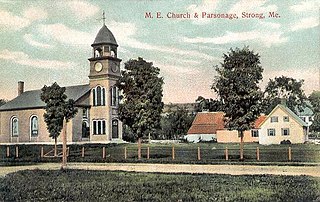
Strong is a town in Franklin County, Maine, United States. The population was 1,122 at the 2020 census. Strong is home to the annual Sandy River Festival.

<span class="mw-page-title-main">Cushing, Maine</span> Town in the state of Maine, United States

Cushing is a town in Knox County, Maine, United States. The population was 1,502 at the 2020 census. A favorite of artists for its unspoiled natural setting, Cushing includes the villages of North Cushing, Cushing, South Cushing, and Pleasant Point.

<span class="mw-page-title-main">Friendship, Maine</span> Town in the state of Maine, United States

Friendship is a town in Knox County, Maine, United States. It is 31 miles (49.9 km) southeast of Augusta. The population was 1,142 at the 2020 census.

<span class="mw-page-title-main">Warren, Maine</span> Town in the state of Maine, United States

Warren is a town in Knox County, Maine, United States. The population was 4,865 at the 2020 census. It includes the villages of East Warren, Warren and South Warren, the latter home to the Maine State Prison and minimum security Bolduc Correctional Facility.

<span class="mw-page-title-main">Canton, Maine</span> Town in the state of Maine, United States

Canton is a town in Oxford County, Maine, United States. Canton is included in the Lewiston-Auburn, Maine metropolitan New England city and town area. The population was 1,125 at the 2020 census. Located beside Lake Anasagunticook, Canton is a summer recreational area.

Otisfield is a town in Oxford County, Maine, United States. Otisfield is included in the Lewiston-Auburn, Maine metropolitan New England city and town area. The population was 1,853 at the 2020 census. Otisfield is a summer recreation area and home to Seeds of Peace Camp and Camp Arcadia.

<span class="mw-page-title-main">Roxbury, Maine</span> Town in the state of Maine, United States

Roxbury is a town in Oxford County, Maine, United States. The population was 361 at the 2020 census. Ellis Pond is popular with recreational fishermen.

<span class="mw-page-title-main">Bowdoin, Maine</span> Town in the state of Maine, United States

Bowdoin is a town in Sagadahoc County, Maine, United States. Bowdoin is included in the Lewiston-Auburn, Maine metropolitan New England city and town area. The population was 3,136 at the 2020 census. Bowdoin is 31 land miles north of Portland, and 21 land miles south of Augusta.

<span class="mw-page-title-main">West Bath, Maine</span> Town in the state of Maine, United States

West Bath is a town in Sagadahoc County, Maine, United States. The population was 1,910 at the 2020 census. A sub-locality of West Bath is Winnegance. West Bath is part of the Portland–South Portland–Biddeford, Maine metropolitan statistical area.

<span class="mw-page-title-main">Solon, Maine</span> Town in the state of Maine, United States

Solon is a town in Somerset County, Maine, United States. The population was 978 at the 2020 census.

<span class="mw-page-title-main">Prospect, Maine</span> Town in the state of Maine, United States

Prospect is a town in Waldo County, Maine, United States. The population was 698 at the 2020 census.

<span class="mw-page-title-main">Waldo, Maine</span> Town in the state of Maine, United States

Waldo is a town in Waldo County, Maine, United States. The population was 795 at the 2020 census. It is the home town of Heather Hemmens, who is known for her role on Hellcats.

<span class="mw-page-title-main">Acton, Maine</span> Town in the state of Maine, United States

Acton is a town in York County, Maine, United States. The population was 2,671 at the 2020 census. It includes the villages of Acton, Miller Corner and South Acton. The town is home to the Acton Fairground, which holds the Acton Fair every late summer. It is part of the Portland–South Portland–Biddeford, Maine metropolitan statistical area.

<span class="mw-page-title-main">Dayton, Maine</span> Town in the state of Maine, United States

Dayton is a town in York County, Maine, United States; the town is located near the Saco-Biddeford city area. Dayton borders Biddeford by land, and borders Saco on the Saco River. It is also part of the Portland–South Portland–Biddeford, Maine metropolitan statistical area. The population was 2,129 at the 2020 census. Dayton is one of the smallest towns in York County.

<span class="mw-page-title-main">Lyman, Maine</span> Town in the state of Maine, United States

Lyman is a town in York County, Maine, United States. The population was 4,525 at the 2020 census. It is part of the Portland–South Portland–Biddeford, Maine metropolitan statistical area. Lyman, together with Alfred, is home to Massabesic Experimental Forest.

<span class="mw-page-title-main">Newfield, Maine</span> Town in the state of Maine, United States

Newfield is a town in York County, Maine, United States. The population was 1,648 at the 2020 census. The town is part of the Portland–South Portland–Biddeford metropolitan statistical area.

<span class="mw-page-title-main">Effingham, New Hampshire</span> Town in New Hampshire, United States

Effingham is a town in Carroll County, New Hampshire, United States. At the 2020 census, the town population was 1,691, up from 1,465 at the 2010 census. Effingham includes the villages of Effingham Falls, Effingham, Center Effingham, and South Effingham. Pine River State Forest is in the south.

<span class="mw-page-title-main">Thomaston (CDP), Maine</span> Census-designated place in Maine, United States

Thomaston is a census-designated place (CDP) comprising the main village in the town of Thomaston in Knox County, Maine, United States. The population was 1,875 at the 2010 census, out of 2,781 in the town of Thomaston as a whole.

<span class="mw-page-title-main">Thomaston, Maine</span> Town in the state of Maine, United States

Thomaston, formerly known as Fort St. Georges, Fort Wharf, and Lincoln, is a town in Knox County, Maine, United States. The population was 2,739 at the 2020 census. Noted for its antique architecture, Thomaston is an old port popular with tourists. The town was named after Major General John Thomas.

References

  1. 1 2 "US Gazetteer files 2010". United States Census Bureau . Retrieved December 16, 2012.
  2. "Census - Geography Profile: South Thomaston town, Knox County, Maine" . Retrieved January 19, 2022.
  3. Coolidge, Austin J.; John B. Mansfield (1859). A History and Description of New England. Boston, Massachusetts: A.J. Coolidge. pp.  310–312.
  4. Varney, George J. (1886), Gazetteer of the state of Maine. South Thomaston, Boston: Russell
  5. "Census of Population and Housing". Census.gov. Retrieved June 4, 2015.
  6. "American Fact Finder (Economic Characteristics)". Archived from the original on February 12, 2020. Retrieved December 4, 2012.
  7. "U.S. Census website". United States Census Bureau . Retrieved December 16, 2012.

44°03′05″N69°07′40″W / 44.05139°N 69.12778°W / 44.05139; -69.12778