Spofford, Texas

Last updated

Spofford, Texas
Kinney County Spofford.svg
Coordinates: 29°10′22″N100°24′41″W / 29.17278°N 100.41139°W / 29.17278; -100.41139
Country United States
State Texas
County Kinney
Area
[1]
  Total0.24 sq mi (0.62 km2)
  Land0.24 sq mi (0.62 km2)
  Water0.00 sq mi (0.00 km2)
Elevation
[2]
1,011 ft (308 m)
Population
 (2020)
  Total41
  Density170/sq mi (66/km2)
Time zone UTC-6 (Central (CST))
  Summer (DST) UTC-5 (CDT)
ZIP Code
78877
Area code 830
FIPS code 48-69560 [3]
GNIS feature ID1368916 [2]

Spofford is a city in Kinney County, Texas, United States. The population was 41 at the 2020 census.

Contents

Geography

Spofford is located in southern Kinney County at 29°10′22″N100°24′41″W / 29.17278°N 100.41139°W / 29.17278; -100.41139 (29.172681, –100.411388). [4] It is on the east side of Texas State Highway 131, which leads north 10 miles (16 km) to Brackettville, the county seat, and south 24 miles (39 km) to U.S. Route 277 in the Rio Grande valley.

According to the United States Census Bureau, Spofford has a total area of 0.2 square miles (0.6 km2), all land. [5]

Demographics

Historical population
CensusPop.Note
1950 246
1960 138−43.9%
1970 69−50.0%
1980 7711.6%
1990 68−11.7%
2000 7510.3%
2010 9526.7%
2020 41−56.8%
U.S. Decennial Census [6]
2020 Census [7]

As of the census [3] of 2000, 75 people, 24 households, and 19 families resided in the city. The population density was 299 inhabitants per square mile (115/km2). The 38 housing units averaged 151.4/sq mi (58.7/km2). The racial makeup of the city was 81.33% White, 18.67% from other races. Hispanics or Latinos of any race were 52.00% of the population.

Of the 24 households, 50.0% had children under the age of 18 living with them, 66.7% were married couples living together, 8.3% had a female householder with no husband present, and 16.7% were not families. About 16.7% of all households were made up of individuals, and 16.7% had someone living alone who was 65 years of age or older. The average household size was 3.13 and the average family size was 3.45.

In the city, the population was distributed as 29.3% under the age of 18, 5.3% from 18 to 24, 30.7% from 25 to 44, 17.3% from 45 to 64, and 17.3% who were 65 years of age or older. The median age was 40 years. For every 100 females, there were 92.3 males. For every 100 females age 18 and over, there were 103.8 males.

The median income for a household in the city was $39,583, and for a family was $39,583. Males had a median income of $36,250 versus $11,250 for females. The per capita income for the city was $36,485. Around 5.3% of families and 11.8% of the population were living below the poverty line, including 17.4% of those under 18 and none of those over 64.

History

Spofford was named after C.K. Spofford, who opened a hotel in town shortly after the railroad came through in 1882. The town grew around the hotel and was granted a post office in 1884. By 1896, the town had its first school, and by 1900, it had 100 residents.

The Galveston, Harrisburg and San Antonio Railroad (later part of the Southern Pacific Railroad, and today part of the Union Pacific Railroad) had chosen Spofford over Brackettville. At Spofford, they laid a spur to Eagle Pass, and the main line continued west to Langtry. At various times, Spofford was a stop on the Sunset Limited . Amtrak’s Sunset Limited passes through the town on Union Pacific tracks, but makes no stop. A stop is located 30 miles northwest in Del Rio.

The population reached the high-water mark of 373 people in the mid-1940s. After the school consolidations in the '40s, Spofford's students were bused to Brackettville. In 1961, the population was only 138, and it went as low as 54 people in the mid-1970s.

Education

Spofford is served by the Brackett Independent School District.

Related Research Articles

<span class="mw-page-title-main">Kinney County, Texas</span> County in Texas, United States

Kinney County is a county located in the U.S. state of Texas. As of the 2020 census, its population was 3,129. Its county seat is Brackettville. The county was created in 1850 and later organized in 1874. It is named for Henry Lawrence Kinney, an early settler.

<span class="mw-page-title-main">Cherokee, Kansas</span> City in Crawford County, Kansas

Cherokee is a city in Crawford County, Kansas, United States. As of the 2020 census, the population of the city was 590.

<span class="mw-page-title-main">South Wallins, Kentucky</span> Census-designated place in Kentucky, United States

South Wallins is an unincorporated community and census-designated place (CDP) in Harlan County, Kentucky, United States. The population was 859 at the 2010 census, down from 996 at the 2000 census.

<span class="mw-page-title-main">Sadieville, Kentucky</span> City in Kentucky, United States

Sadieville is a home rule-class city in Scott County, Kentucky, in the United States. The population was 263 during the year 2000 U.S. Census. It is part of the Lexington-Fayette Metropolitan Statistical Area.

<span class="mw-page-title-main">Hopkins, Michigan</span> Village in Michigan, United States

Hopkins, formerly Hopkins Station, is a village within Hopkins Township in Allegan County in the U.S. state of Michigan. The population was 615 at the 2020 census.

<span class="mw-page-title-main">Maynard, Minnesota</span> City in Minnesota, United States

Maynard is a city in Chippewa County, Minnesota, United States. The population was 366 at the 2010 census.

<span class="mw-page-title-main">Johnson, Nebraska</span> Village in Nemaha County, Nebraska, United States

Johnson is a village in Nemaha County, Nebraska, United States. The population was 313 at the 2020 census.

<span class="mw-page-title-main">Waterloo, Oregon</span> City in Oregon, United States

Waterloo is a city in Linn County, Oregon, United States. The population was 229 at the 2010 census.

<span class="mw-page-title-main">Richmond Township, Crawford County, Pennsylvania</span> Township in Pennsylvania, United States

Richmond Township is a township in Crawford County, Pennsylvania, United States. The population was 1,352 at the 2020 census, down from 1,475 at the 2010 census.

<span class="mw-page-title-main">Lakeland, Tennessee</span> City in Tennessee, United States

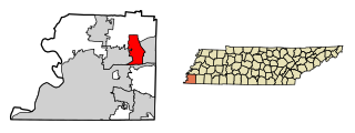
Lakeland is a city in Shelby County, Tennessee, United States, and a part of the Memphis metropolitan area. The population was 12,430 at the 2010 census.

<span class="mw-page-title-main">Huntington, Texas</span> City in Texas, United States

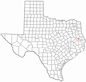
Huntington is a city in Angelina County, Texas, United States. The population was 2,025 at the 2020 census. The site is named for Collis Potter Huntington, the chairman of the board of the Southern Pacific Railroad when the town was formed and one of the Big Four. Huntington is known as the "Gateway to Lake Sam Rayburn".

<span class="mw-page-title-main">Marietta, Texas</span> Town in Texas, United States

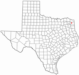
Marietta is a town in Cass County, Texas, United States, incorporated in 1963. The population was 134 at the 2010 census, up from 112 at the 2000 census; in 2020, its population was 115.

<span class="mw-page-title-main">Tool, Texas</span> City in Texas, United States

Tool is a city in Henderson County, Texas, United States. The population was 2,175 at the 2020 census. Located on the west side of Cedar Creek Lake, it is a popular second home and retiree destination.

<span class="mw-page-title-main">Falls City, Texas</span> City in Texas, United States

Falls City is a city in Karnes County, Texas, United States. The population was 514 at the 2020 census. Falls City is near the location of a uranium tailings disposal cell, completed in 1994 under the terms of the 1978 Uranium Mill Tailings Radiation Control Act. The early settlers, predominantly Polish Catholics, founded the Holy Trinity Catholic Church in 1902.

<span class="mw-page-title-main">Brackettville, Texas</span> City in Texas, United States

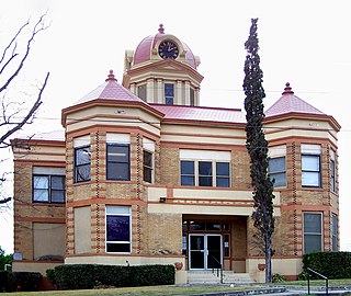
Brackettville is a city in Kinney County, Texas, United States. The population was 1,341 at the 2020 census, down from 1,688 at the 2010 census. It is the county seat of Kinney County.

<span class="mw-page-title-main">Mount Enterprise, Texas</span> City in Texas, United States

Mount Enterprise is a city in Rusk County, Texas, United States. The population was 505 at the 2020 census.

<span class="mw-page-title-main">Tye, Texas</span> City in Texas, United States

Tye is a city in Taylor County, Texas, United States. The population was 1,176 at the 2020 census. It is part of the Abilene, Texas Metropolitan Statistical Area.

<span class="mw-page-title-main">Ogdensburg, Wisconsin</span> Village in Wisconsin, United States

Ogdensburg is a village in Waupaca County, Wisconsin, United States. The population was 185 at the 2010 census.

Booker is a town in Lipscomb and Ochiltree counties in Texas, United States. The population was 1,516 as of the 2010 census. It was named for B.F. Booker, a civil engineer for the Panhandle and Santa Fe Railway.

<span class="mw-page-title-main">Mount Hope, Wisconsin</span> Village in Wisconsin, United States

Mount Hope is a village in Grant County, Wisconsin, United States. The population was 225 at the 2010 census. The village is located within the Town of Mount Hope.

References

  1. "2019 U.S. Gazetteer Files". United States Census Bureau. Retrieved August 7, 2020.
  2. 1 2 U.S. Geological Survey Geographic Names Information System: Spofford, Texas
  3. 1 2 "U.S. Census website". United States Census Bureau . Retrieved January 31, 2008.
  4. "US Gazetteer files: 2010, 2000, and 1990". United States Census Bureau. February 12, 2011. Retrieved April 23, 2011.
  5. "Geographic Identifiers: 2010 Census Summary File 1 (G001), Spofford city, Texas". American FactFinder. U.S. Census Bureau. Archived from the original on February 13, 2020. Retrieved May 10, 2019.
  6. "Census of Population and Housing". Census.gov. Retrieved June 4, 2015.
  7. "Census Bureau profile: Spofford, Texas". United States Census Bureau. May 2023. Retrieved June 9, 2024.