Lewis and Clark County is a county located in the U.S. state of Montana. As of the 2020 census, the population was 70,973. Its county seat is Helena, the state capital. The numerical designation for Lewis and Clark County is 5. The county was established on June 2, 1865, as one of the nine original counties of the Territory of Montana named Edgerton County in honor of Sidney Edgerton, first Governor of the Territory of Montana, and was renamed Lewis and Clark County on March 1, 1868, in honor of explorers Meriwether Lewis and William Clark.

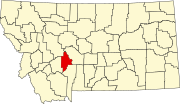
Broadwater County is a county in the U.S. state of Montana. As of the 2020 census, the population was 6,774. Its county seat is Townsend. The county was named for Charles Arthur Broadwater, a noted Montana railroad, real estate, and banking magnate.
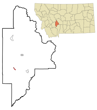
Radersburg is a census-designated place (CDP) in Broadwater County, Montana, United States. The population was 66 at the 2010 census.
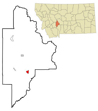
Toston is a census-designated place (CDP) in Broadwater County, Montana, United States. The population was 108 at the 2010 census.

Winston is a census-designated place (CDP) in Broadwater County, Montana, United States. The population was 147 at the 2010 census.

Jefferson City is an unincorporated community and census-designated place (CDP) in Jefferson County, Montana, United States. The population was 472 at the 2010 census. It is part of the Helena Micropolitan Statistical Area.

Montana City is an unincorporated community and census-designated place (CDP) in Jefferson County, Montana, United States. The population was 2,715 at the 2010 census, up from 2,094 in 2000. It is part of the Helena Micropolitan Statistical Area.

Augusta is an unincorporated community and census-designated place (CDP) in Lewis and Clark County, Montana, United States. The population was 309 at the 2010 census and rose to 316 in the 2020 census. The most accepted version in the naming of this town is after Augusta Hogan, thought to be the first child born in this town, the daughter of J. D. Hogan, an early rancher.

Helena Valley Northeast is a census-designated place (CDP) in Lewis and Clark County, Montana, United States. The population was 2,995 at the 2010 census. It is part of the Helena Micropolitan Statistical Area.

Helena Valley Southeast is a census-designated place (CDP) in Lewis and Clark County, Montana, United States. The population was 8,227 at the 2010 census. It is part of the Helena Micropolitan Statistical Area.

Helena Valley West Central is a census-designated place (CDP) in Lewis and Clark County, Montana, United States. The population was 7,883 at the 2010 census. It is part of the Helena Micropolitan Statistical Area.

Garrison is a census-designated place (CDP) in Powell County, Montana, United States. The population was 112 at the 2000 census.

Clancy is an unincorporated community and census-designated place (CDP) in Jefferson County, Montana, United States. The population was 1,661 at the 2010 census, up from 1,406 in 2000. It is part of the Helena Micropolitan Statistical Area.

Helena West Side is a census-designated place (CDP) in Lewis and Clark County, Montana, United States. The population was 1,637 at the 2010 census, down from 1,711 at the 2000 census due to annexation of part of the CDP by the city of Helena. It is part of the Helena Micropolitan Statistical Area.

Marysville is an unincorporated community and census-designated place (CDP) in Lewis and Clark County, Montana, United States. Elevation is 5,413 ft.
Craig is an unincorporated community and census-designated place (CDP) in Lewis and Clark County, Montana, United States. As of the 2010 census, the population was 43. Craig is located along Interstate 15 on the west side of the Missouri River, 43 miles (69 km) north of Helena, the state capital, and 47 miles (76 km) southwest of Great Falls.

The Silos is a census-designated place (CDP) in Broadwater County, Montana, United States. The population was 506 at the 2010 census.
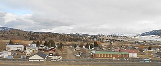
Wheatland is a census-designated place (CDP) in Broadwater County, Montana, United States. The population was 568 according to the 2010 census.
Rader Creek is a census-designated place (CDP) in Jefferson County, Montana, United States. The population was 363 at the 2010 census.
South Hills is a census-designated place (CDP) in Jefferson County, Montana, United States. The population was 517 at the 2010 census.