Spring Mills, Virginia

Last updated

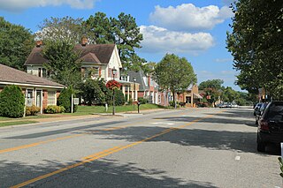
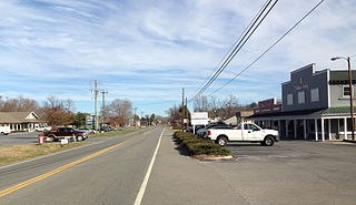
Spring Mills is an unincorporated community in Appomattox County, Virginia, United States.

Appomattox County, Virginia county in Virginia, United States

Appomattox County is a United States county located in the Piedmont region and near the center of the Commonwealth of Virginia. The county is part of the Lynchburg, VA Metropolitan Statistical Area, and its county seat is the town of Appomattox.

Virginia State of the United States of America

Virginia, officially the Commonwealth of Virginia, is a state in the Southeastern and Mid-Atlantic regions of the United States located between the Atlantic Coast and the Appalachian Mountains. Virginia is nicknamed the "Old Dominion" due to its status as the first English colonial possession established in mainland North America and "Mother of Presidents" because eight U.S. presidents were born there, more than any other state. The geography and climate of the Commonwealth are shaped by the Blue Ridge Mountains and the Chesapeake Bay, which provide habitat for much of its flora and fauna. The capital of the Commonwealth is Richmond; Virginia Beach is the most populous city, and Fairfax County is the most populous political subdivision. The Commonwealth's estimated population as of 2017 is over 8.4 million.

United States federal republic in North America

The United States of America (USA), commonly known as the United States or America, is a country composed of 50 states, a federal district, five major self-governing territories, and various possessions. At 3.8 million square miles, the United States is the world's third or fourth largest country by total area and is slightly smaller than the entire continent of Europe's 3.9 million square miles. With a population of over 327 million people, the U.S. is the third most populous country. The capital is Washington, D.C., and the largest city by population is New York. Forty-eight states and the capital's federal district are contiguous in North America between Canada and Mexico. The State of Alaska is in the northwest corner of North America, bordered by Canada to the east and across the Bering Strait from Russia to the west. The State of Hawaii is an archipelago in the mid-Pacific Ocean. The U.S. territories are scattered about the Pacific Ocean and the Caribbean Sea, stretching across nine official time zones. The extremely diverse geography, climate, and wildlife of the United States make it one of the world's 17 megadiverse countries.

Blenheim was listed on the National Register of Historic Places in 1979, with a boundary increase in 1994. [1]

Blenheim (Spring Mills, Virginia) house in Spring Mills, Virginia

Blenheim is a historic home located near Spring Mills, in Campbell County, Virginia. It was built about 1828, and is a 1 1/2-story, five-bay, single-pile, frame I-house dwelling on a brick basement. It is sheathed with beaded weatherboards and covered with a standing-seam sheet metal roof broken by three pedimented dormers. The interior features elaborate, provincially conceived but skillfully executed, woodwork. Also on the property is a contributing late-19th century frame stable.

National Register of Historic Places federal list of historic sites in the United States

The National Register of Historic Places (NRHP) is the United States federal government's official list of districts, sites, buildings, structures, and objects deemed worthy of preservation for their historical significance. A property listed in the National Register, or located within a National Register Historic District, may qualify for tax incentives derived from the total value of expenses incurred preserving the property.

Related Research Articles

Gloucester Courthouse, Virginia CDP in Virginia, United States

Gloucester Courthouse is a census-designated place (CDP) in and the county seat of Gloucester County, Virginia, United States. The population was 2,951 at the 2010 census.

Nottoway, Virginia human settlement in United States of America

Nottoway, or Nottoway Court House, is a census-designated place (CDP) in and the county seat of Nottoway County, Virginia, United States. The population as of the 2010 Census was 84.

Field Club (Omaha, Nebraska)

Field Club is a neighborhood located in the Midtown region of Omaha, Nebraska. Roughly bounded by Pacific Street, 32nd Avenue, Center St., and 36th Street, the neighborhood was placed on the National Register of Historic Places as a historic district on November 15, 2000. Field Club is the location of dozens of historically significant homes in the Omaha area, including the Gerald R. Ford Birthsite and Gardens.

Nellysford, Virginia human settlement in United States of America

Nellysford is a census-designated place (CDP) in Nelson County, Virginia, United States. The population as of the 2010 Census was 1,076. It is home to the Wintergreen golf course at Stoney Creek. Its zip code is 22958.

Randolph, Virginia human settlement in United States of America

Randolph, formerly called Roanoke and Talcott, is a small unincorporated community in Charlotte County, Virginia, United States, near the Staunton River. Its elevation is 354 feet. The community is the home of Staunton River Battlefield State Park.

Locust Dale, Virginia human settlement in United States of America

Locust Dale is an unincorporated community in Madison County, Virginia, United States.

Wolftown is an unincorporated community located in Madison County, Virginia.

New Church, Virginia human settlement in United States of America

New Church is a census-designated place (CDP) in Accomack County, Virginia, United States. The population as of the 2010 Census was 205.

Arrington is a census-designated place (CDP) in Nelson County, Virginia, United States. The population as of the 2010 Census was 708. Harmony Hill Bed and Breakfast is the only lodging location in Arrington, run by innkeepers Wendie and Jay Fines.

Gladstone is an unincorporated community in Nelson County, Virginia, United States.

Midway Mills is an unincorporated community in Nelson County, Virginia, United States. Midway, now called Midway Mills, was established on June 6, 1774, by Dr. William Cabell,, and was the first European settlement in Nelson County. It was named Midway because it was midway between Richmond and Lynchburg along the James River. The area, at that time part of "Old Albemarle County", was later divided into the counties of Albemarle, Amherst, Buckingham, Nelson, and Fluvanna between 1741 and 1809.

Norwood, Nelson County, Virginia human settlement in United States of America

Norwood is an unincorporated community in Nelson County, Virginia, United States. It was among the communities severely affected by flash flooding from Hurricane Camille in 1969.

Shipman is a census-designated place (CDP) in Nelson County, Virginia, United States. The population as of the 2010 Census was 507.

Wintergreen, Virginia human settlement in United States of America

Wintergreen is a census-designated place (CDP) in Augusta and Nelson counties, Virginia, United States, located near Wintergreen Resort. The population as of the 2010 Census was 165.

Woodmont is an unincorporated community in Washington County, Maryland, United States. Western Maryland Railroad Right-of-Way, Milepost 126 to Milepost 160 was listed on the National Register of Historic Places in 1980.

North Ridge, New York is a hamlet in the town of Cambria in Niagara County, New York, United States.

Deatonville is an unincorporated community located in Amelia County, in the U.S. state of Virginia.

Kents Store, Virginia human settlement in United States of America

Kents Store is an unincorporated community in Fluvanna County, in the U.S. state of Virginia.

Harrisburg is a small unincorporated community in Charlotte County, Virginia, United States. Its elevation is 548 feet.

Shirley is an unincorporated community in Washington County, in the U.S. state of Missouri.

References

Coordinates: 37°14′43″N78°55′09″W / 37.24528°N 78.91917°W / 37.24528; -78.91917

Geographic coordinate system Coordinate system

A geographic coordinate system is a coordinate system that enables every location on Earth to be specified by a set of numbers, letters or symbols. The coordinates are often chosen such that one of the numbers represents a vertical position and two or three of the numbers represent a horizontal position; alternatively, a geographic position may be expressed in a combined three-dimensional Cartesian vector. A common choice of coordinates is latitude, longitude and elevation. To specify a location on a plane requires a map projection.